21 September 2019
The 10 best day hikes near Tokyo in Japan
All of these can be done in a day and accessed by public transport
OK so here it is, another attempt to get people to find my website and explore its extensive content.
Google and therefore people seem to like ordered lists of content linking to other content, so to get things started, here is a list of day hikes near Tokyo.
All of these are easily achievable in a day, you can wake up, catch a train or a bus to somewhere pristine, hike for a while or a long while, and still get back into Tokyo for a bowl of ramen for dinner.
The format of these lists posts will be similar, in that the content here on this page will be informative and factual, but then link to a much more detailed post with many more photos that may not be quite as factual and serious.
If you have any questions on how to get to these places, click full trip report and use the comments things at the bottom, generally its hidden from these blog style posts but I just let you know how to get to it!
Now without further adieu, here are my 10 personal favourites, from least to most favourite so that you have to scroll to the end! Enjoy.
10. Mount Oyama - Mosquito mountain camera failure - Isehara Station then a connecting bus - 7 November 2015

Mount Oyama is a very popular hike west of Tokyo. It is very popular because you do not actually need to climb it, there is a ropeway if you are lazy. I recommend climbing, it is not far.
Take the Odakyu line from Shinjuku to Isehara, where there should be connecting buses to take you to the ropeway station, follow the crowds.
Walk around the ropeway station then up a lot of staircases to the temple / shrine, which if you go in Autumn will be full of Chrysanthemums on display. I really like the bonsai variety.
It should not take too long to climb, a couple of hours. Depending on the day and weather it might be a bit difficult to find a spot at the top to sit and rest, I recall walking over the summit to a grassy area set up for camping.
Unfortunately I do not have as many pics as I should of this day as I suffered my only ever camera malfunction, but the linked post still has plenty of shots of the temple, steps, trains.
Click here to ascend Mount Oyama.
9. Mitsutogeyama and Shimoyama near Kawaguchiko - I saw it! Mount Fuji! - Mitsutoge station - 18 October 2016
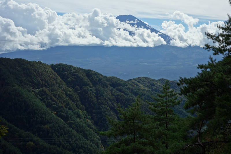
Fun fact: I have never climbed Mount Fuji. I have never been to Japan when its open to climb. Every year when I do go I consider climbing it out of season, but so far I have not been foolish enough to attempt a snowy blizzard typhoon climb.
I have however climbed lots of mountains that have a great view of Mount Fuji, there will be more Fuji views better than this one further down this list.
Kawaguchiko is a very popular spot to take a side trip from Tokyo, or even a day trip like I did. I may head back there again this year, the important thing if you go is to plan it as part of 3 days of daytrips and get the JR Tokyo wide pass. This allows 3 days of travel on all JR trains that go quite a long way from Tokyo for about $100.
In addition to the JR trains it allows travel on select non JR trains, including the one that gets you to Kawaguchiko, known as the Fujikyu railway. The full journey is to get the Chuo line from Shinjuku or Tokyo or wherever, try for a limited express if you have the pass, then change to the Fujikyu railway at Otsuki, generally its timed to meet the Chuo line.
Then enjoy the views up the valley, and if you are like me, get off about 5 stations before the end at Mitsutoge and start you hike. It should take you about 7 hours max to hike over both peaks, stop for rests etc. Remember to buy supplies before you get to Mitsutoge, when I went there wasnt even a shop there.
There is really only one logical road to follow to the trail head, if you head in a North Westerly direction from the station.
Once you have hiked over both peaks, you will get to a ropeway near the famous lake, ignore that and walk down! There are great views of the amazing blue lake on the way down.
Click here to hike over a couple of mountains while looking at Mount Fuji and a wonderful blue lake.
8. Ougiyama and Momokurayama - Lost on twin peaks - Torisawa to Saruhashi station - 24 October 2017
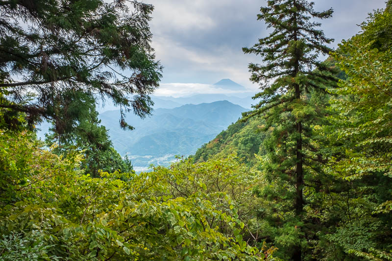
This one is quite easy to get to, take the Chuo line to Torisawa. It may be quicker to take a limited express to a nearby station and change to the local line.
Once you get off the train, follow the signs to Ougiyama, north of the station, google maps calls it Ogiyama. You follow the road for a while, under an expressway, through some farms, but its well signposted.
Once you start the hike, its mainly pine trees, lots of them. When I visited it had rained recently, and the trail was muddy, but not too difficult, yet somehow I got lost and had to backtrack. No big problem, you should always be aware how to at least get back to where you came from!
Eventually I found the right path, and enjoyed a wonderful hike across to Momokurayama, where there were other hikers enjoying the summit area, the hike between the two was however very lonely.
I had some views of Fuji early on but by the time I got to the summit areas it had become cloudy. On a clear day the views would be spectacular.
Click here to hike up one mountain and down another.
7. Mount Jinba - Far beyond Takao - Takao station then a bus to get back - 29 October 2018
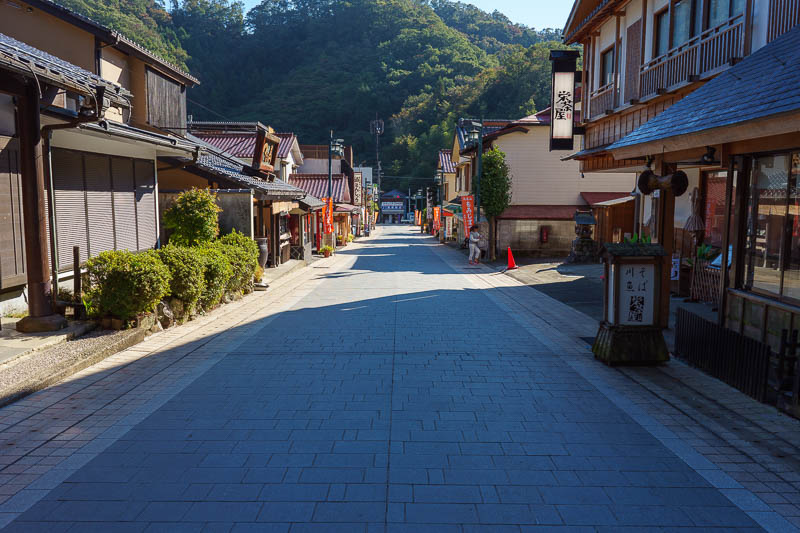
Here it is, the most popular hike in all of Japan, maybe the world. This one is so popular, I think there are actually 2 ropeways to pull you up if you are lazy, I suggest you ignore them.
Of course as the title suggests, once you get to the top of Takao, you have only just started, just keep going. The paths here are all very well marked and heavily populated. There are numerous spots to sit and enjoy the views of Fuji if the weather is clear.
You can actually keep going much further than I did, but on this day in 2018 I stopped at Mount Jinba. You will see a larger white statue on the peak of this mountain, find a path down from here, and you should be able to get a bus back to Takao from a small town in the valley at these coordinates, 35.663531, 139.189371
Click here to hike beyond Takao and look at Mount Fuji.
6. Mount Kawanori - Hiking with others - Kawanori to Hatonosu station - 17 November 2018
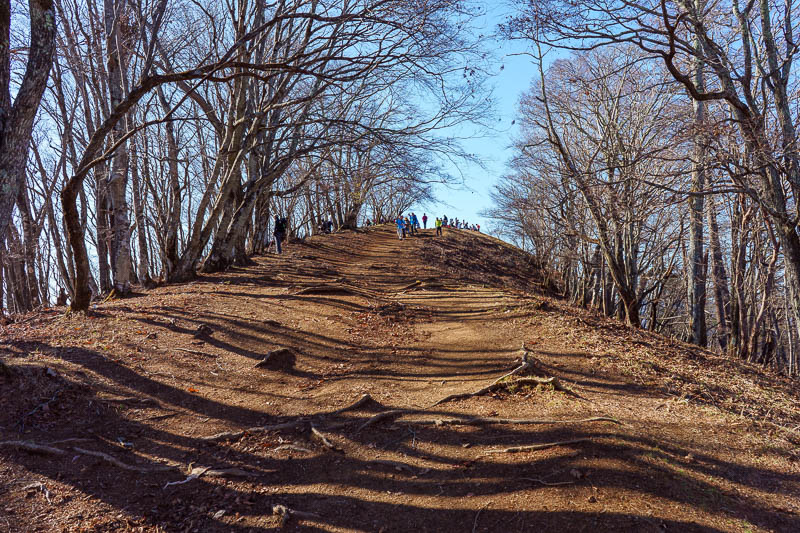
The Okutama area of Japan is wonderful. You will see that I have included it twice in this list as you go further down.
Getting to Okutama station can take a while, so leave early! Generally you take the Chuo line west, change at Tachikawa and then take the Ome line to the end. Theres a few other ways to connect, but its all JR lines if you have a pass of some description.
Once you get off at Okutama, there will be amazing scenery, but dont spend too long gawking, theres a long way to go yet. You can get a bus to the trail head, but if theres a long line, just walk up the road! The view along the road is amazing.
You cant really miss the trail head, but here are the coordinates just in case, 35.831782, 139.076249, from that point on, its even better scenery, steep at times, but a really great hike.
The only disappointing thing is that the view from the top is not fantastic, and there will probably be a lot of people who hiked up the easier route. The good news is that the easy route down is smooth and fast, so you can make good time back to Hatonosu station to get a train back to Tokyo.
Click here to go up Mount Kawanori the hard way.
5. Asoyama, Hinodesan and Mitakesan - Between the tracks - Musashi-Itsukaichi to Mitake station - 15 November 2017
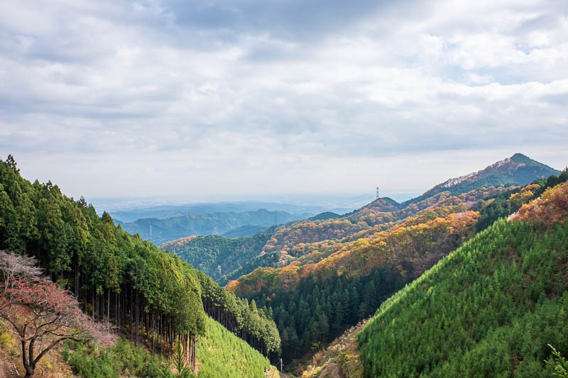
The views on this hike are nothing spectacular, and its not particularly strenuous as far as an ascent goes, however it does have the distinction of starting on one train line, going over mountains, and ending up on another train line, hence the title, between the tracks.
I started this hike at the last station on the Itsukaichi line, and ended up at Mitake station on the Ome line. Both are JR lines, so you can use a pass if you have one.
The path starts quite near the station in a garden area on the side of the mountain. At the top of the garden it can be a bit hard to find the path to get started, as there are a few. The best plan is to know the order of the peaks you want to hit, Asoyama, then Hinodesan then Mitakesan.
The path is reasonably popular, and generally quite flat, but it is long. You will pass many pine plantations until you end up at the summit of Mitakesan, which is the top of a ropeway and very popular. There are all kinds of shops and shrines here. If you are lazy you can get the ropeway down, or do as I do, and jog down the paved access road to Mitake station, where just when you thought the day was over comes perhaps the most spectacular scenery of all! The photos of the gorge area in the below link are particularly spectacular.
Click here to start on one train line and end on another.
4. Usui Pass, Sakamoto and the Nakasendo - Central mountain route - Yokokawa to Karuizawa station - 13 November 2017
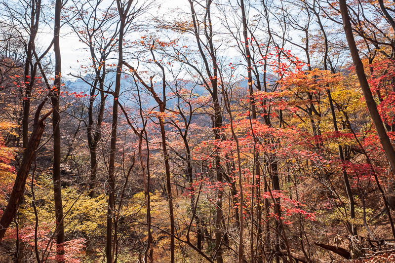
The Nakasendo, sometimes written as Nakasendou is one of the most famous walking trails in Japan. Much of it is now quite developed, this area between Yokokawa and Karuizawa is not.
To get here, its probably best to have a 3 day JR Tokyo wide pass or similar, as you will need to take a Shinkansen in both directions. Get the bullet train heading to Nagano or Niigata and change at Takasaki. Sidenote: I am actually staying in Takasaki in a few weeks time but I digress.
Change to the Shin-Etsu line and catch it to the last station, Yokokawa, it is not far.
This trip looks far on the map, but due to the Shinkansen, its really not!
Once you get off the train, follow the abandoned train line in the direction of travel through the picturesque town until you get to a sign pointing up a mountain that says "Nakasendou", you cant miss it.
Then just follow the path! After the initial ascent it is quite flat, and as I was there in the middle of Autumn, very colorful. I even saw a Serow (photographic proof in below link!).
Your goal is the top of Karuizawa, at the Kumanokotai Shrine located at 36.368880, 138.656126
From the shrine you can catch an infrequent bus back down to the Shinkansen station in Karuizawa, or as I always do, walk! The shops in the tourist town are very interesting, and then you end up in a huge high end outlet mall and artificial ski village before boarding the fast train back to Tokyo.
Click here to hike along the famous Nakasendo.
3. Seihachiyama, Hongjagamaru and the wonderful view of Mount Fuji - My short hike became very long - Sasago station - 31 October 2018
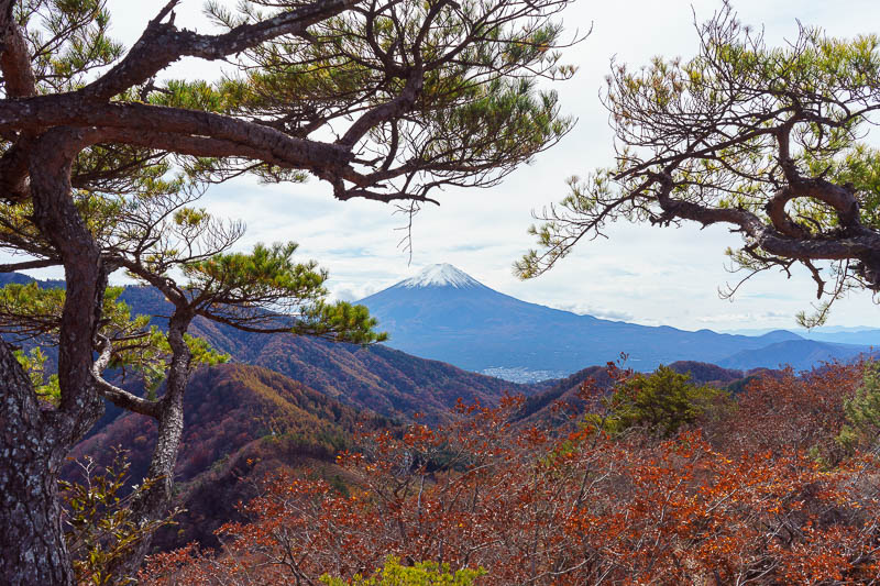
Is this hike the best view of Mount Fuji in Japan? Maybe. Although I have another contender below. It is however a great hike, not very well known, and easy to get to.
Take the Chuo line out to Sasago, a very desolate looking station with no shops (stock up before you go!).
Walk along the road a bit and through a tunnel located at 35.602353, 138.809689. You will then see a power substation and some serious flood control or hydroelectric waterways, I dont know what to call them, but photos are included below, this is the start of the hike. When I did it there was a fence to open and close to keep deer out and the first bit was quite overgrown, but it opened up after a short ascent and joined other trails along a ridge.
Once on the summit of Seihachiyama you are rewarded with a wonderfully framed view of Mount Fuji. Then I got lost instead of backtracking! I tend to do that. My path took me over Hongjagamaru and past some large electricity pylons. I think I should have turned to head back down there, but I pushed on and descended by following ribbons tied to trees rather than a defined path. Nothing to worry about, as long as you dont get in so far that you cant double back before dark if you get really lost! As a bonus, if you click the link below and scroll past the hiking, there are photos of Halloween in Shibuya.
Click here for lots of pics and info about the wonderful view of Fujisan from Seihachiyama.
2. Lake Okutama - Magnificent lake Okutama - Okutama station and a bus - 20 November 2018
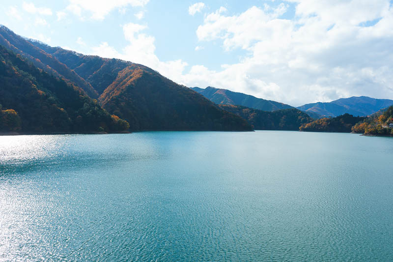
In an earlier item in this list I went to Okutama station on the end of the Ome line and hiked up a mountain. It was such a cool spot, I went again and hiked around the lake.
Most people take the train to the station, change to a bus, and then bus around the lake, but you can actually take a great hike from the station to the lake. Excellent views of the canyons the whole way, multiple old abandoned rail bridges to cross, as shown in the photos linked below.
Once you are at the lake, the scenery just gets better, but its a long way around, so be prepared! I ran a lot of it to make it back before dark and eventually caught a bus from the Lake Okutama visitor centre to Okutama station. It is over 30km if you follow the path I took. An easier alternative would be to take the bus to the lake, head counter clockwise to the red bridge shown in my pics, then get the bus all the way back from there. If you go that way its only about a 12km pleasant hike.
Click here to take a picturesque hike to Lake Okutama before jogging a lap of the lake.
1. Mount Tanzawa, Tounodake and the best ever view of Fuji - All the views - Shibusawa station and a bus - 11 November 2017
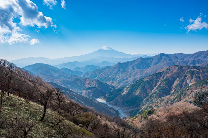
And finally, we get to the end of the list, and again its about views of Mount Fuji. Well thats just part of the amazing views I beheld from Mount Tanzawa.
When I did this hike I was actually staying in Yokohama, but its easy to get to from Tokyo. Its on the same Odakyo Odawara line as the Mount Oyama hike described above, just stay on the train for 5 more stations.
Once you get off the train, race to the bus, there will be other people doing the same! It is probably too far to walk to the trail head, prepare to be squashed on the bus.
There are multiple ways up these mountains, its a very popular hike, you cant get lost.
On a clear day, the views are amazing, as shown in all my photos linked below. Do not stop at Mount Tou (Tounodake), many people do, but the best views are beyond, through the field of mini bamboo and looking up the spectacular valley to Mount Fuji. The above photo is just a taste of what awaits if you click the link below!
You can keep hiking beyond the point I got to, and the map suggests it loops back around to another trail down. I was out of time so doubled back and enjoyed all the great views in the reverse direction.
Click here to enjoy the fantastic views from Mount Tanzawa.