
Climbing Mount Bandai from Inawashiro station
Today was the longest hike of the trip so far. Unless I get lost somewhere on my 3 remaining hiking days, it will likely remain the longest hike of the trip.
The weather was absolutely SUPERB. I cannot overstate that. I had seen photos taken just 4 or 5 days ago from near the summit of Mount Bandai that showed a similar amount of ice to that which I experienced on Mount Zao. Probably taken on the same day as I climbed Mount Zao then I guess. There was no ice at all today, and taking my jacket was a mistake. Shorts would have been fine!
The hike today can be split into 5 distinct sections.
1. From the station to the ski fields.
2. From the bottom of the ski fields to the hiking trail.
3. From the hiking trail to the plateau.
4. From the plateau to the emergency shelter.
5. From the emergency shelter to the summit.
Then you have to do them all again in reverse.
Most people would not walk, or run as I did from the station to the ski fields. In fact most people use a completely different much shorter trail approaching from the west which meets up with the trail I used at the Emergency shelter. Going this way requires a car, but would halve the time taken.
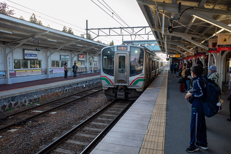
Getting back to the station at the end of the day was a mad sprint. I ran the last 5km at ridiculous speed, wearing my jacket, and had a full sweat going on as I made the train by 5 seconds. Missing it meant a 90 minute wait for the next one! It sure was exhilarating to run so fast at the end of a long day. Then the train was quite full of people looking at me trying to figure out why I was wearing a jacket and sweating profusely.
Lots of pics today, the very bright sun ruined some of them, as did the farmers smoke which created a terrible haze. The sky was amazingly blue at times, the difference between bright sun and dark shadows made it impossible not to clip exposure levels in some shots.
Thats enough text, lets do the photos.
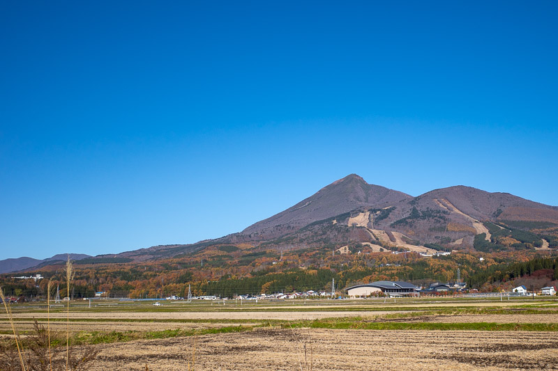
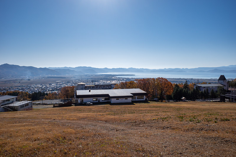
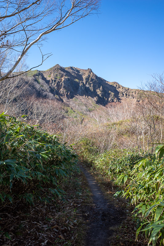
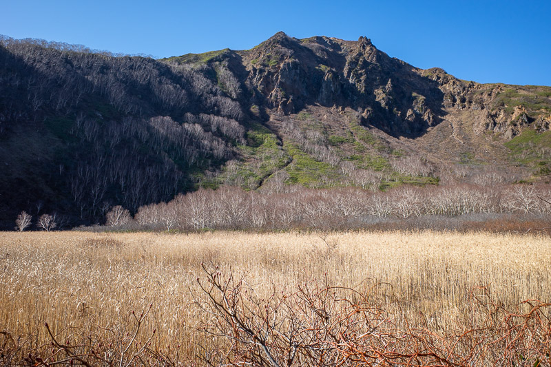
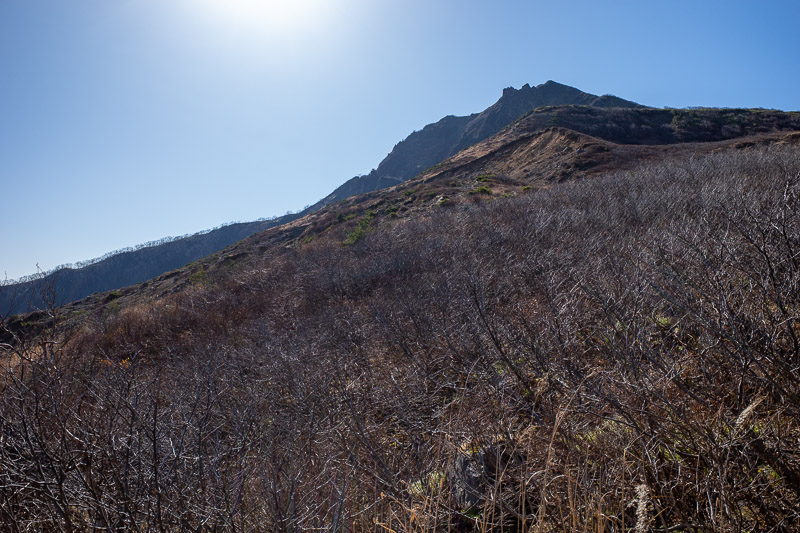
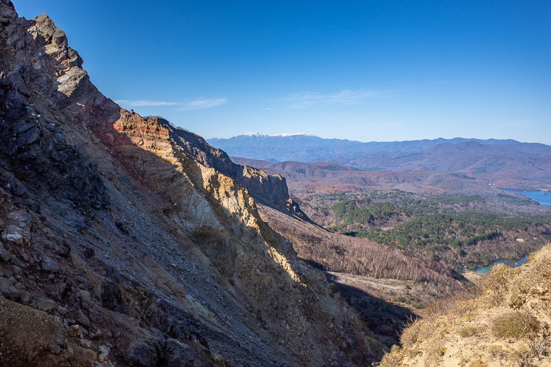
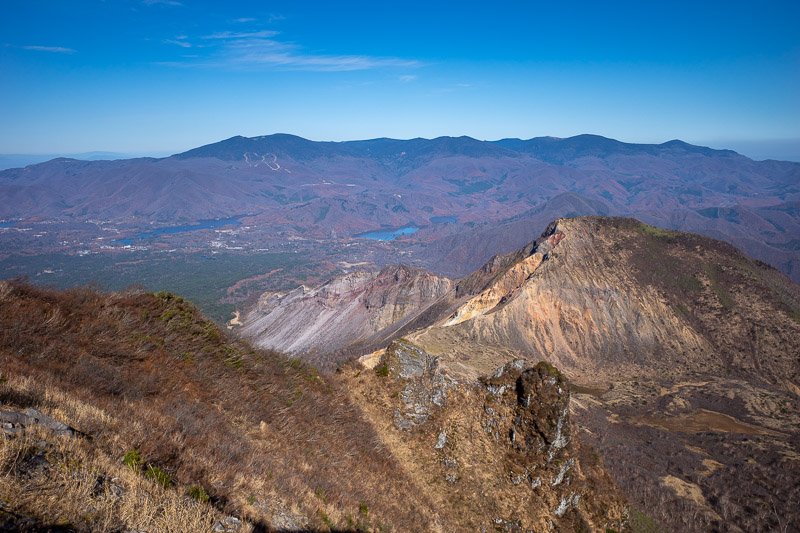
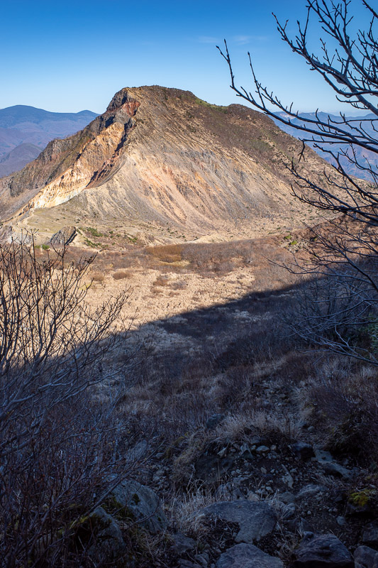
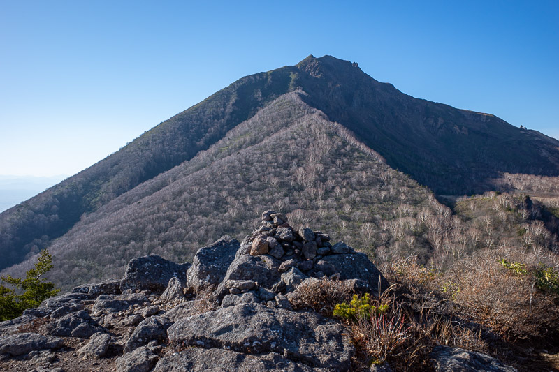
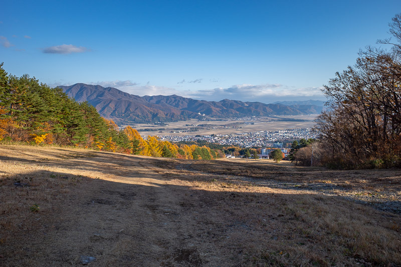
The peak at the back is Mount Bandai. Theres a cliff with rocks that you will see later, so you have to hike around the back to get to the summit.
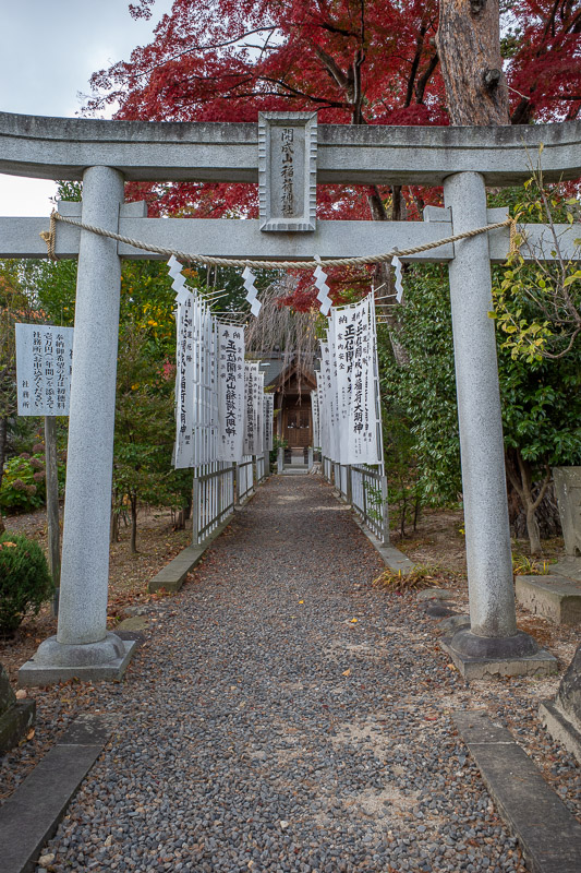
I passed a shrine on my way up to the ski field but had no time to explore, just enough time for this leaf shot. As you can see a tv crew was filming below. I ruined their live cross to NHK.
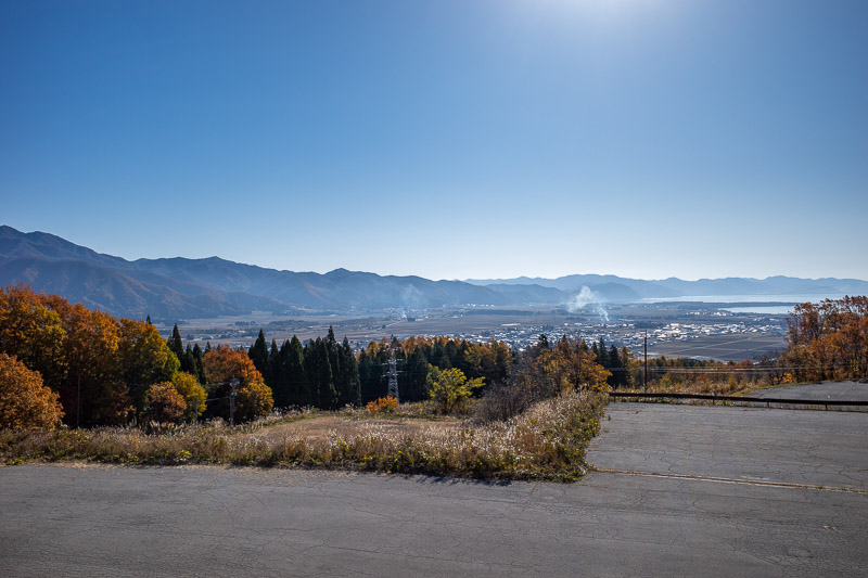
The view from the ski field car park is pretty good, apart from that damn smoke rising into the sky everywhere.
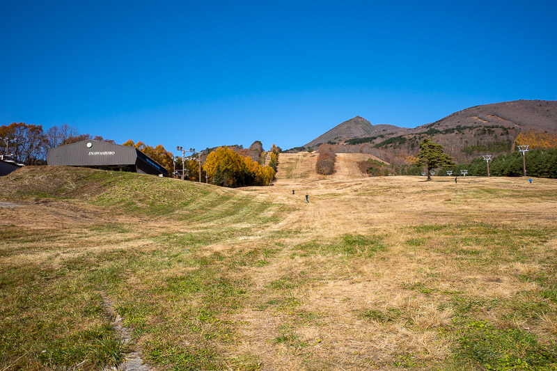
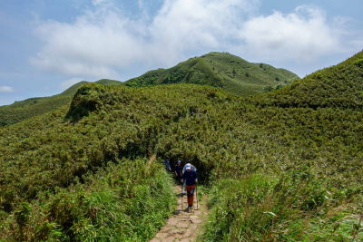
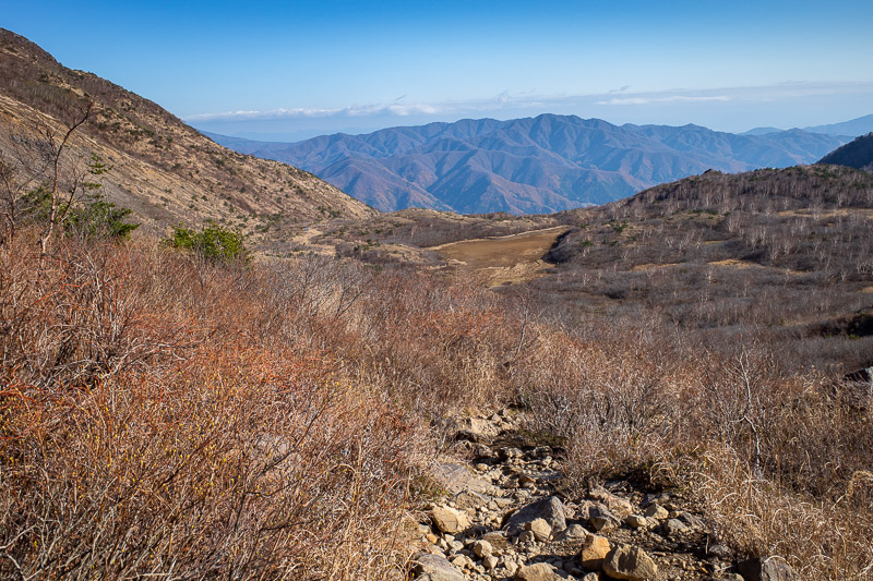
Time to start my ascent through the ski fields. There are not as many ski runs as Mount Zao, and there is no sightseeing cable car at all, just the ski lifts which obviously are not yet operating.
The view back down remained great. I was following a yamap map again to know which ski slopes to run up.
I can assure you its much steeper than it looks. The only vehicles using that service road have caterpillar tracks.
Lots of mountains around here.
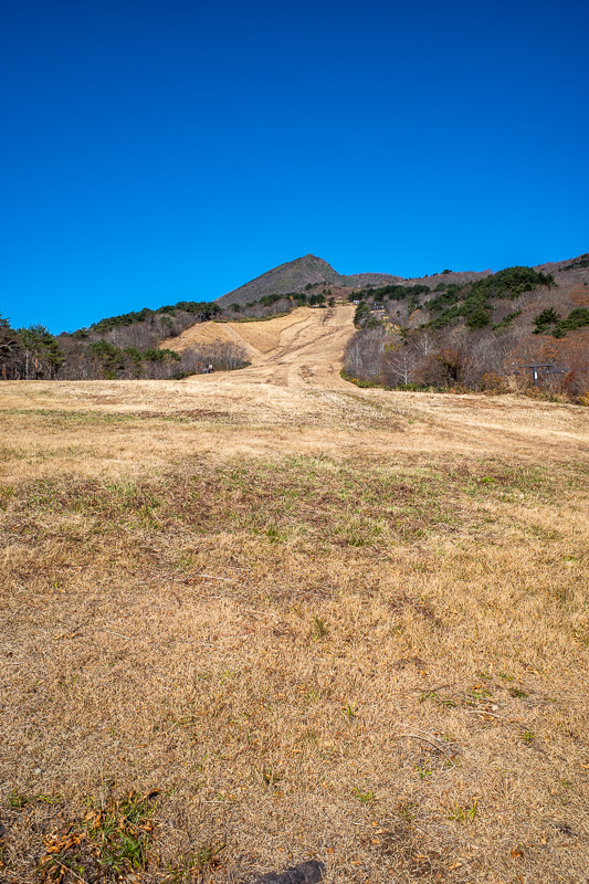
The peak does not seem to be getting any closer.
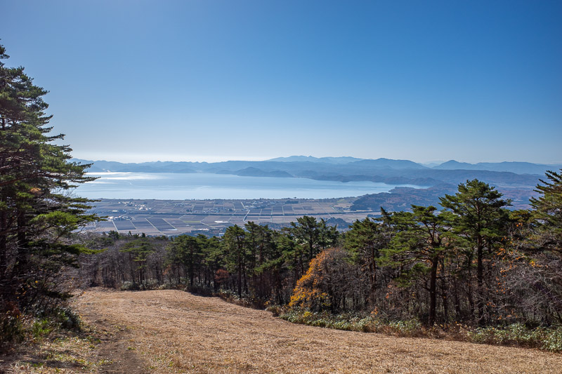
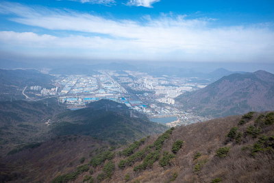
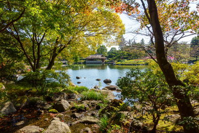
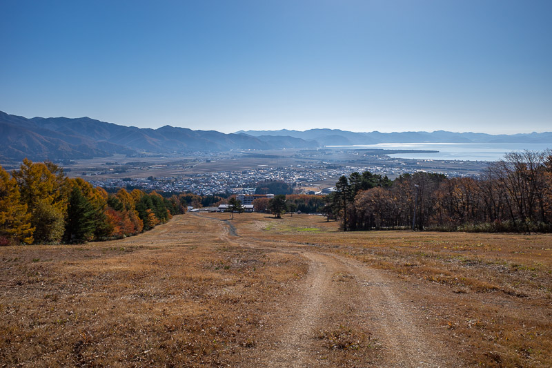
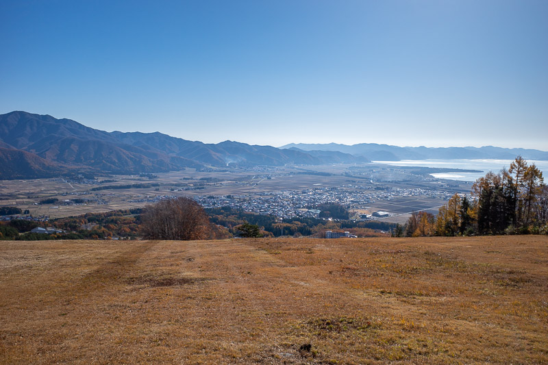
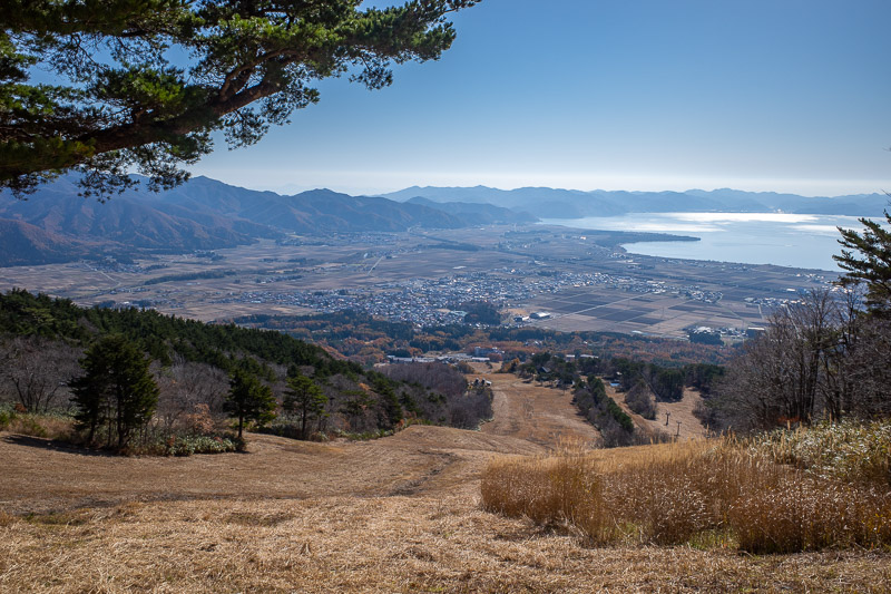
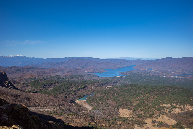
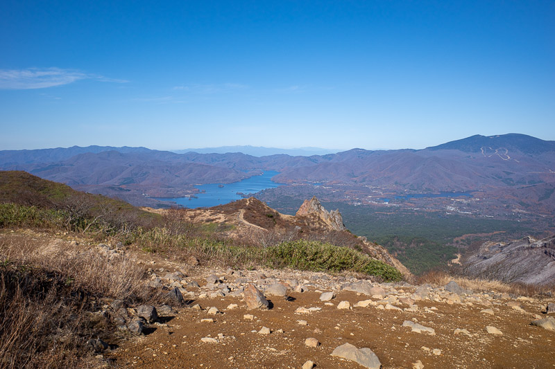
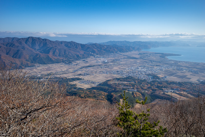
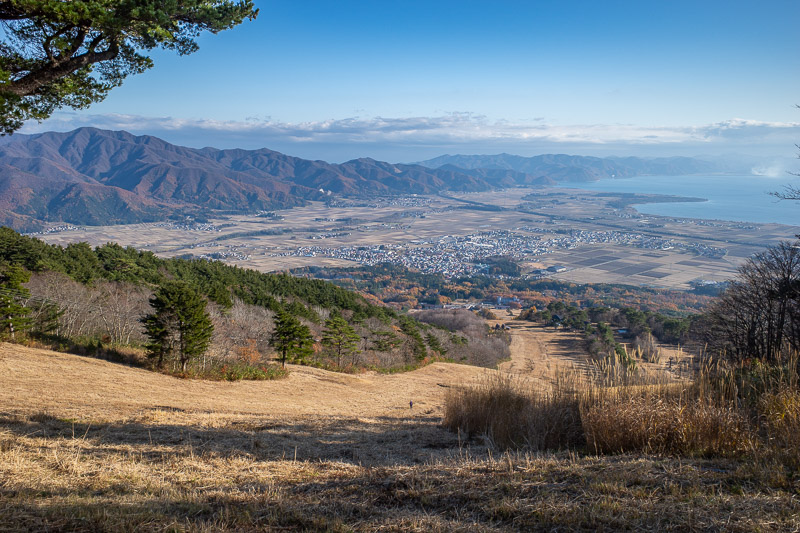
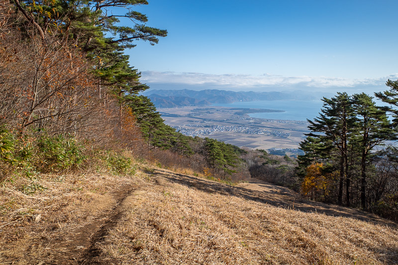
You will see a lot of Lake Inawashiro today. It is the fourth largest in Japan.
Here is the view from the very top of the ski fields.
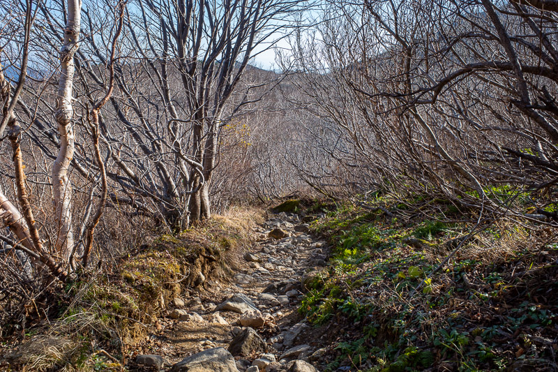
Time to start phase 3 of the hike, ski fields to plateau.
I thought the weather could change at any point, even though it never did, so I was getting every kind of photo while the sky was still clear, including one of these.
This is the start of the plateau section, with the peak of Mount Bandai in the distance.
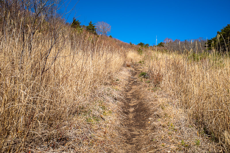
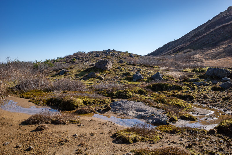
There are a number of small lakes and marshes in this area. It was a great part of the hike, quite flat, I ran most of it.
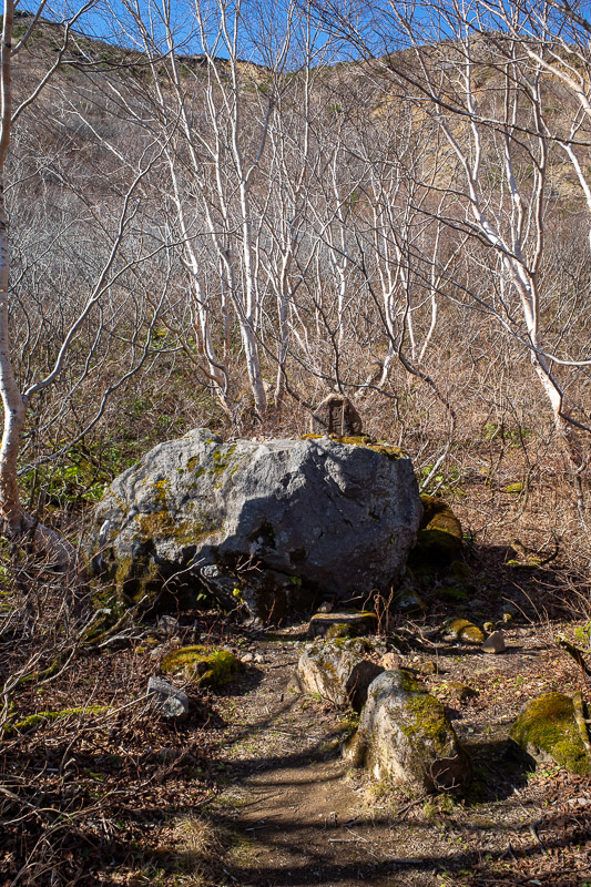
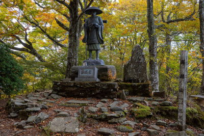
A small shrine of some kind.
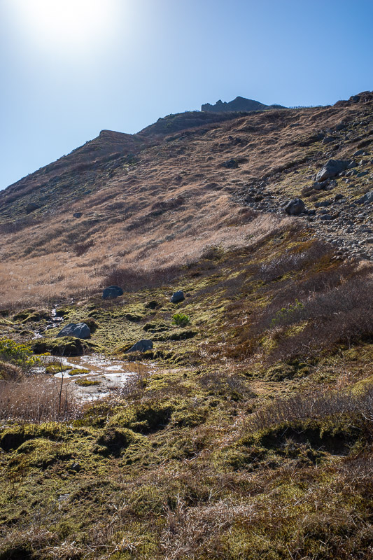
Now its time to get out of the trees and start appreciating the view. Below is what I have been referring to as the plateau. Word of the day is plateau, you will hear it some more.
It still looks like a long way up from here!
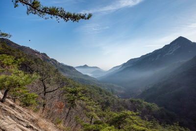
There is nowhere you can really plummet on this hike, but this area has been roped off, the ridge was very fine volcanic looking rock. Also, check out those snow capped peaks in the distance, those are the ones I saw on the train from Niigata to Yamagata.
I believe that area is off limits.
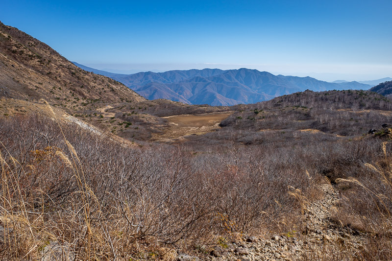
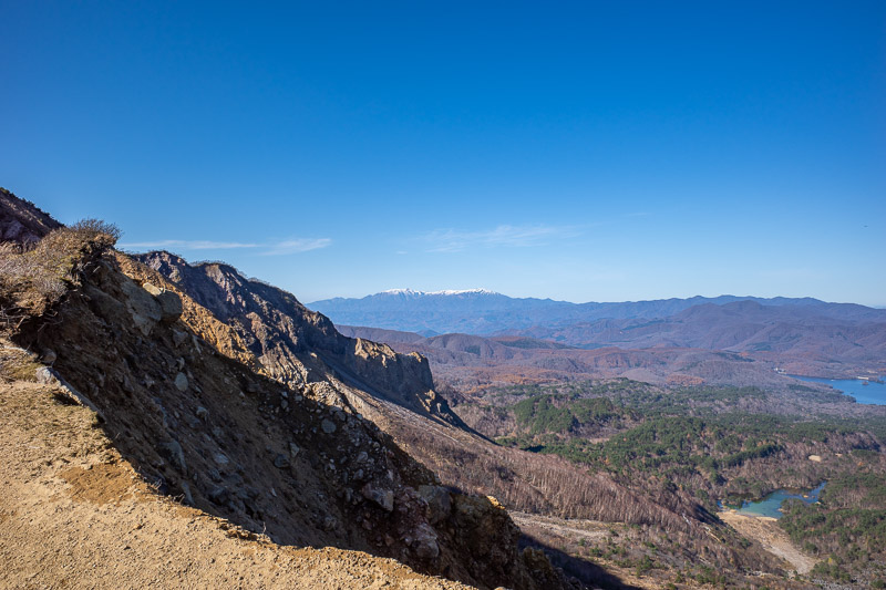
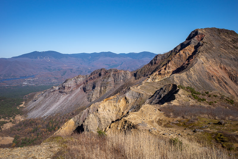
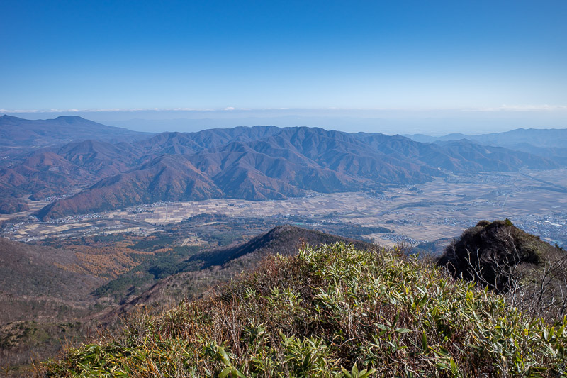
Now this is the far side of the mountain, and its a high plateau where all those blue lakes are. It does not look anywhere near as far down as the ski field side to Lake Inawashiro. Keep scrolling I will show you.
This part of the hike had great views of cliffs.
The peak STILL seemed far off, but I was enjoying myself.
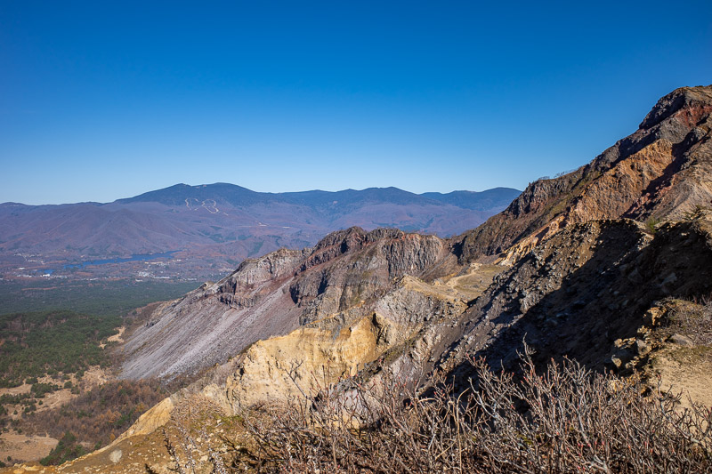
Looks like a quarry has destroyed the mountain, I suspect a volcanic eruption did.
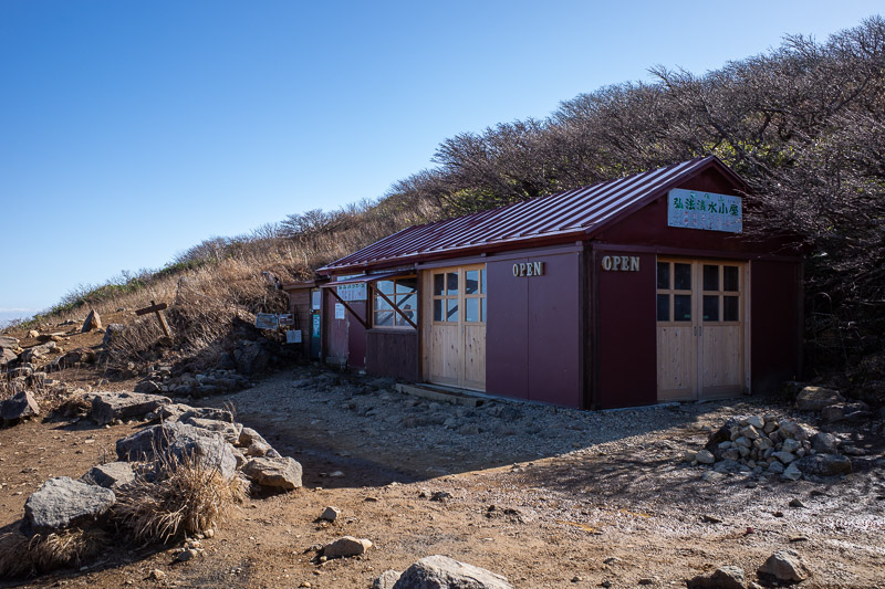
Here is the emergency shelter, it is where the main trail from a road joins on. I saw only one other person before getting to this hut. After the hut to the summit there were lots of people.
Bonus pic of small lake plateau.
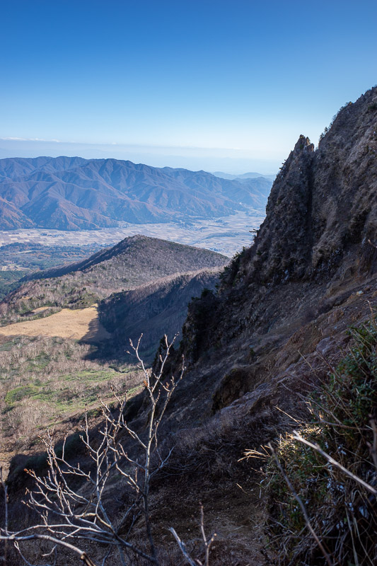
Cool cliff, tricky light. This kind of shows how I had hiked around to the back of the mountain to get up.
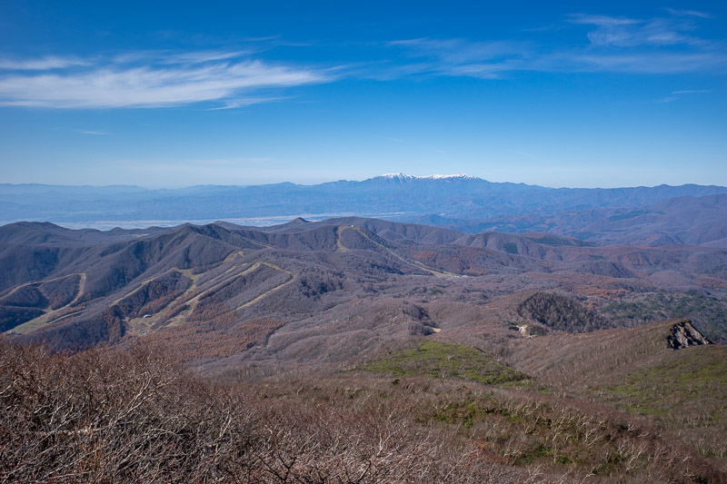
Some more snowy peaks, very near the top now.
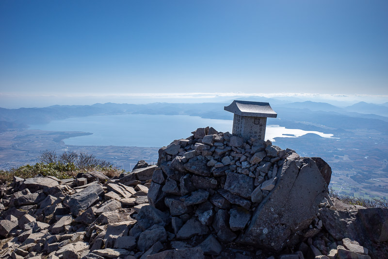
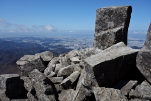
Here is the summit. It was actually an easier hike than I thought, it took a long time because I had to get from the station to the ski slopes, but the path was well maintained, no ropes or ladders anywhere.
Now for some summit views, there are those yellowy looking sandy ridges.
I think this is looking back towards Koriyama over smaller mountains.
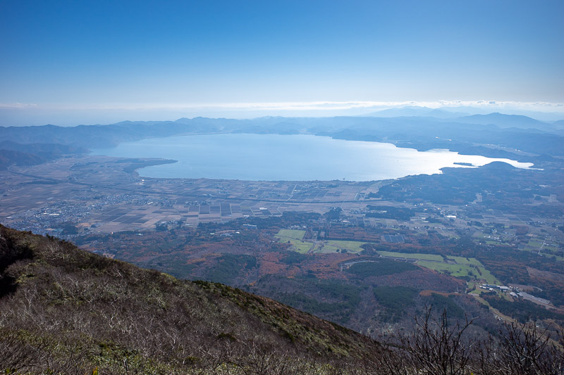
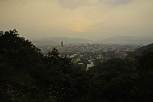
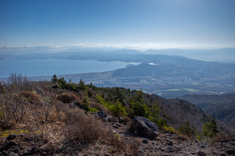
And there is all of Lake Inawashiro. It fits in one shot! It looks a long way down! I started from very close to the lake where the station is.
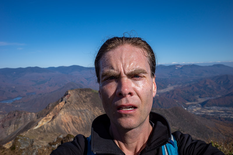
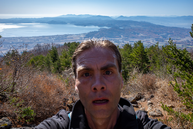
Time for another shot of my big old head.
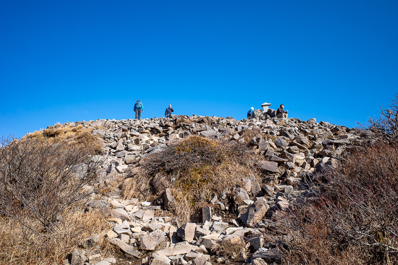
There were a few others at the summit.
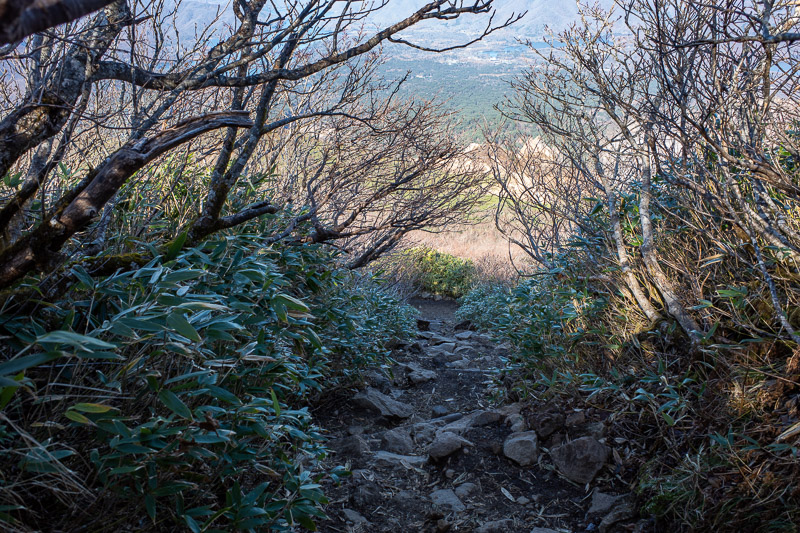
I am on my way down here. This side is mainly in shade this time of year, and its where I saw an ice tunnel in recent photos. No ice today.
The light was better on the way down, but I did not take as many photos. I am sure you are all relieved.
A nice green area. Slimy.
Oh, its the plateau again. Both on the way up and down I had this all to myself.
The path down was rockier than I remembered on the way up!
I had made very good time, so I decided to take a slight detour on the way down to another peak. It only adds 20 minutes or so. Here is the view from unnamed peak looking back at Mount Bandai.
Of course I had hiked back up hill so I could hike futher down hill.
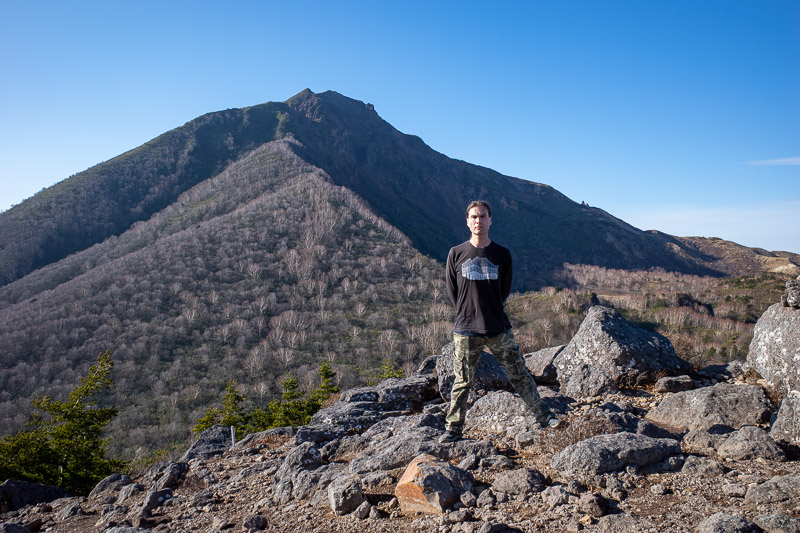
But it did allow me to complete THE STANCE. Note these are my mountain clothes. They appear in many photos on many trips for many years now! The top in particular is more than ten years old, and looks it. It was soaked through on my back with sweat!
Cool view down. I am over half way down at this point, better light, better detail. Oh look, some cloud on the horizon.
Back at the ski fields, now I can run!
I did not run the whole way, but should have, I should have checked earlier when the train was coming....
It does not take long to get back to the ski field parking lot. I NARUTO RAN the last bit. Look that up.
Then I checked the train timetable, and realised I had about 25 minutes to run 5km. At least it was down hill, but remember by now I had hiked up a mountain and already travelled over 20km. TIME TO GET RUNNING. I made it onto the platform just as the train arrived, no joke!
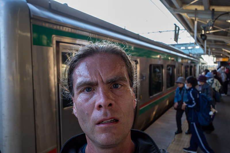
Here I am, sweating profusely as I board the train. Another great day in the mountains today, the weather really helped make it excellent!
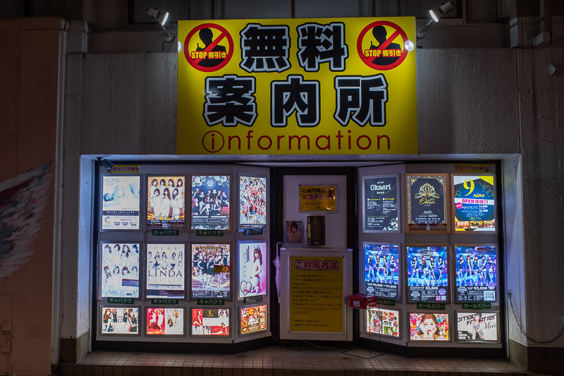
Eating Champon in Koriyama
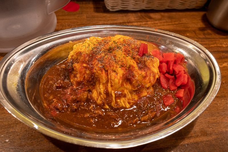
Champon, also known as chanpon, is the main thing people eat in Nagasaki. I was not brave enough to eat it when I was in Nagasaki last year. It is literally udon noodles and other things, cooked in lard. The soup then has lard added to it. And yes it tastes like lard. I am not a big fan! I decided today was the day when I had burnt enough calories to give lard noodle soup a try. Once was probably enough.
I have now explored Koriyama a bit, but not too much, I was taking it easy this evening. Initial impressions are that Fukushima, just up the road, is busier and nicer. Thats not to say Koriyama is horrible, I am just trying to pick a winner.
I see there are 2 big malls quite near the centre of Koriyama, those may have impacted business in the city centre. Rain is forecast tomorrow, so who knows, I might end up at a mall.
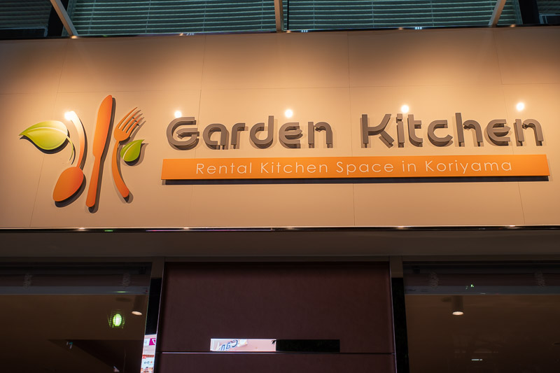
Japanese concept maybe. You have no kitchen in your house, you go to the rental kitchen when you feel like cooking.
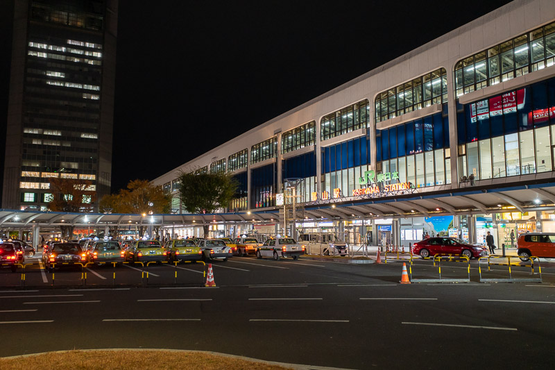
I thought this evening I would just go to the station and that would be the end of that. Here is the station photo. But as you will see, I then decided to wander and gawk a bit.
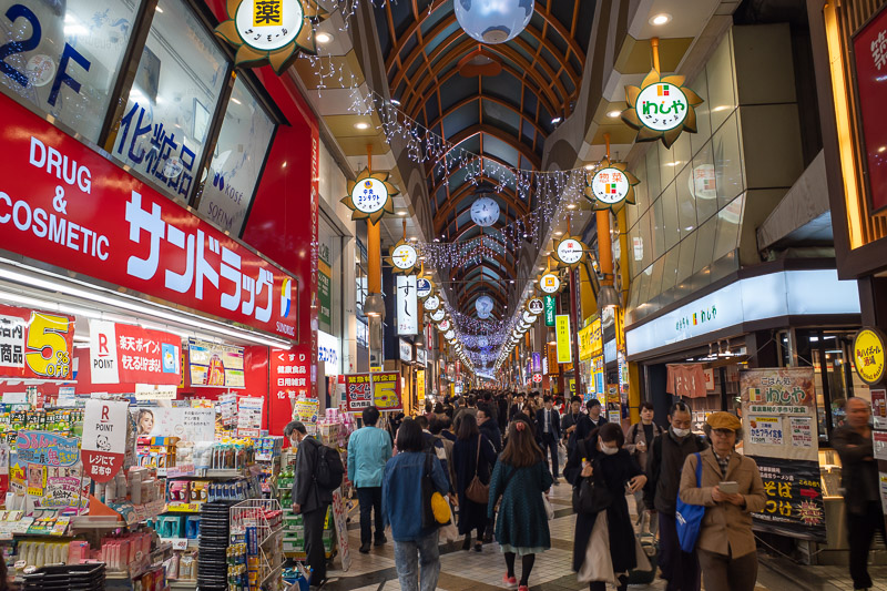
The covered street thing is pretty small here.
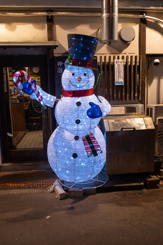
The station has their christmas illuminations ready to go, but they do not seem to be turning them on yet, instead I present, snowman out the front of a bar.
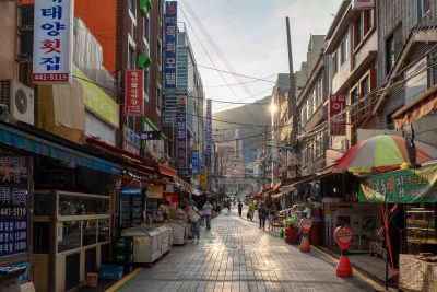
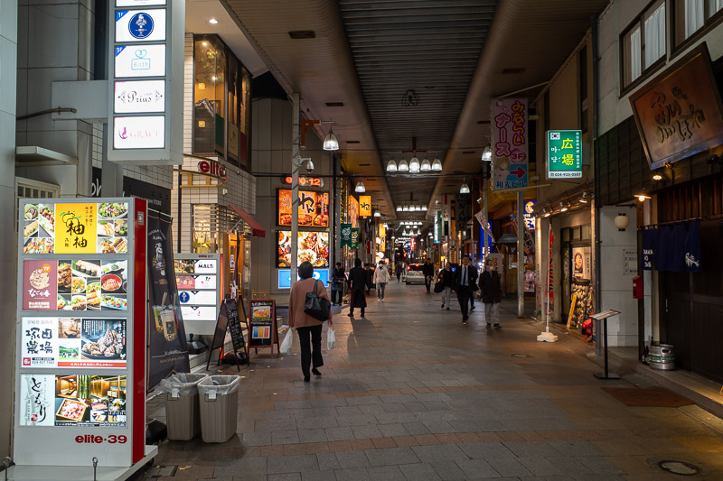
The main street was busy enough.
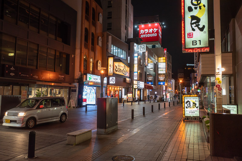
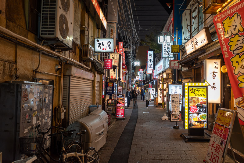
There are also a few busy side streets.
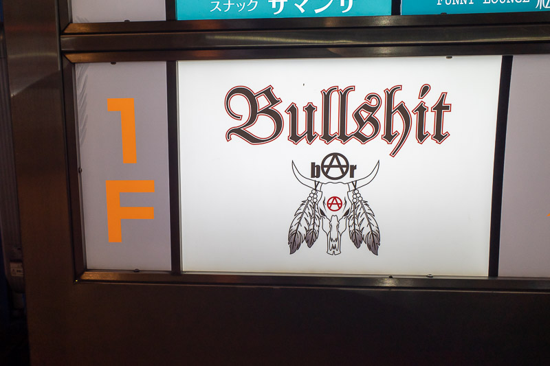
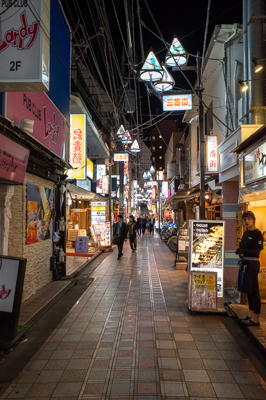
If I was going to go to a bar, this is the one for me.
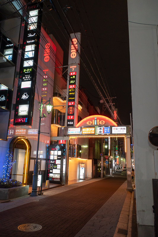
A lot of Koriyama places are quite vertical, and many of them are owned by a company called 'Elite'. There are at least 10 such towers I noticed so far. All seem to be a mix of bars, love hotels and karaoke in one building. Also I did not photograph it but theres a cool looking cinema, with 10 screens, in 5 buildings. Very unusual. The 5 building thing is why I did not photograph it, 5 photos would have been too many.
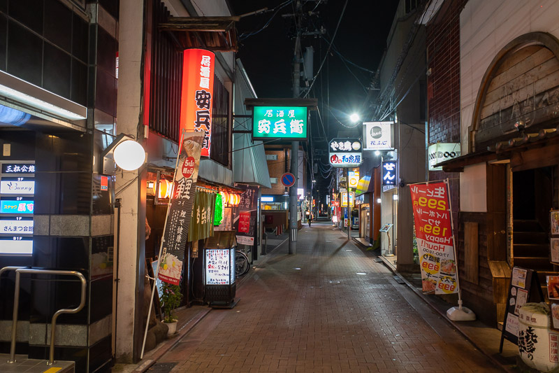
The alleyways here are not too narrow.
Tourist information centre. I went in and asked what time the zoo would be open tomorrow.
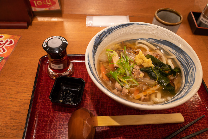
And here they are, lard noodles. If you like lard, give them a try!
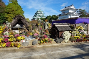
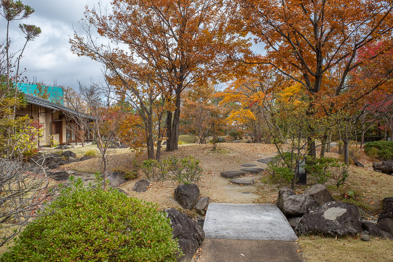
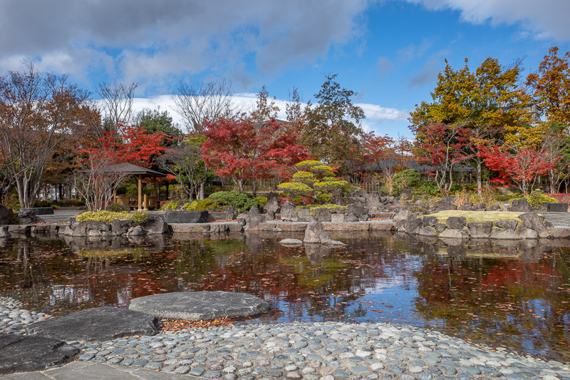
Wandering around the many gardens of Koriyama
Today is my rest day after yesterdays big hike. The weather seemed very changeable. There was very fast moving cloud, high winds, then a few seconds of sunshine and no wind, then rainbows, but never really any rain. At least where I was.
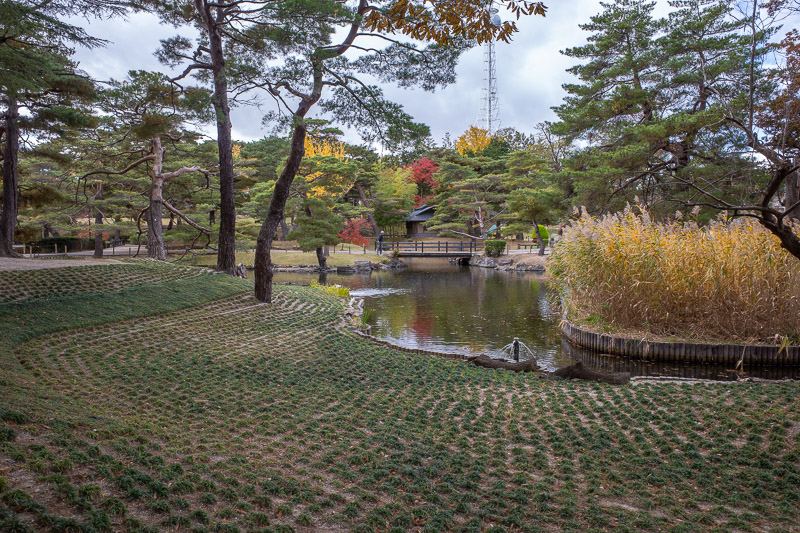
I set off towards the main park, described as a beloved park, Kaiseizan. What I want to know now though, does any place describe their park as a hated park? Anyway, it was not much of a park, just a few sporting stadiums, a pond, a metal red bridge. No turtles.
In one of the sporting stadiums a school sports day was being held. I watched from afar, cause watching kids is creepy and I will be arrested. The 10 year olds were lined up for the 800m, which is two laps of the track. I was amused that in a 2 lap race, about half the field got lapped. Shameful.
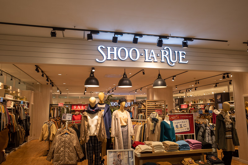
After the main park and attached shrine visit, I battled a leaf force gale (leaves were sandblasting me) and headed to the mall. Literally its called 'The Mall'. Strangely this mall had nowhere to sit and have a cup of coffee. There were 2 supermarkets and a kind of department store, as well as a food court. Mcdonalds was the only place serving coffee of any kind. After a quick walk through I pushed on.
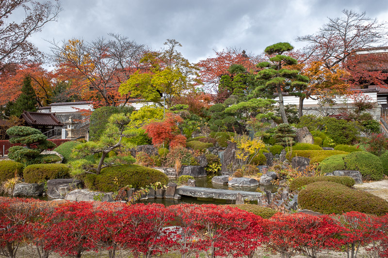
Then I stumbled onto numerous other parks and gardens, they didnt seem to rate a mention on the things to do in Koriyama lists, but they were a lot nicer than Kaiseizan. At least in my (correct) opinion. One feature of these parks is that all the kids playground equipment was roped off. All of it. Swings removed, slides roped off, monkey bars covered in hazard tape. What happened?
Finally I wandered back into the main part of town, found somewhere for another coffee, fled from the flash Tiffany and Gucci department store and ended up having a crust free fruit sandwich for lunch.
Somehow that was still quite a lot of walking despite not doing anything, and I am back at my hotel just after lunch with nothing planned.
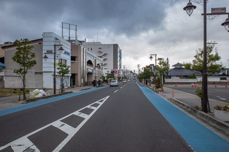
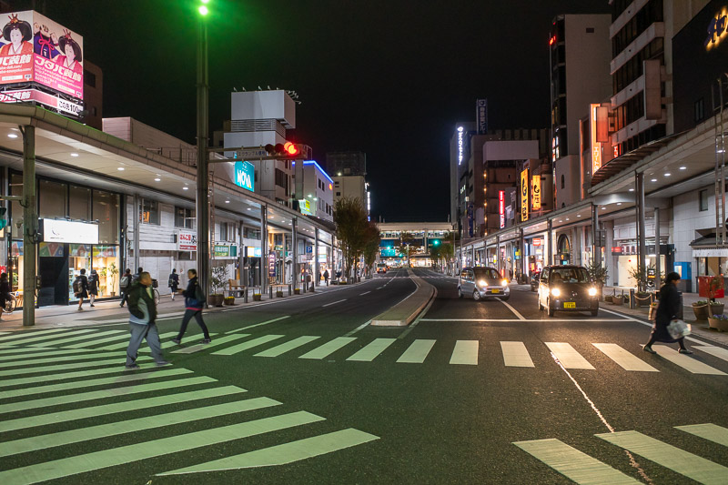
Heading towards the Kaiseizan garden, and the skies were looking ominous. Fast moving cloud. Nice street though.
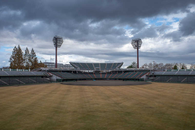
My first stop was the baseball stadium. I was surprised the gate was open and I could just wander around.
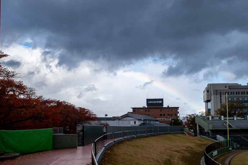
If you look closely, its a rainbow.
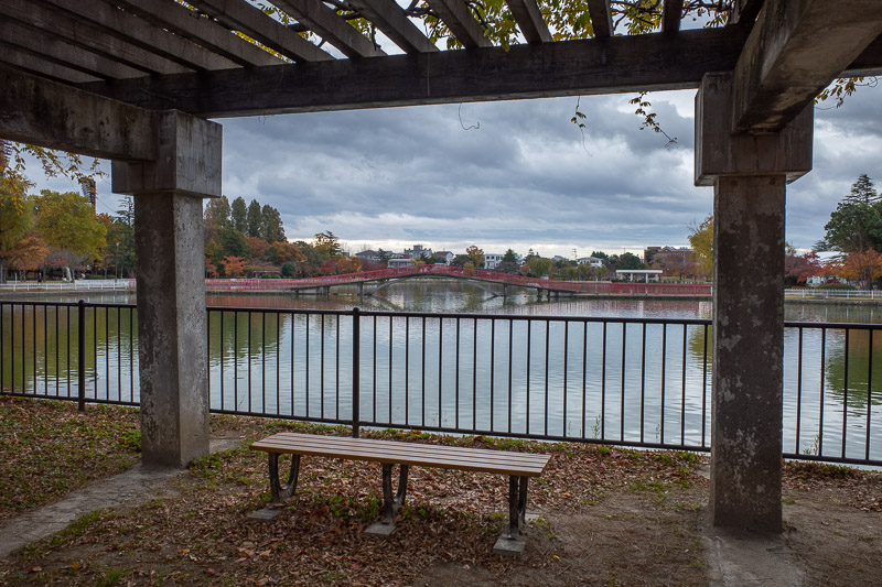
This is probably the best view of the beloved park, and its red metal bridge.
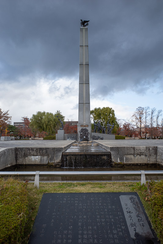
The martyr monument. No is it? Do they have those in Japan or just in the other Asian countries? Are they generally monuments to people who died fighting Japan? I have no idea.
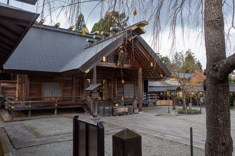
The nearby shrine smelt brand new. It smelt like freshly cut timber. I hoped they installed a fire suppression system!
The grounds of the shrine were quite nice.
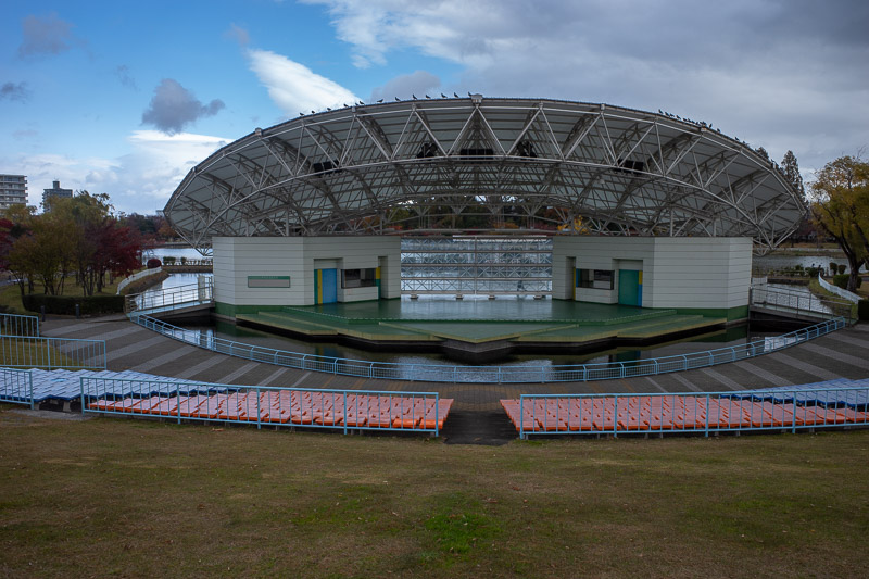
Back to the beloved park now, here is the outdoor performance area. A live performance of leaf sweeping was occurring.
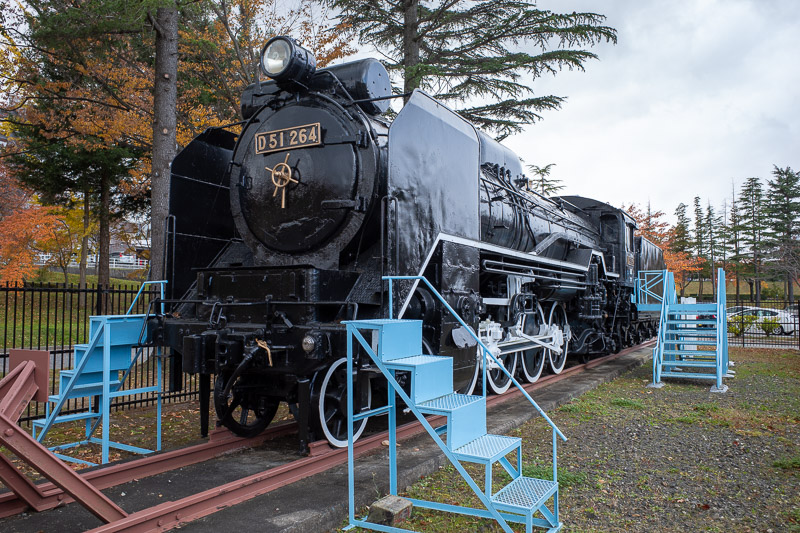
The train was fenced off. I wanted to climb up the ladder and pretend to be a train driver.
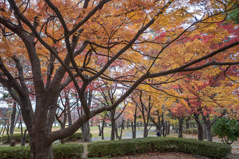
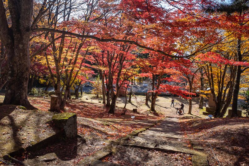
Some leaf color, more later.
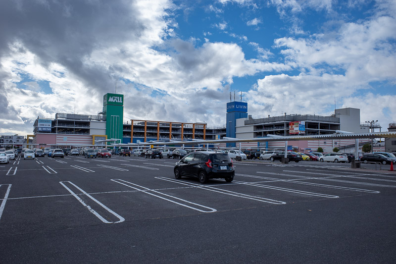
Here is 'The Mall'. Its a mall. A mall without a coffee shop.
Cultural misappropriation!
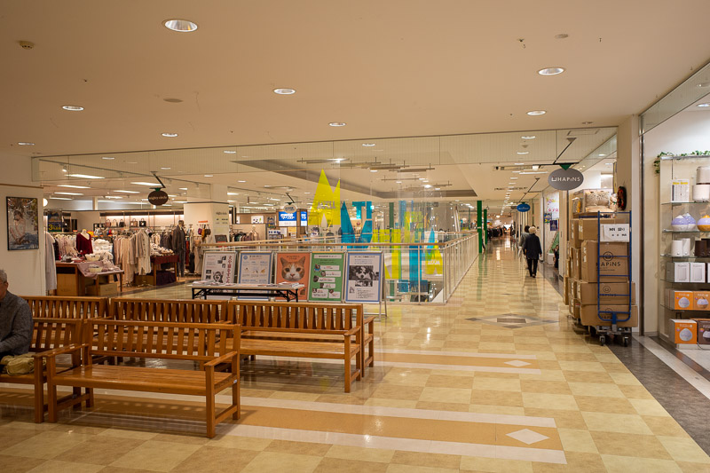
Its an older style mall. Photo here otherwise I am sure there would be complaints. There were no empty shops at all.
I fled the mall and found an open gate to this garden. I was not sure if I was supposed to just walk in or not as there were signs on the open gate suggesting you cant come in. I went in anyway, snapped a quick photo and left.
Nearby the private garden area was this public garden area. And surprise blue sky. No turtles though.
Another park nearby. This is the one that had all the playground equipment roped off with crime scene CSI tape.
Annnnnd the last garden for today. Still no turtles. My turtle hunt had failed.
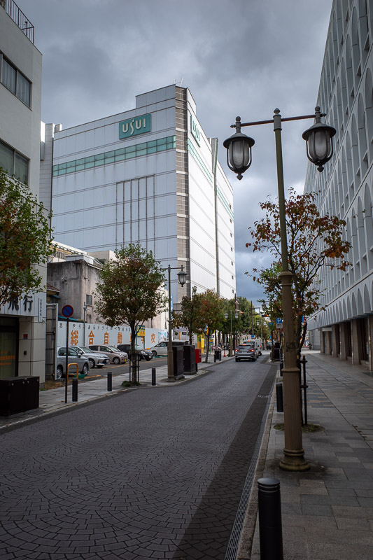
Last pic for the day, the beloved historic Usui concrete block. Its the flashiest department store in town, with Tiffany, Luis Vuitton, nothing of interest to me. It has been constructed to last a thousand years. It was blue sky when I went in, brief sideways pouring rain 5 minutes later when I came out.
Shopping at Aeon Town in Koriyama
It was cold tonight, I didnt take many photos, so time for a rant.
I dont understand why geishas are romanticized as they are. On the one hand, I come from a round eye country where grid girls have been banned at car races, beauty pageants no longer exist, using attractive females in advertising of any kind leads to product boycotts.
Meanwhile in Japan, 15 year old girls are trained to entertain wealthy men and because they do so while painting their face white and wearing a kimono, its considered magical and wonderful, the flower and willow world.
I am aware that they have taken sexual services off the menu, officially, despite former prime minister of Japan Sosuke Uno losing his job in 1985 for providing stingy gifts in exchange for sex to the Geisha Mitsuko Nakanishi. The funniest part about that story is there wasnt outrage for his affair with a Geisha, the outrage was that he did not lavish her with enough gifts! I will assume that no longer happens.
We are still left with the concept of girls and women who are housed under a 'mother', cut off from their families and the outside world, and trained in music, dance and appearance to flirt with wealthy men and make them feel important, for a huge fee. $800 an hour seems to be the going rate.
Wherever I looked online today, I saw only people defending this wonderful practice. Because, tradition. The actual tradition is far worse than the watered down version of what a Geisha now is but I digress.
What I dont understand is, if you go to Tokyo or Osaka or any other big Japanese city, there are young girls, in maid outfits, sometimes with a tail and cat ears, who feed fat guys cheesecake and sing for them in cafes.
Whats the difference? The maid cafe girls get to have lives outside of the cafe, see their friends and family, watch tv, own a phone, have a partner of their choosing etc. Geishas, do not.
Thats enough rant, back to Tokyo for me tomorrow.
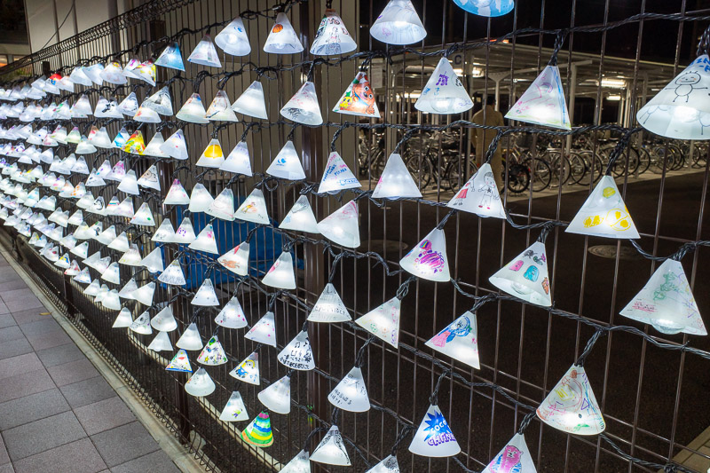
I crossed over to the wrong side of the tracks. It was an illuminating experience. These are all hand decorated.
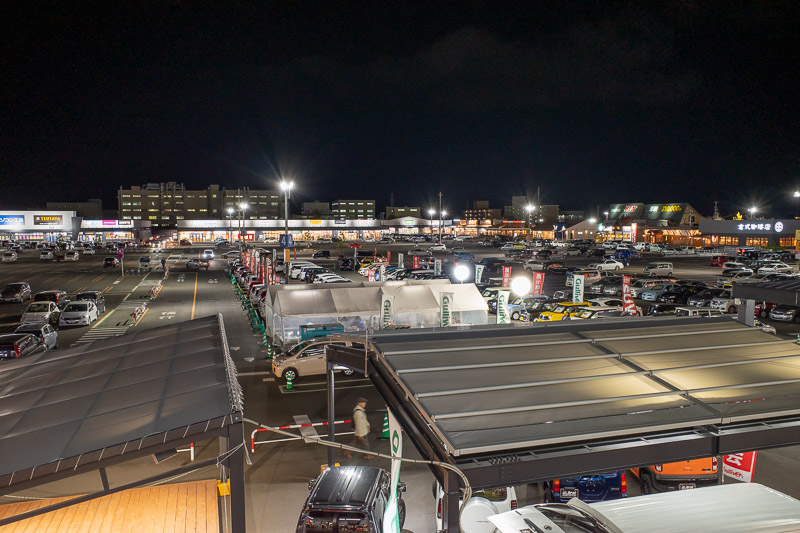
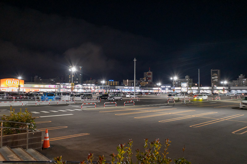
Before long I ended up at Aeon town. A different sort of shopping centre. Lots of big box stores.
The big value store appeared to be a Wal-Mart clone.
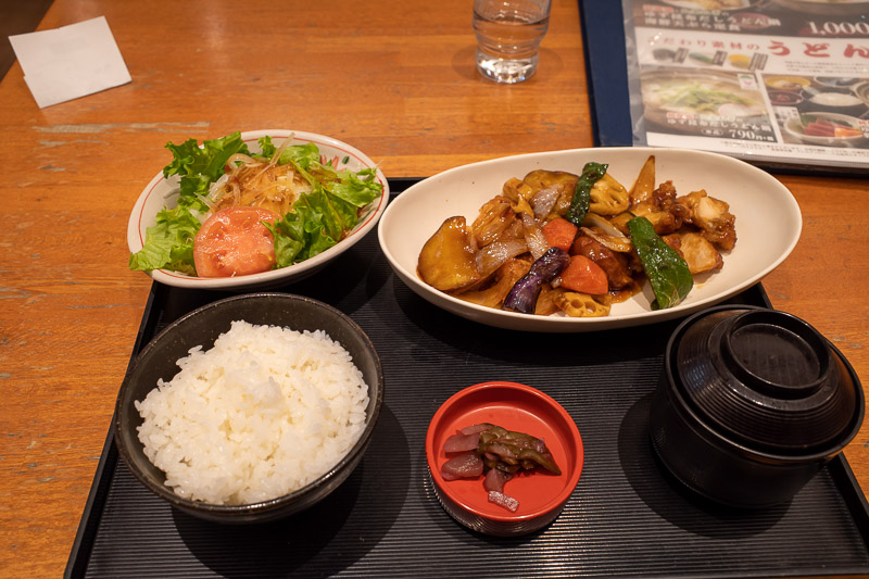
My mother said no noodles no curry, so here it is, honey chicken / fish / pork / tofu with vegetables, miso, rice, salad.
One side of Aeon town had a factory outlet kind of setup. And a nice ice cream shop that let me order a 200 yen kiddie cup. They were very confused that I made my selection without tasting them all on disposable plastic spoons.
On my way back, a long exposure. Star beams are not very nice looking, I think f/16 aperture makes them look crappy, should have stuck to f/8. The bullet train goes over head here, and they dont all stop at Koriyama, they go past at full speed. I can also see them from my hotel window. Everything shakes and electricity arcs from the wires. At one time today I think a passing train set off car alarms.
There are currently 3 comments - click to add
David on 2019-11-14 said:
Research and rant was brought on by all the online discussion about the ban on photos in the Gion district in kyoto
jenny on 2019-11-14 said:
interesting rant - i tend to agree. what set it off?
mother on 2019-11-14 said:
The monument is to thank the pioneers who were involved in some kind of land development project. I did some research.
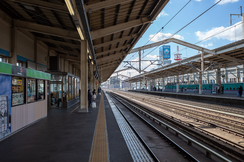
From Koriyama to Tokyo on the Shinkansen
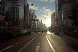
Now I am back in Tokyo, Korea town on the outskirts of Shinjuku to be precise, it will be my last stop.
I still have 6 more nights here, which means probably 3 more hikes, 2 days of doing not much, today and the day I go home... yeah that adds up. That will be weather dependent of course.
From Koriyama to Shinjuku is a 90 minute bullet train ride followed by a normal rapid Chuo line train from Tokyo station to Shinjuku followed by a small walk through Kabukicho to Korea town. I see Korean food in my future.
The train today was not very full, which was lucky, the guy next to me had 2 laptops, an ipad, an iphone and a flip phone on the go. From what I could understand, he was using Microsoft excel on one laptop, copying a pdf version of an excel file on the other laptop, using his ipad to look up help on how to use excel and using his two phones as calculators. Everyone around us was marveling at his amazing efficiency, not even one fax machine or pager was needed.
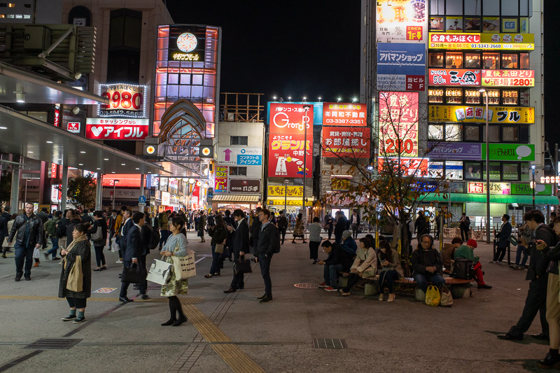
I have not stayed in Shinjuku the last couple of trips, it is full of tourists including me, and full of places I would like to eat at which all have full English menus everywhere. On some street corners, tourists outnumber locals. Also the robot cafe which I have never been to and will never go to now seems to occupy 9 blocks of Kabukicho. Theres at least 5 different buildings acting as ticket offices, as well as waiting area buildings and marketing buildings.
I got up early and walked a lap of Koriyama. Excellent weather today, it really should have been a hiking day.
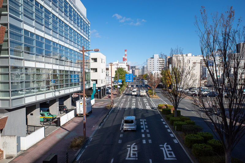
Another shot of blue sky from a convenient overpass. A woman reading her phone walked into me as I was standing here and got very angry at me for being in her way! Its forbidden to eat or drink and walk at the same time in Japan, reading your phone and walking into people is fine though.
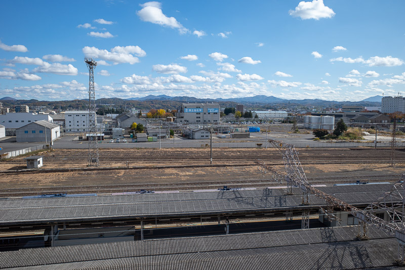
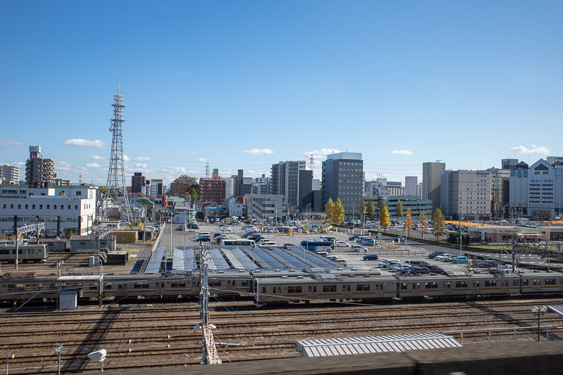
View from Koriyama station. Nice clouds.
View of Koriyama station. Also nice clouds.
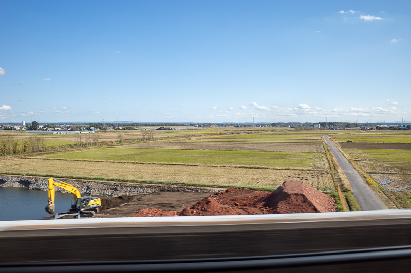
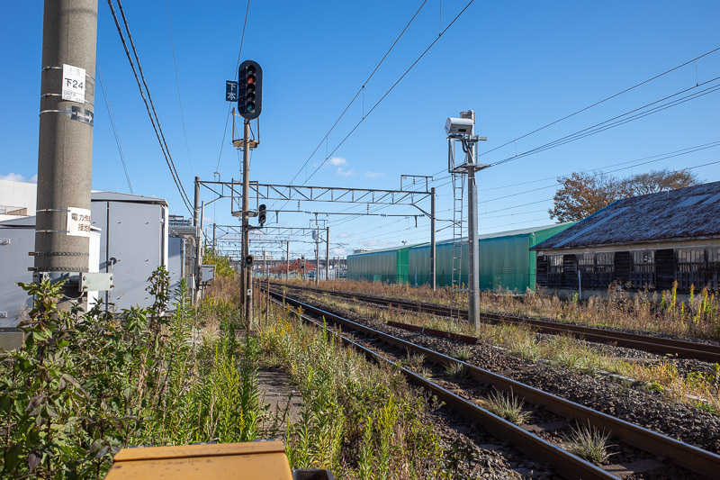
Todays picture from a moving train features flat terrain. Its nearly all flat from Koriyama back to Tokyo.
This is just before stopping at Utsonomiya, which i basically the start of the built up Tokyo metropolitan area. From this point on its all city.
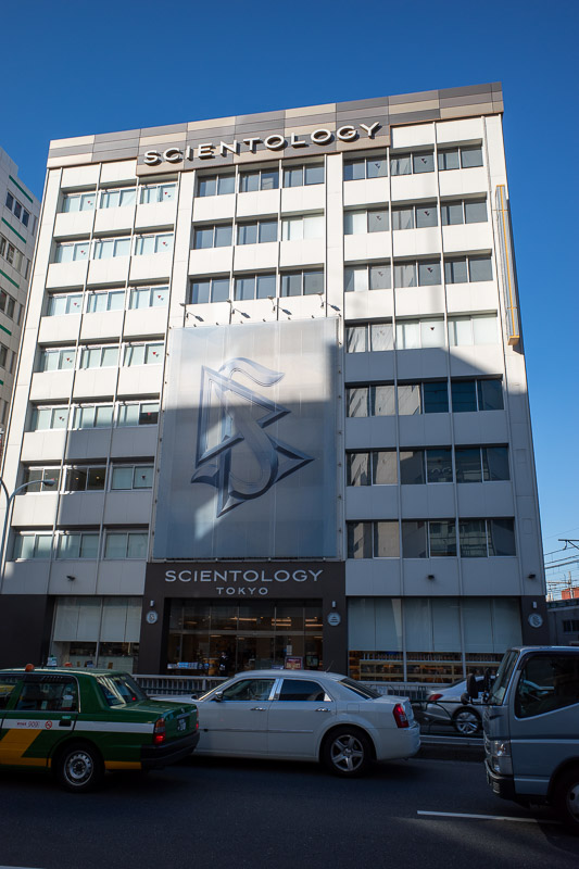
Guess what? I was too early to check in, so I went and did a bit of Scientology. Inside tip - the aliens are coming out of the volcano some time next week.
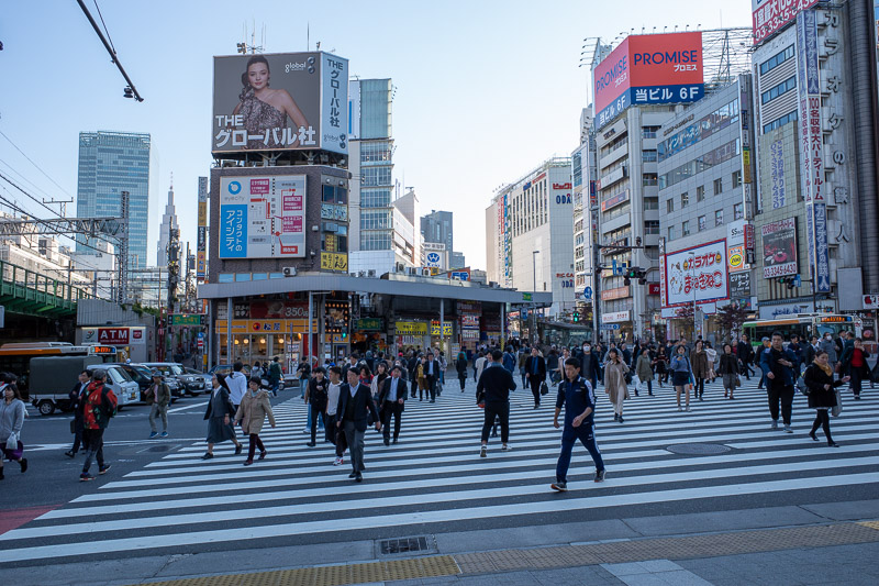
Heres a crossing near Shinjuku station, on the wrong side of the tracks.
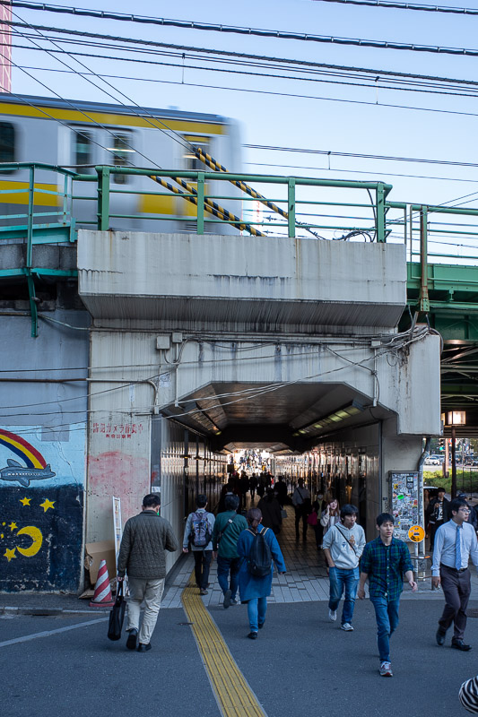
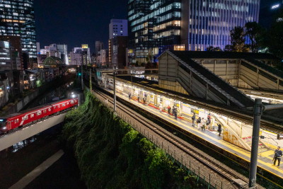
A view back to the right side of the tracks as a train goes overhead.
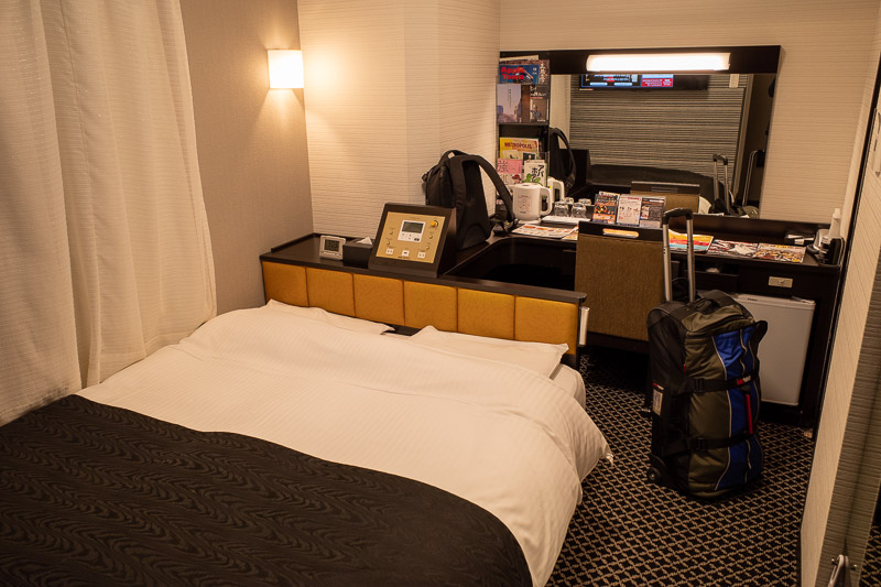
And heres my last boring APA hotel photo of this trip. It is a weird setup, the bed is backwards with a bar area behind it. The TV is behind where I sit here typing this, and is the biggest tv yet. Having said all that, its probably the newest room I have stayed in on this trip, you can tell because it has more power points. There are 5 different APA hotels within 100 metres of here.
Curry for dinner at Nakano
I have been to Nakano at least twice before. It is very conveniently located from Shinjuku, just one stop on the Chuo rapid line. And since I had already activated my use any 5 out of 14 days train pass today to get to Tokyo, I thought I should maximise its value and use a train this evening rather than just hang around in Shinjuku. That was another one of my really poorly constructed sentences.
I really like Nakano. Sure the actual Broadway old shopping centre is very interesting, with all the shops full of anything you could possibly ever want to collect, but also, the surrounding streets are great too. I think theres more little casual restaurants per square unit of measure than anywhere else in Shinjuku. On a Friday night, many of them had lines. Also they were nearly all Ramen places or meat on sticks. I still dont think of meat on sticks as being a meal, so I ended up with curry? That made very little sense I know, but I spotted a curry place I think I went to last time I was here for dinner. I could not quite remember for certain. The place serves you the curry in a metal dog bowl, which is a good sign. I guess I could check now if I had eaten there before... be right back.... yes I did, and I had the same thing! HERE IS THE PROOF! That was from 2012, when I went to Tokyo for a long weekend. I have an amazing memory.
Actually I did something similar involving curry before. In 2017 I found a very weirdly located place called pyramid curry in Kobe that I had previously visited in 2012 also. In 2012 I actually went to Japan twice. I could link those shots of old bowls of brown on rice to prove how amazing my memory is as well.... ok I will.
2012 Pyramid curry in Kobe
2017 Pyramid curry in Kobe
Having such a great memory is a real burden, there are many things I wish I could forget. Repeat curry is not two of them.
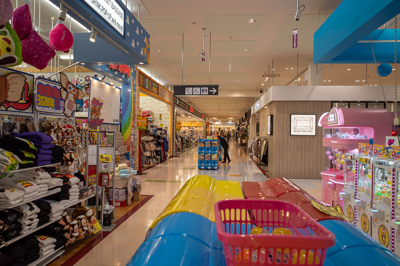
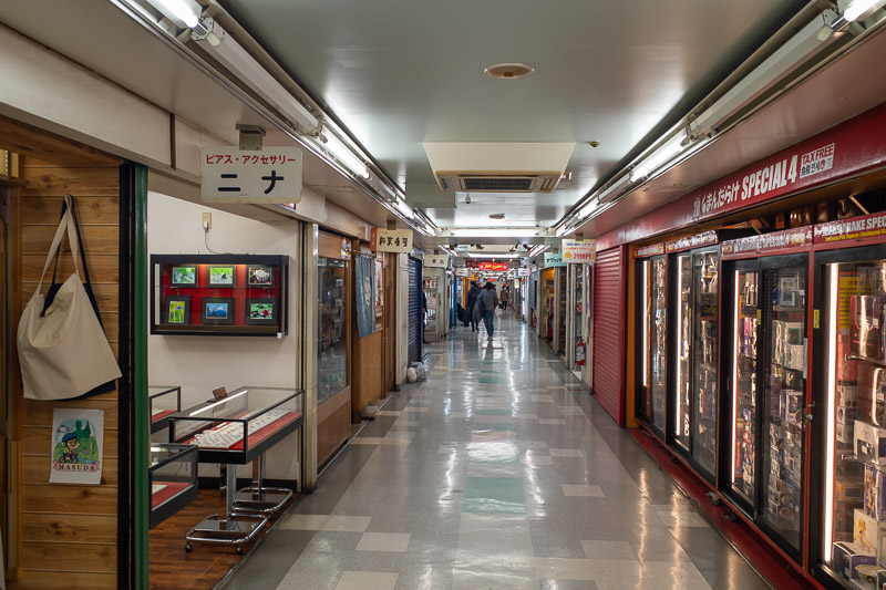
Between the station and the place called Nakano Broadway is this covered shopping street. More restaurants than most of these places.
There are many little alleyways running in every direction, lots and lots of restaurants.
Here, another alleyway.
I shall call thee, flashback curry.
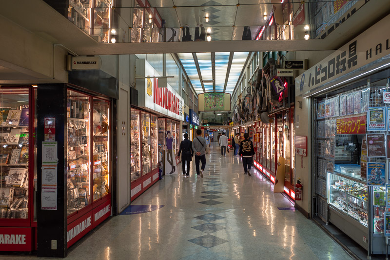
This is inside the Otaku area. It has never been busy when I have been there.
A little more Otaku. I like the headphone stores and audio gear stores the best, but it is mostly comics, dolls etc.
It is definitely a popular area, a good mix of everything, old, new, weird, clean and shiny.
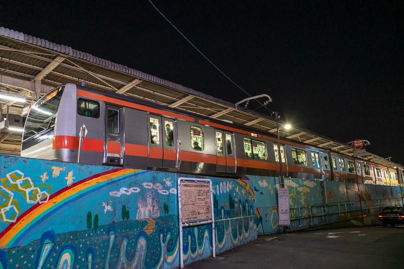
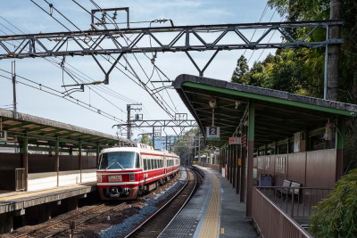
The Nakano station is a little weird, you can reach up and touch moving trains as they go past. I do not recommend doing this.
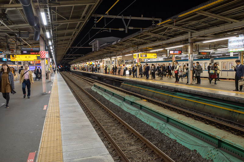
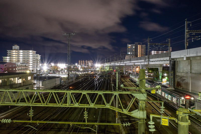
Here is tonights shot of a train platform. Night versions are generally more interesting than day versions. Although this mornings had nice clouds.
There are currently 3 comments - click to add
adriana on 2019-11-15 said:
a shotengai (covered shopping street) that is still alive - yay!
David on 2019-11-15 said:
I still have 53 to choose from on my list
mother on 2019-11-15 said:
Are there any hikes left round Tokyo that you haven't already done?
There are currently 4 comments - click to add
Brian on 2019-11-14 said:
Bullshit? Sounds like the place I work 🤣🤣🤣🤣
adriana on 2019-11-13 said:
I notice the main shopping street has awnings over the footpaths like in Kyoto. Very convenient. time you had something other than soup and noodles for dinner. Or curry. Your challenge for tomorrow.
David on 2019-11-13 said:
I would have been disappointed if you did not mention the word tree line.
Not quite 2000m. But it has 1500m prominence. There were trees in the valleys near the summit, some of the lower down bits that are bald are too sulphury for trees to grow. Fuji only has about 10cm of soil on top of hard lava from historic eruptions, hence the trees end very low down compared to other mountains.
mother on 2019-11-13 said:
Looked it up - I can Naruto stagger. How high were you today? The peak looks like it is above the tree line with all the rocky terrain.