
Hiking from Okutama station to Lake Okutama and hiking a lap of the lake
Well that all took longer than expected. So long that I didnt even come back to the hotel between todays activity and dinner, more on that later, this first part will be all about the lake.
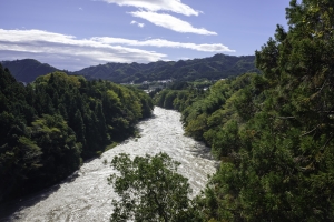
The other day I went to Okutama, and climbed over a mountain. I do that. While I was there I noticed a lot of people went a different way and they all went to look at a lake. I did my research on that lake on the long train ride back that day, the lake is awesome, I must see it I thought! So today I went to see it. It was awesome. I am also awesome because I hiked to the lake from Okutama station (10km) then ran around most of the lake on the most amazing trail ever (additional 22km). So yeah, just casually walked/ran over 32km today all the time trying not to pass out from the excitement of looking at the amazing scenery.
There is a bus that will get you to most of the sites around the lake, but it wont go all the way around, and the best trail is between the dam and the last bus stop, which is a 12km trail.
If anyone reading this ever goes to that lake, please try and do the 12km hike around the back of the lake, its one of the best things I ever did in Japan.
I dont know why its not more popular, sun moon lake in Taiwan is insanely popular, personally I think Lake Okutama is better, but my visit to Sun Moon lake, which I also ran around, was in very bad weather and I nearly got hypothermia.
Anyway, waaaaaay too many photos, so I will do some more typing there.
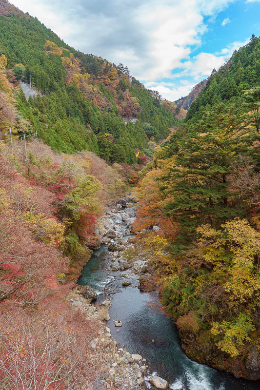
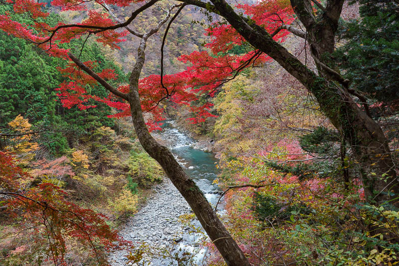
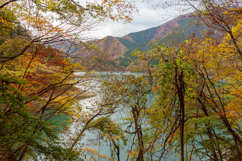
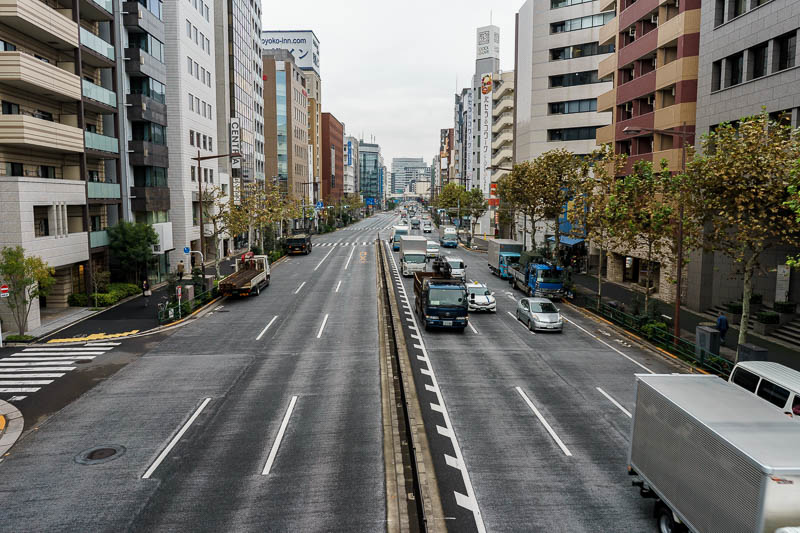
OK, there are too many pics. So they wont all have witty (by my low standards of wit) descriptions. This is the start of part 1, getting to the lake from Okutama station. The view from over the bridge was good, just like the other day, only there was no sun at this point.
This is a different part of Okutama compared to the previous visit on Saturday, this side has a convenience store, how convenient!
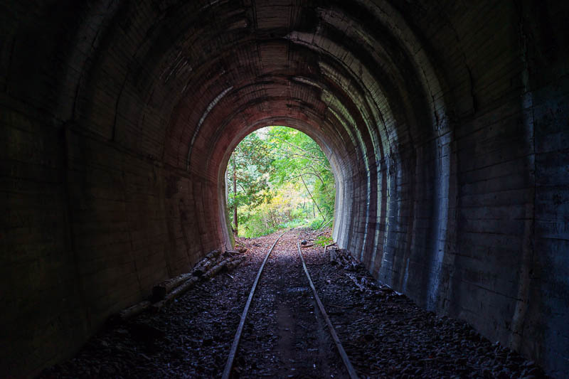
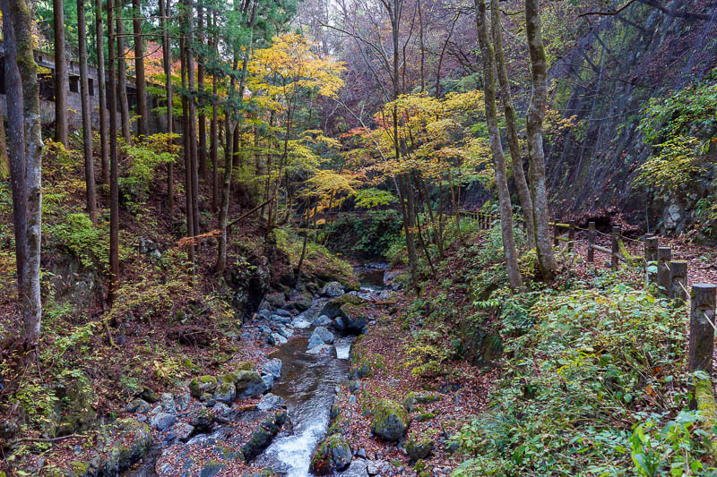
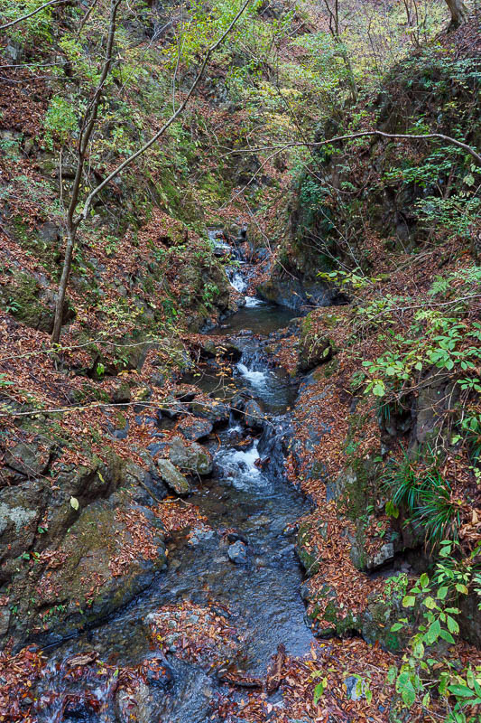
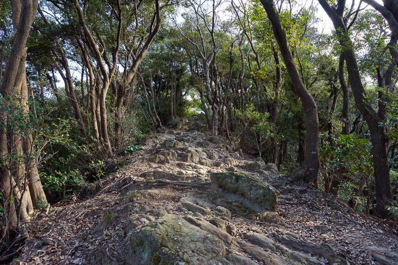
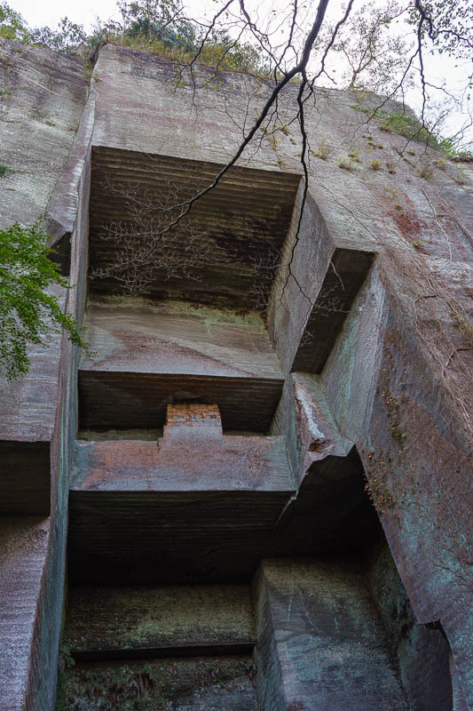
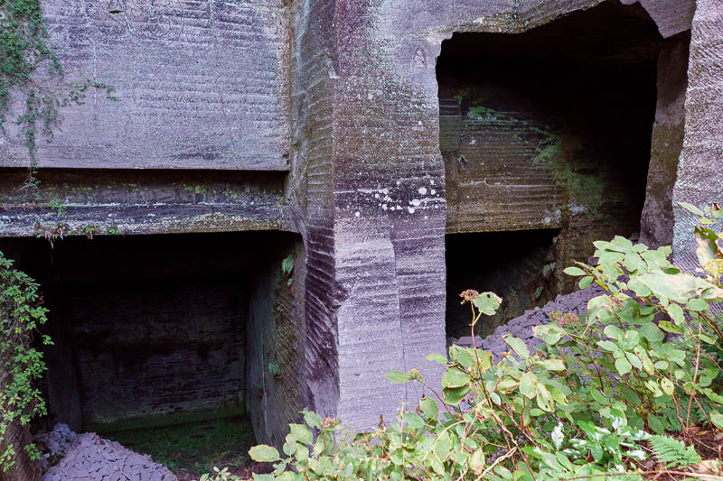
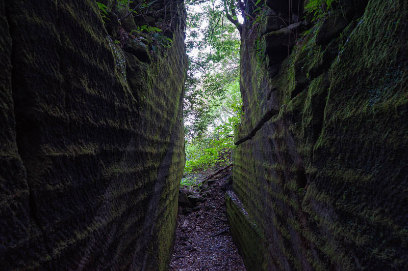
Starting on the path to the lake, you notice that there is an old train line and many tunnels. It has been abandoned for 50 years and was used to build the hydroelectric plant at the lake. I read about it, the bridges on the old line have been collapsing, so you cant walk along the old line, stick to the official path! You can however periodically follow a staircase up to look in an old tunnel.
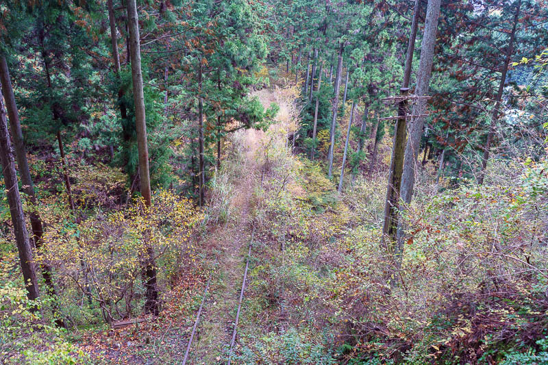
There is a bit of the old train line. It is actually a bridge going into a tunnel but it is so overgrown you cant really tell.
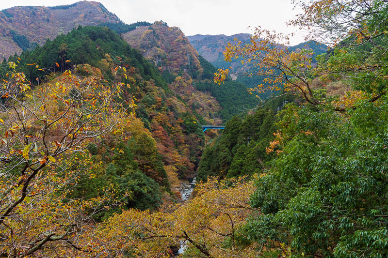
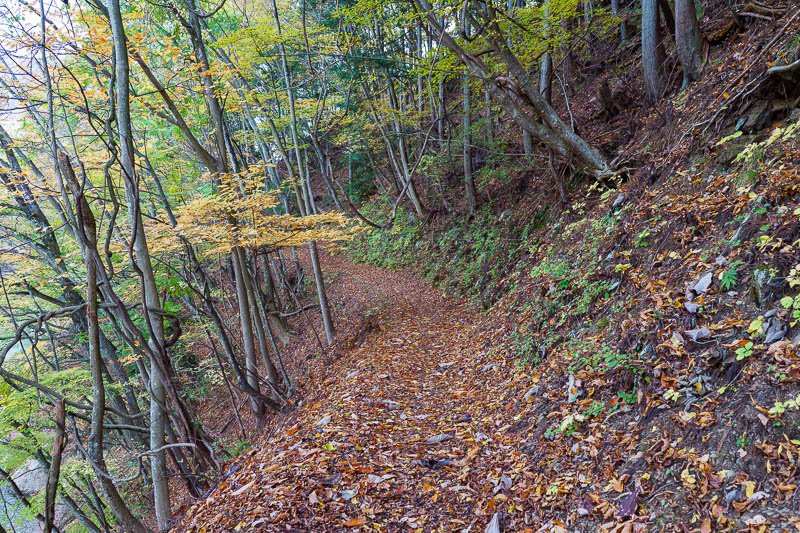
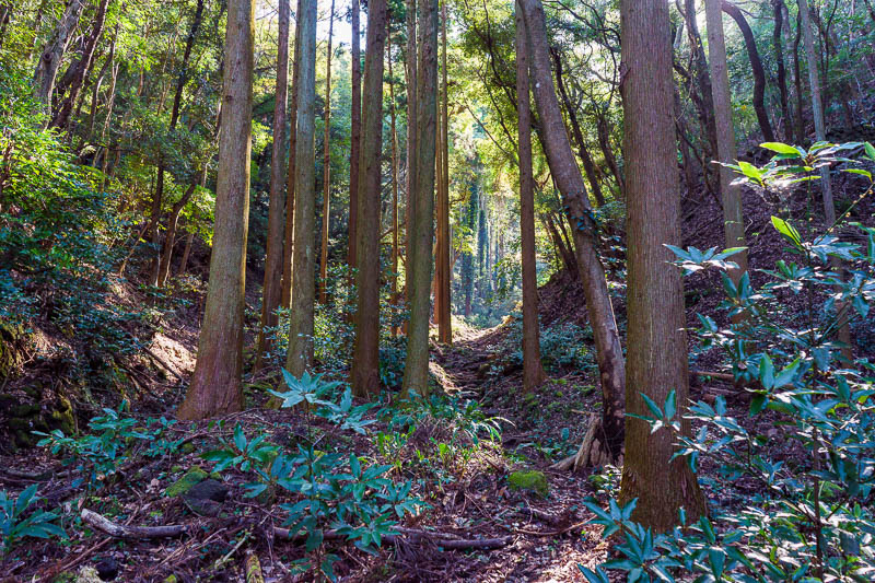
The path to the lake is an official tourist path, called the Mukashi Michi. There is plenty of info about it online, its 10km from the station to the lake. It is generally higher than the highway and does not cross as many bridges over the river. The views of the ravine are better from the highway.
Of course there are still views to be had, and there are many old Japanese people with their tripods taking photos of leaves. I should mention, on the train I sat next to an old female retired doctor who chatted to me for half an hour. She climbs a mountain a week. We compared photos. Her husband still works and is too unfit to climb mountains. She was very surprised how many of the mountains near Tokyo I have climbed.
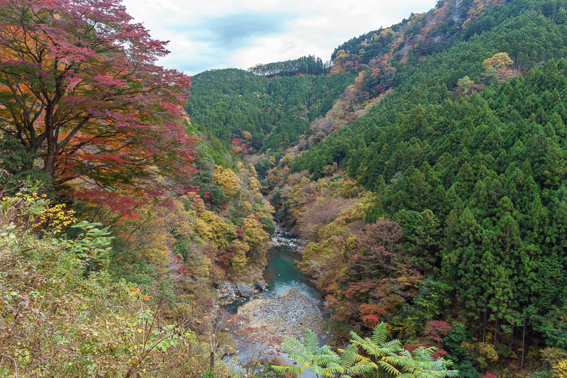
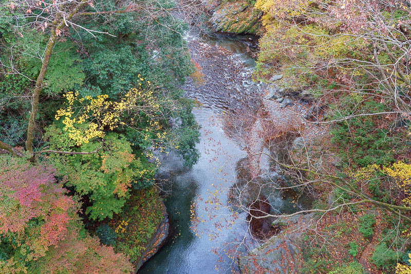
Just one of many opportunities to peer into the canyon with the river running through it.
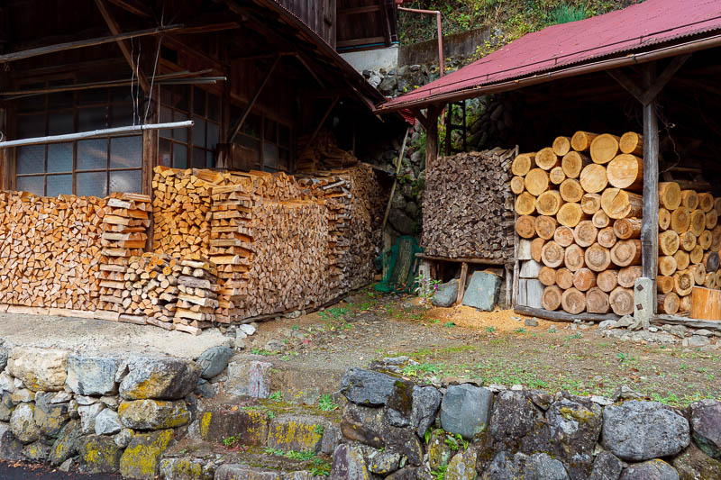
Here are some environmental terrorists that live along the tourist path (there are many little houses). These people are fully ready to burn timber all through the winter and send polluting smoke into the skies to ruin my photos.
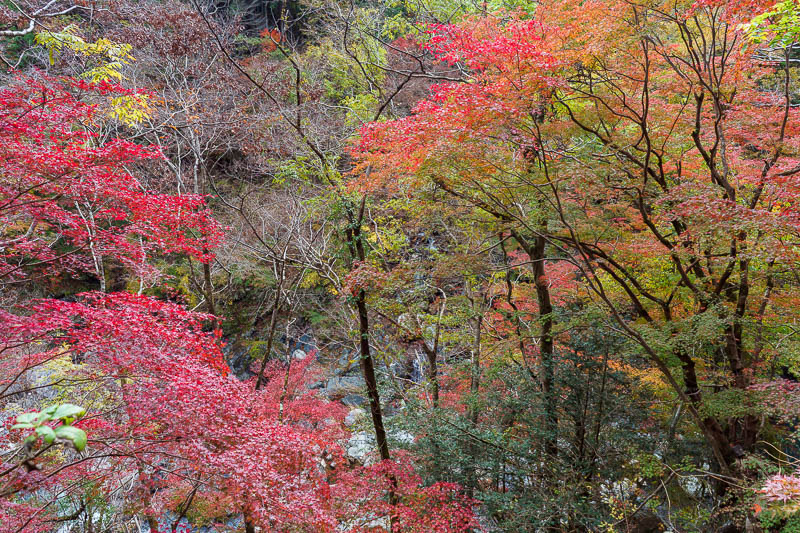
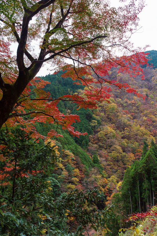
Some more colorful leaves. The descriptions of these photos are going to get shorter.
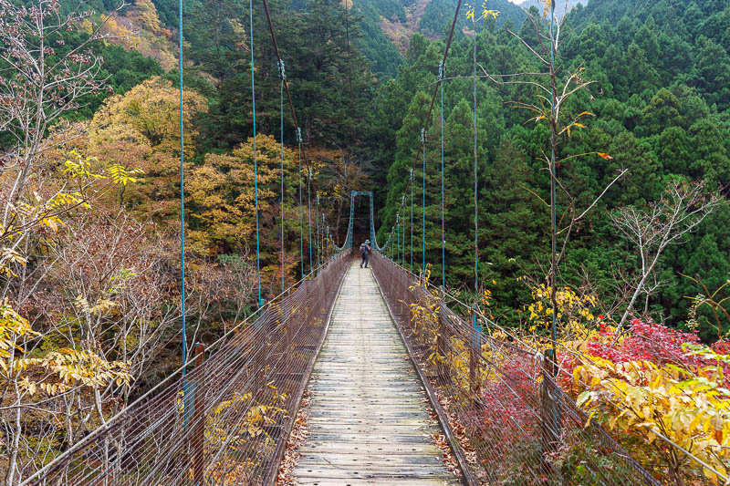
There are a couple of old bridges to climb over and take photos from. They move around a lot, and no more than 5 people at a time are allowed on the bridge.
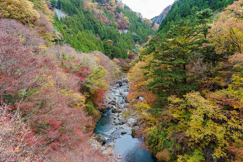
View from bridge.
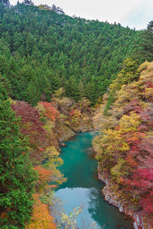
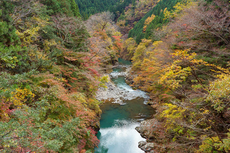
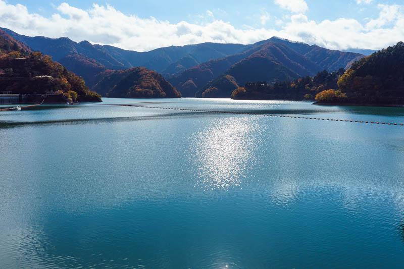
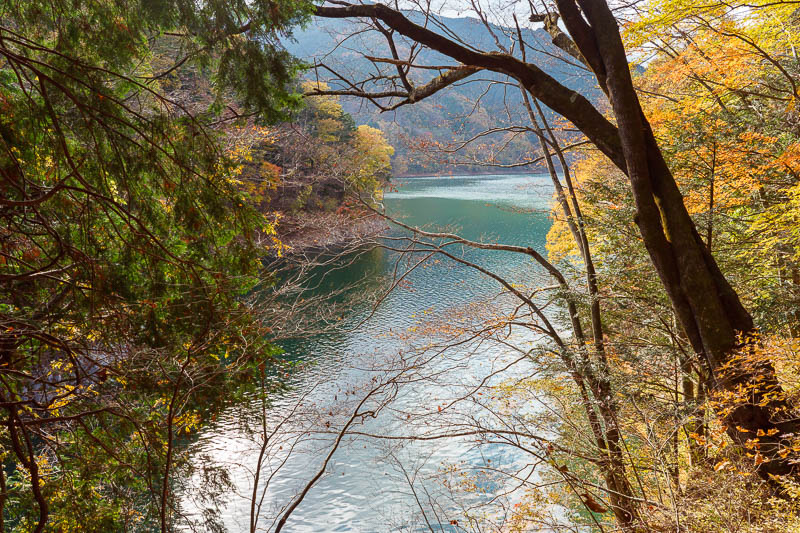
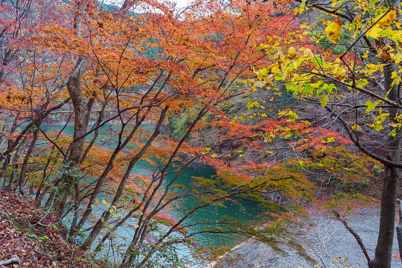
View from bridge the other way. Check out the color of the water, someone dropped a box of pens into it to make it that color.
Maybe you prefer portrait orientation? I very quickly edited all these raw images, I need to spend a bit more time...when I get a chance.
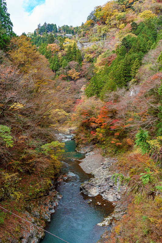
Here is the view from the next scary little bridge made out of wood and wire.
The view the other way is even better.
Maybe you prefer portrait?
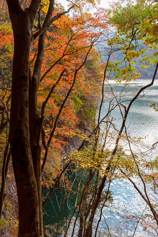
Yes, it really was that red. There were 2 other people with tripods taking a photo from here. I pushed in front of them.
I had already walked a long way along the tourist trail which was a mixture of gravel track and paved old road.
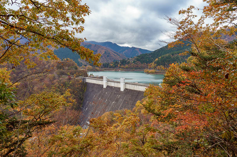
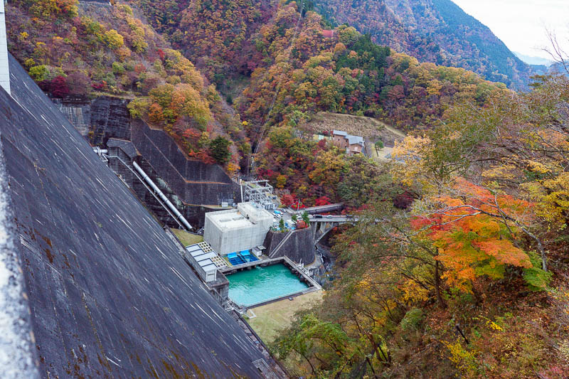
Here is my first view of the dam, its so close but the trail takes you around up a valley past it and then back again. I think theres a shortcut along the main road. I dont ever take shortcuts.
It doesnt look like it, but that is very steep, thats the kind of shortcut I do take. Not today though.
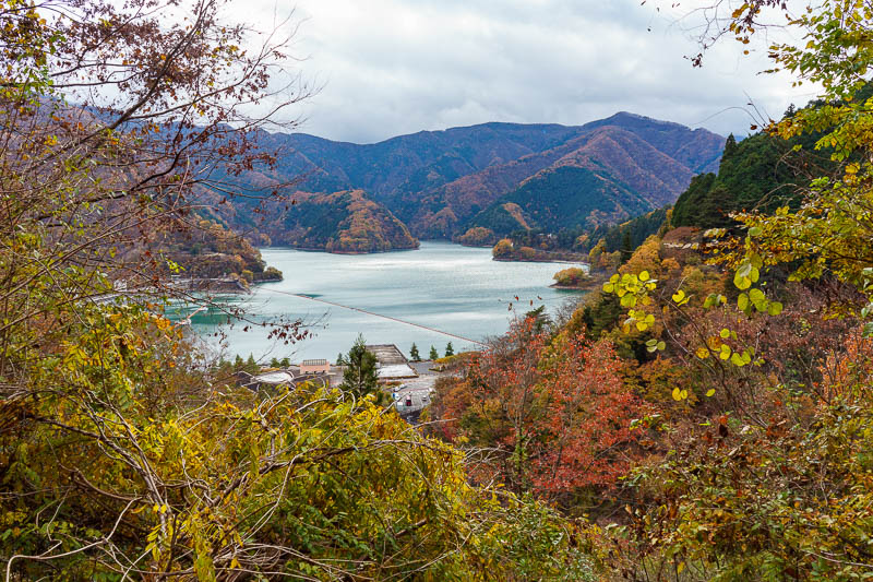
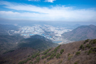
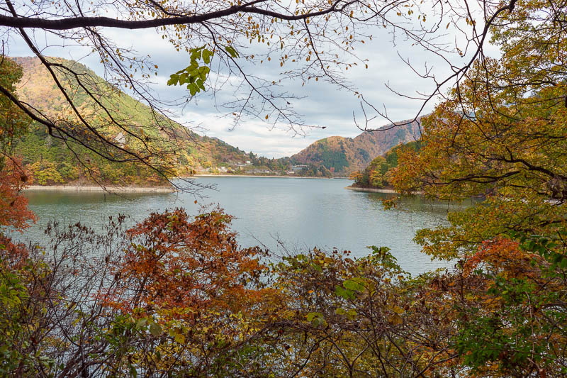
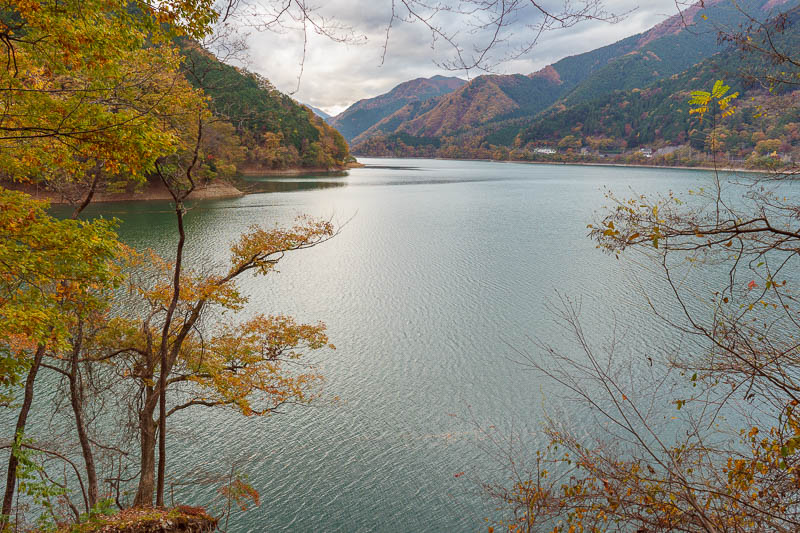
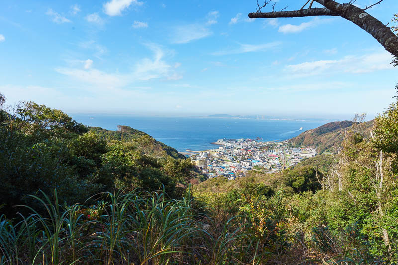
First view of the lake. I am actually going away from it now and getting higher. I decided to stick to the path.
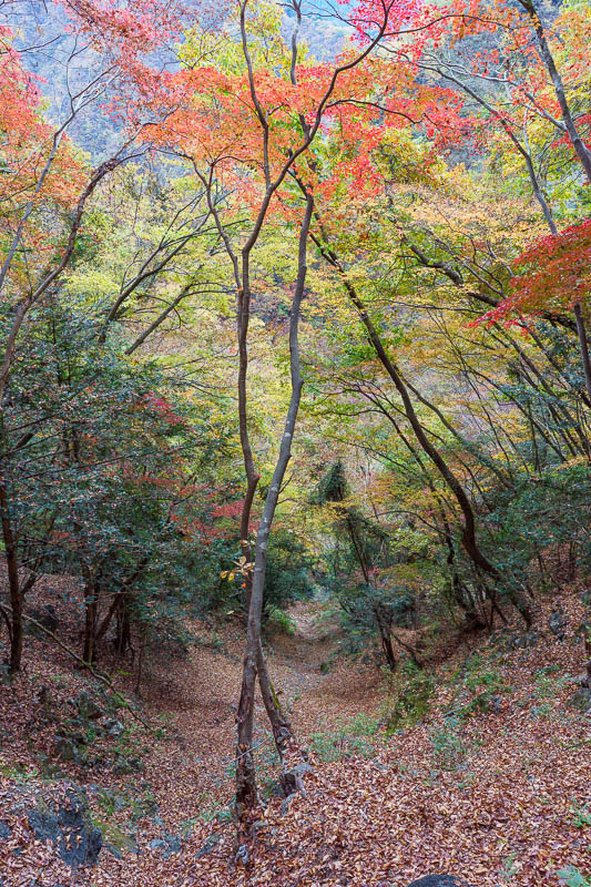
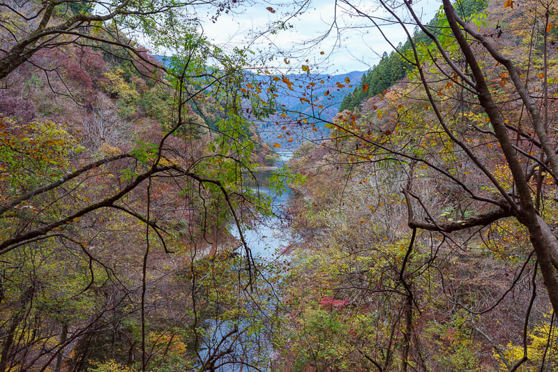
The path soon descended into this dark valley. I liked it. I am glad I did not take the shortcut.
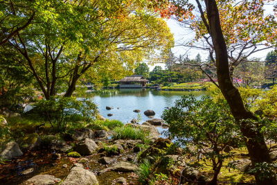
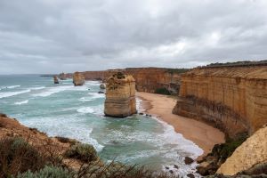
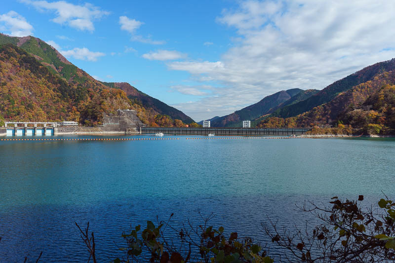
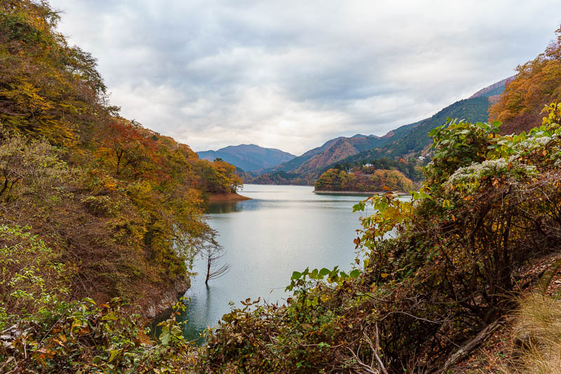
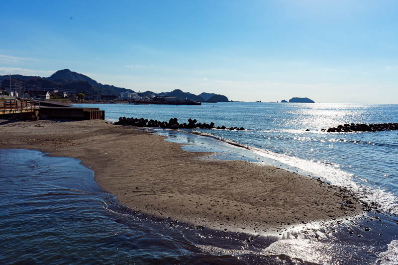
Finally arrived at the lake! Time to get my lake on.
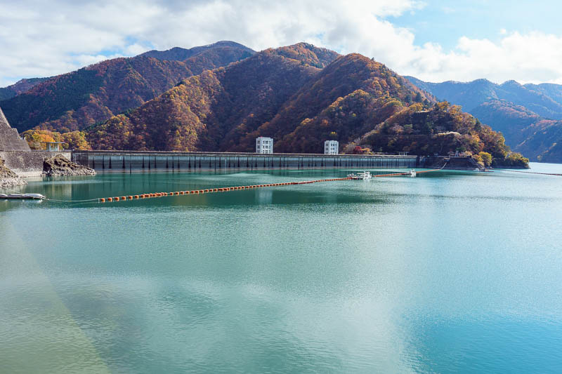
Here is the dam. You will see later it is quite high up. It is both a hydroelectric plant and also the main source of water for Tokyo.
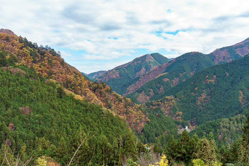
I probably made a mistake in going the way I did. I had to follow the road. Luckily there was not much traffic, but there were excellent views!
Thankfully a bit of sun arrived. It did not last long, and by the time I was done for the day it had already descended behind the mountains.
Fantastic views!
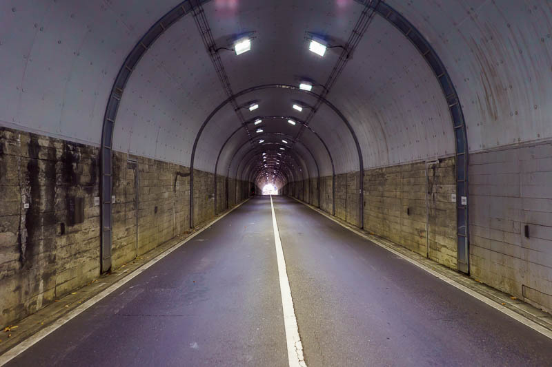
As I mentioned, I was following the road, you are meant to take the bus. That means I went through 10 or so tunnels, that means I can stand in the middle of the road and take photos like this.
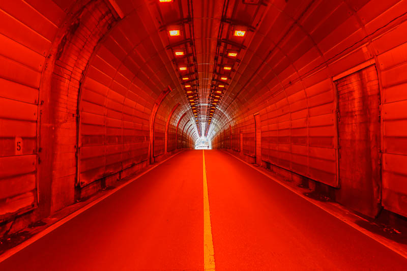
This was the only tunnel with the red lighting. Not sure why. Definitely worth another tunnel photo to celebrate the red lighting.
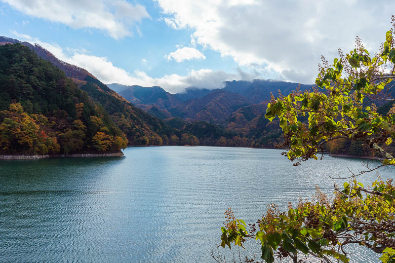
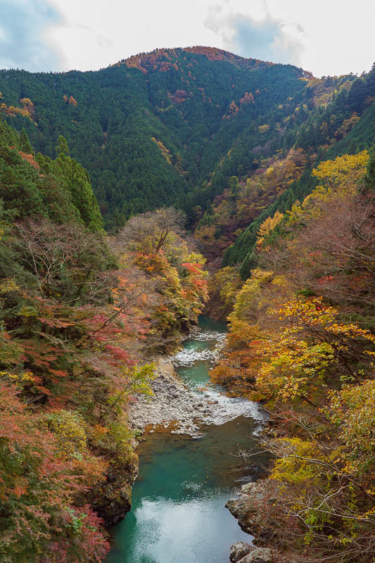
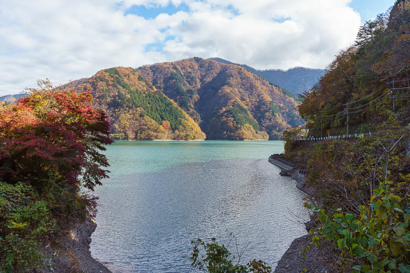
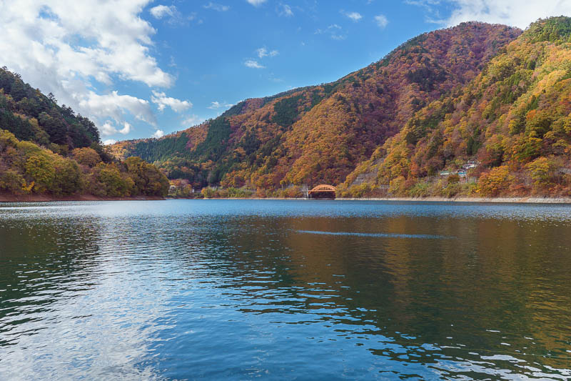
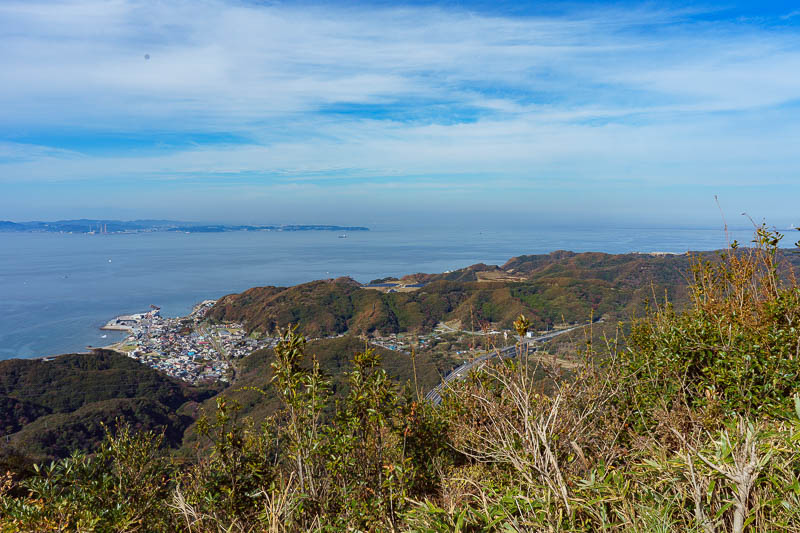
More view. Despite the sun the cloud is still covering the tops of the mountains on the far side of the lake. I would run all the way around the edge of every part of the lake you have seen so far.
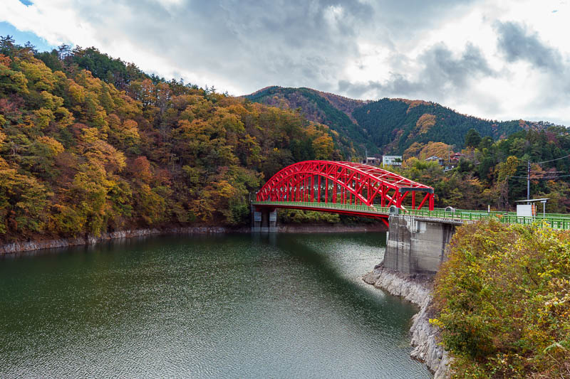
A red bridge! Everyone loves a red bridge.
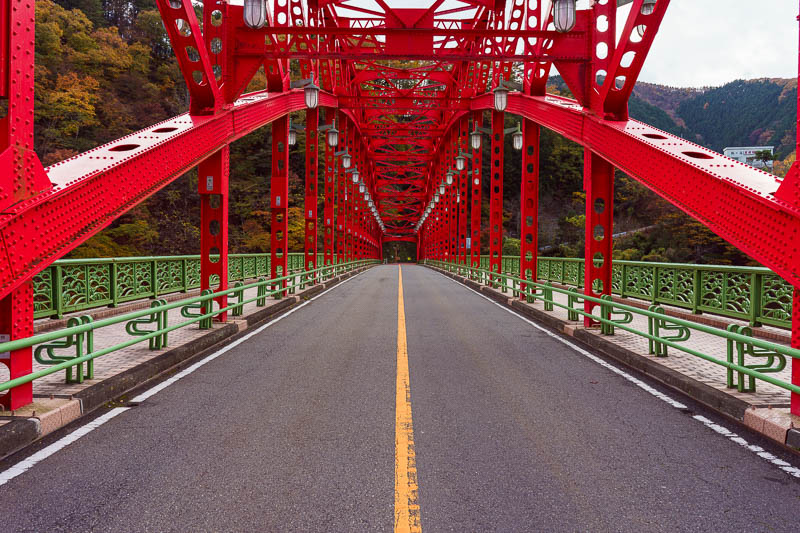
A red bridge is an opportunity for me to stand in the road again and hope the traffic behind me isnt a silent electric car I dont hear coming.
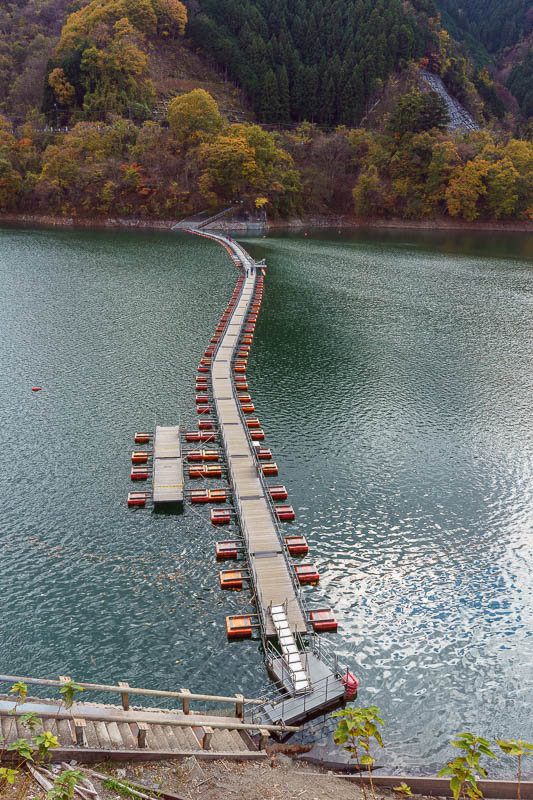
OK, about 10km around the lake you get to this pontoon bridge. It was decision time since I had gone the wrong way. Do I now run the 12km back around the other side of the lake, or double back / catch the bus from here? I would be leaving the road at this point. I think everyone knows the choice I would make?
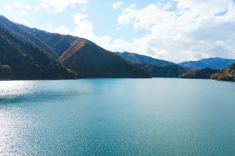
Pontoon view 1 of 2. That is the area of the lake beyond the pontoon that I would not be running around.
Pontoon view 2 of 2. I would be running the 12km trail around the base of the lake to the right of this picture.
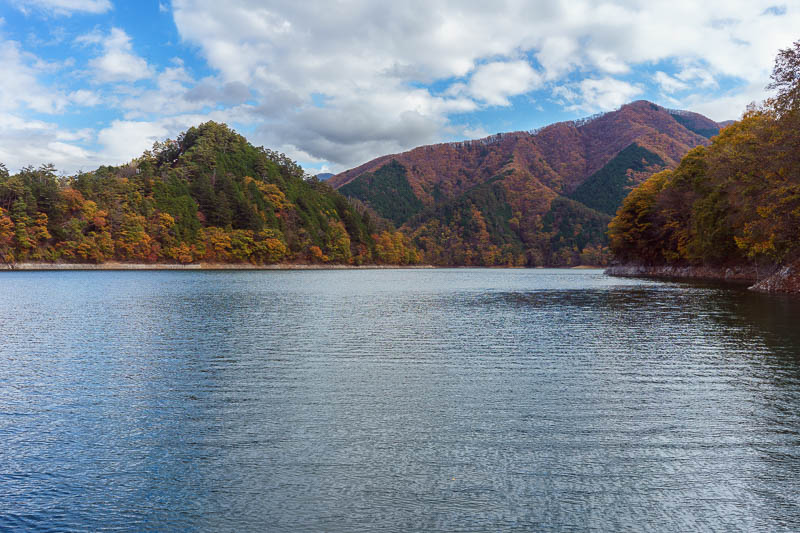
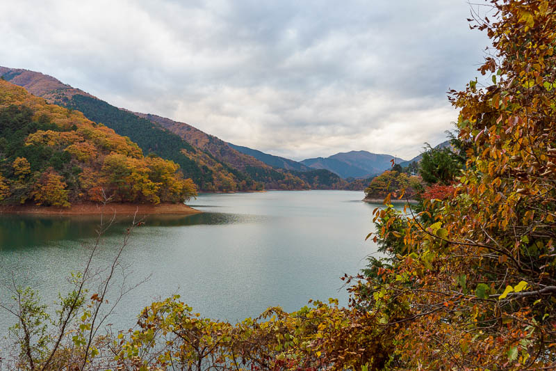
The path around here was superb, such amazing views.
More amazing views.
It just gets better.
It was a very high quality path, with distance markers. Quite smooth, not many ups and downs. I fell over once at a rare time while I was walking. Skin removed on one knee and one elbow. Oh well.
Hmm, this is photo 1000. This photo is not worthy of being 1000. I never got to 1000 on any previous trip.
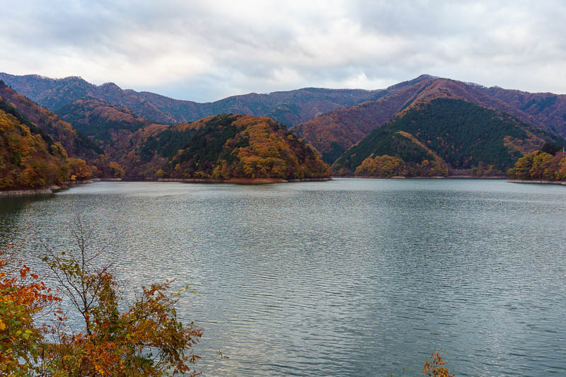
I knew it was 12km from the pontoon bridge back to the dam, at times it didnt look that far, but then you would be sent off down another long arm of the lake.
I didnt mind, 12km is 12km, I ran 90% of it and the view was totally worth it.
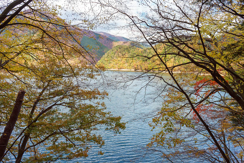
There were plenty of spots to stop and take a photo of the lake.
Theres proabably 5 or so long detours down arms of the lake. I dont know what else to call them. Its all fake of course, man made due to the dam.
Down the longest detour I followed a stream for a while, then over it on a little wooden bridge, then back up the other side.
Now for 3 photos that could have been culled. Culling candidate 1 of 3.
Culling candidate 2 of 3.
Final culling candidate. They cant be culled now, once they are uploaded its done.
I was finally back at the dam. Here is the dam wall. As always, its further down than the photo makes it appear.
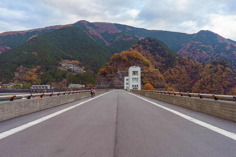
One last chance to stand in the middle of a road.
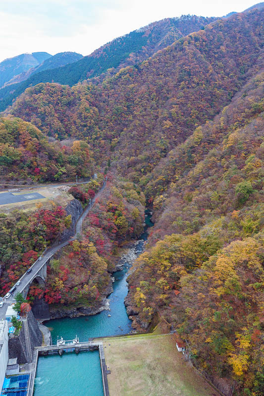
I guess it looks quite high from this point. The ravines / canyons down stream that I like so much are created by this dam. Thank you dam.
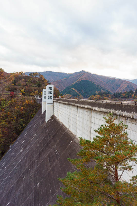
One last dam shot.
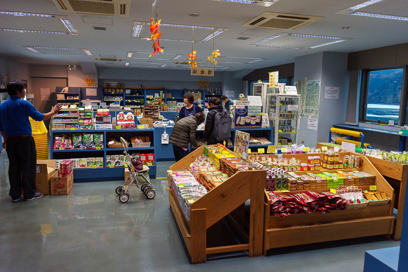
I was running out of light so decided to wait 35 minutes for the bus back to the station. The dam museum has a little shop. Time for an ice cream!
The dam museum is free and pretty good. Lots of little exhibitions to keep me enthralled until my bus arrived.
Now onto the long journey home!
Train delays cause dinner to be found in Hachioji
Now for the trials and tribulations of getting from Lake Okutama back to Kanda (Tokyo). This update will pleaes train nerds and test the geography experts of the greater Tokyo area.
Leaving the lake was fine, get on the bus, ride back to Okutama station. It was too late to take the return 10km hike back as it was getting dark up in the mountains. The first train was fine, that went from Okutama to Ome, stopping all stations but they do that during the week.
Then the fun started.
My next train was supposed to go from Ome to Tachakawa, which takes about 30 minutes, changing at Tachakawa for the Chuo rapid line back to Kanda. If you have been to Tokyo you are probably familiar with the Chuo rapid line, its the one that cuts through the middle from Tokyo to Shinjuku.
Anyway, the train would not depart Ome. All services were cancelled between Ome and Tachakawa, fatality.
Also in a separate incident, all services were cancelled on the Chuo Rapid line between Tachakawa and and Tokyo due to another fatality!
The two lines I needed to use both had all services cancelled. At Ome where I was now there was not much to do except wait, eventually the destination of the train I sat on started updating to stations prior to Tachakawa. We all watched as it changed back and forth multiple times until eventually they settled on Haijima (a couple of stops before Tachakawa) and we set off! Slowly. Then we stopped. For a long time. Then we went maybe 5 metres, stopped again. There were lots of announcements in Japanese, but they didnt really seem to be helping anyone, I suspect they were 'sorry I have no idea when we can go'.
After an hour, we got to Haijima, great, now what? Time to study google for a while and decide where I could go from the reasonably well connected station. My two choices were either end of the Hachiko line, which were Kawagoe (where I was yesterday) or Hachioji, which I thought was Kichioji where I went last year. I settled on Hachioji thinking it was a different place entirely.
The train to Hachioji also stopped inexplicably a few times but it got me there. I had decided to have my dinner here, and just return straight to my hotel after that, assuming the services on the Chuo line had since resumed. My detour had got me past Tachakawa where most of the drama seemed to be.
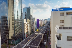
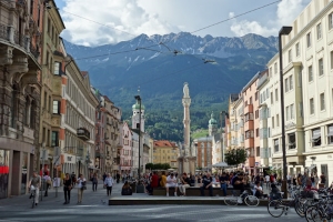
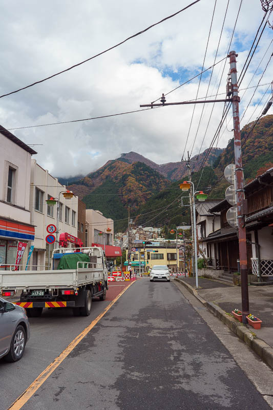
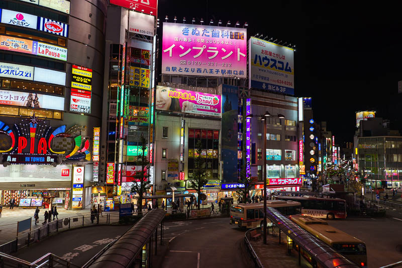
So now I am wandering around Hachioji thinking its Kichioji, questioning my sanity because it was not as I remembered it from a year ago. And of course it wasnt, it was not the same place at all. Hachioji is 20km west of Kichioji. No wonder it was damn cold, its at the foot of the mountains.
Because I was still returning from my hiking I was in hiking clothes including shorts. But since I was in a new place I decided I had better wander around in the 9 degrees weather and take a few photos.
Now to check on the Chuo rapid line, the boards showed trains were coming. Hooray! I stood on the platform, there were a lot of people, more than there should be for a train that comes every 5 minutes or so. It didnt come. But wait!
A limited express liner came, and my 3 day train pass is valid on that, there was almost no one on it, so I went from the end of the line of people waiting for the normal train straight into a luxury seat all the way back to Shinjuku only stopping once in between (at Kichioji!). From Shinjuku I could get a Chuo rapid line back to Kanda, this section of the track had now resumed services.
WHO IS CONFUSED????
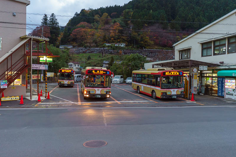
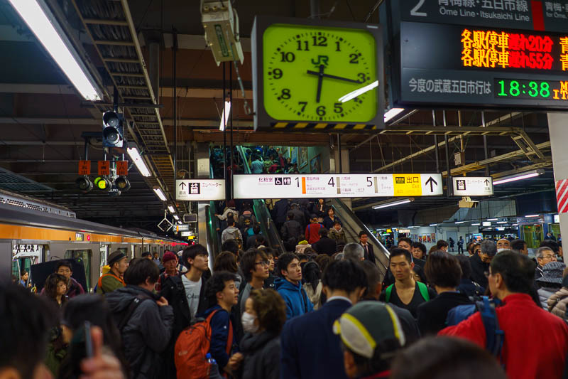
The bus came on time, but it was absolutely full. I nearly landed on an old ladies lap more than once. I took a photo back at Okutama station to remember my bus ride over all the bridges over all the canyons.
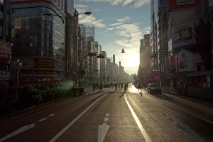
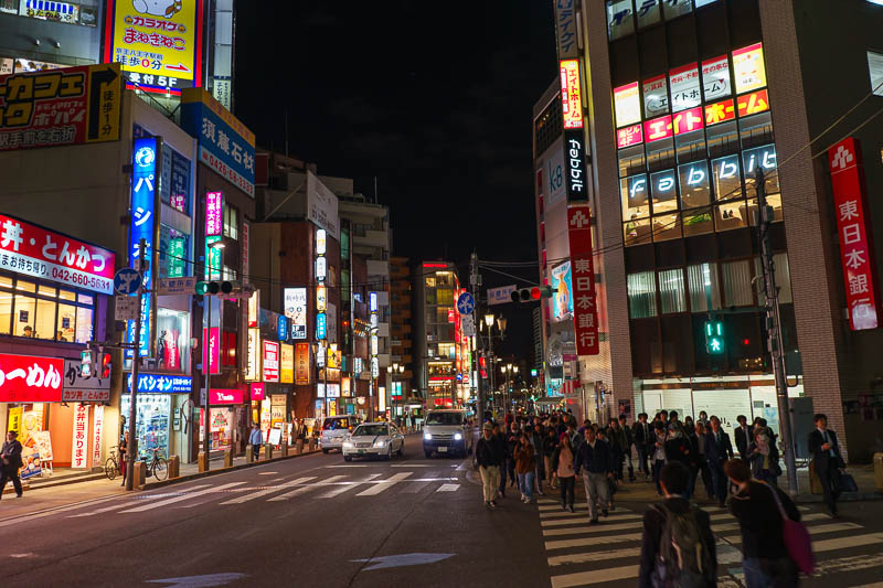
There were a few minutes until the first train (the one train that came as planned). This gave me enough time to take one last photo of Okutama.
Chaos at Ome station. All services cancelled. Now what?
After navigating the train chaos. I was at Hachioji thinking it was Kichioji. Once I worked out it was somewhere new, I decided I should take a few photos.
Random corner.
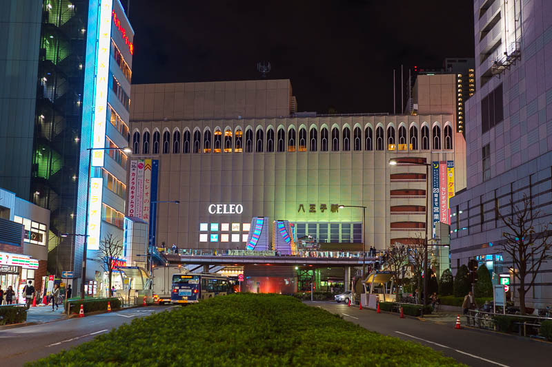
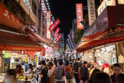
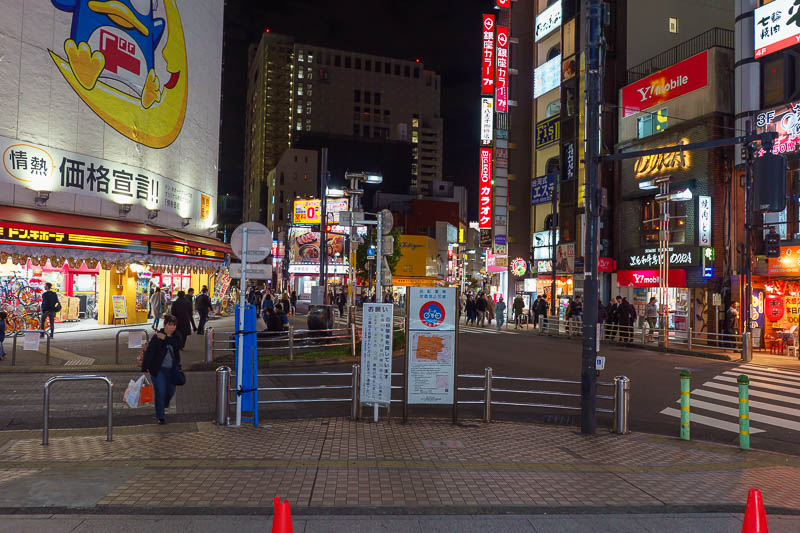
3 different railways including JR all converge on Hachioji. There are therefore many department stores and eating areas.
It is a very busy area.
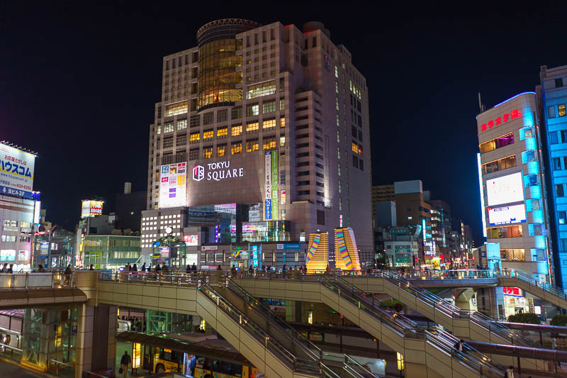
Tokyu square seems the newest and nicest of the department stores. To give you an idea of how busy Hachioji is, in my brief walk around in my shorts I counted 9 Starbucks.
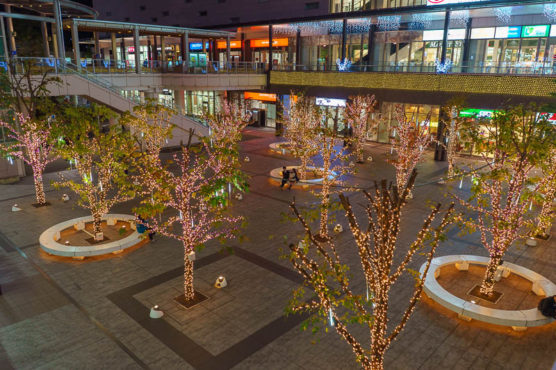
The far side of the JR station has some illuminations.
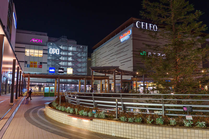
It also has some more departments stores and a huge BIC camera. Who knew this outer suburb was so large?
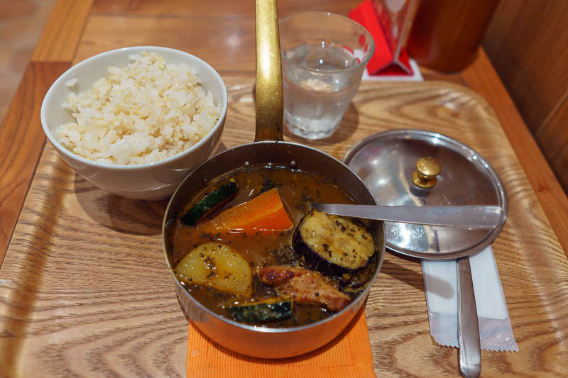
I was starving by now, having only eaten calorie mate and an ice cream on my long hike / run. Time for a vegetable stew.... with chicken! I was surprised it had chicken. It was delicious. Another great day. Photos need some more processing when I get time. Tomorrow is my last full day, time for another adventure. Hopefully some of this makes sense, I typed it super fast, have to go to bed to get up at 6 to go on tomorrows adventure!
Hiking up and around Nokogiri from Hama-Kanaya station
My titles are getting a lot less creative.
For my last journey on this trip I took a 2 hour (each way) train ride down past Chiba, east of Tokyo to Nokogiri. I had never been to this region before.
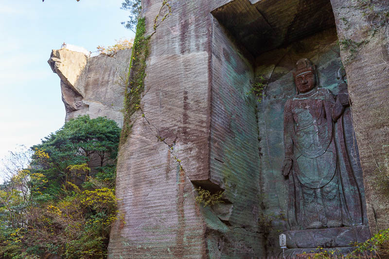
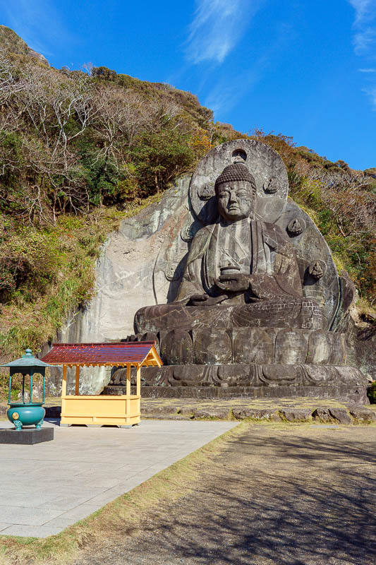
Nokogiri is a mountain of sorts, but more well known as the home of the giant Buddha. It is possibly the largest in Japan. It is also an old quarry.
Taiwan and China and Chinese Taiwan and one China and Chinese Taipei and former Japan occupied Formosa all do giant Buddha better than Japan, but giant Buddha is giant Buddha.
Anyway, its not all about the Buddha, there is also a small mountain to climb and more views to be had. But first, 3 trains of snot garglers. Now for some casual racism.
I think its genetic. Japanese people gargle mucus non stop. I have never heard the movement of liquid inside the heads of people outside of Japan. But, is this genetic or environmental? Is it a learned behaviour?
I think it might be genetic, because I think Chinese people have the same issue, but rather than gargle on it all day long, they spit it out. Currently I think I prefer the spitting!
This is why in Japan they have the face masks, so they can pretend its not them thats choking on a litre of mucus, but someone else with a face mask nearby.
Thats my theory, its probably wrong.
My return journey from the giant Buddha allowed me to change to a slightly faster limited express train that went via the coast through all the industries and past the Disney resorts. This was very interesting, its all reclaimed land and the amount of very large canals and huge industry mixed with numerous resorts was all in a part of Tokyo I had not seen before. I guess at street level you wouldnt really see much, but the train was elevated and at times was above the water for kilometres at a time. I enjoyed my quicker quieter return journey very much, I had an entire limited express carriage to myself.
Now onto the last big set of pics for this trip, only tonight and tomorrow morning to go, and those will probably be very boring.
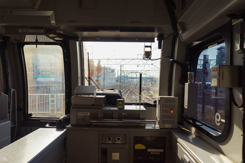
Todays photos are not nearly as nice as yesterdays. The Landscape was dull and grey, even the leafy areas. Perhaps fittingly then, here is the view out the front of one of my trains. I dont know how the driver can see, the windows are filthy.
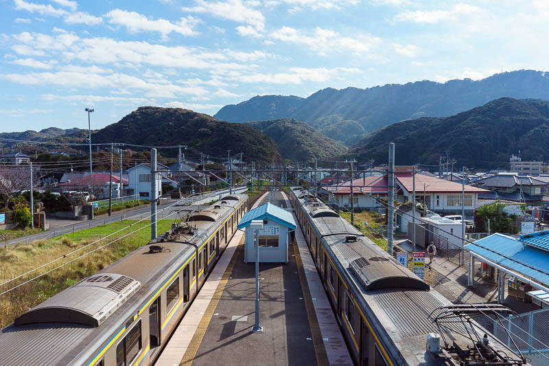
I got off at Hama-Kanaya, a tiny station in the middle of nowhere. Thats some annoying lense flare again!
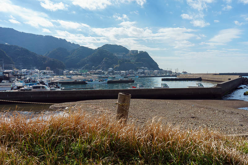
Before going uphill, I went downhill, to the beach. It was quite nice, very very bright! This photo came out quite well.
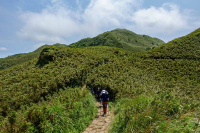
Time to get climbing. I had meticulously planned a path to take me up a remote way to the top of Mount Nokogiri. It did not go to plan and I got lost 3 times! Luckily it is only a very small mountain.
There were lots of spots to check out the view today, but it was very hazy. The whole place smelt like a fire due to farmers again. Bloody farmers ruining my view. I have done what I can to cut through the haze!
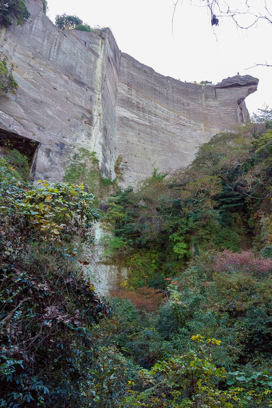
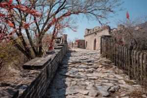
This whole place used to be a quarry, right up until 1980. I dont understand how they cut the huge cubes of stone out of the cliff face using just a hammer and chisels.
Basically all of that rock face was cut away by men wearing only their underpants, the photos I looked at on the signs made it look like hot hard and dirty work.
Here you can see where they cut into and under the cliffs. Just to see if they could invent the most awesome way ever to die, crushed by a million tonnes of rock.
This is not bricks or concrete, those lines are from hand tools used to cut out slabs of solid rock some how. I dont understand it at all.
It was at about this point after going a long way down I realised I should not have been going down at all. Time to double back. I do that a lot.
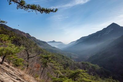
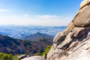
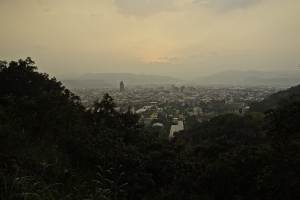
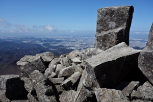
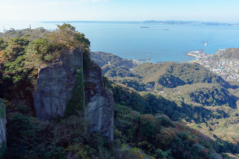
Before too long I was back on the right path. This is the view back to Tokyo. You cant see it due to the smog.
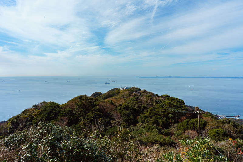
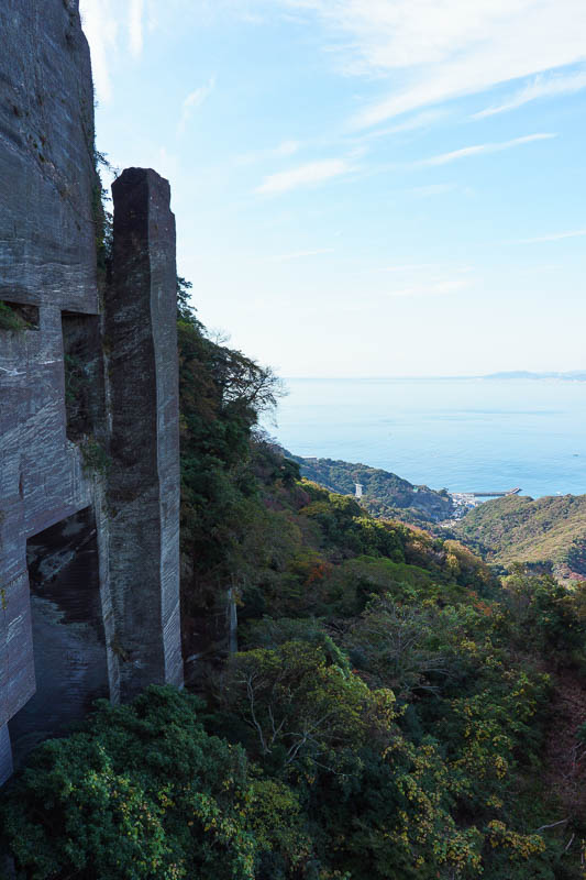
You can however see across to the other side of Tokyo bay, and check out a heap of ships. The white building is the top station of the ropeway for lazy people going to see the Buddha. I was quite far from that at this point, but still a bit further to go to the summit of tiny Mount Nokogiri.
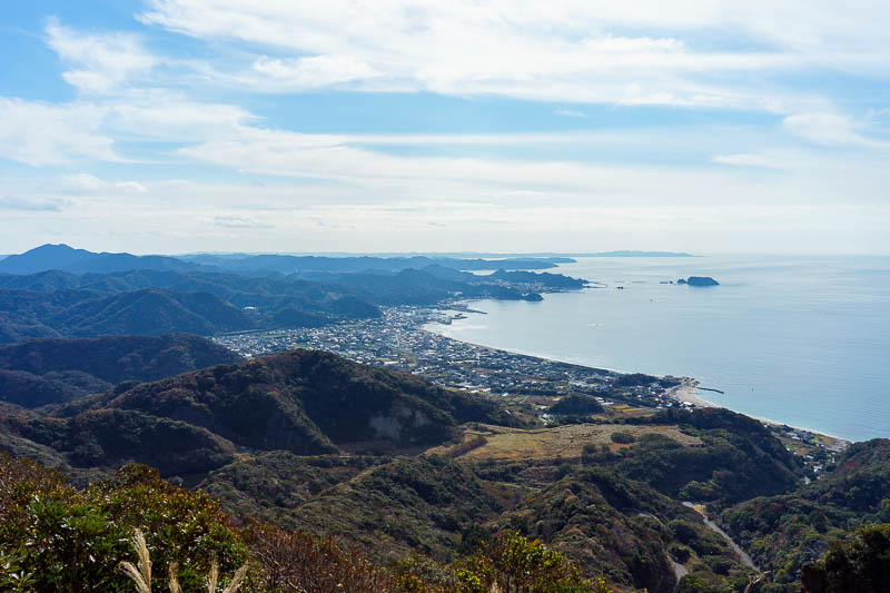
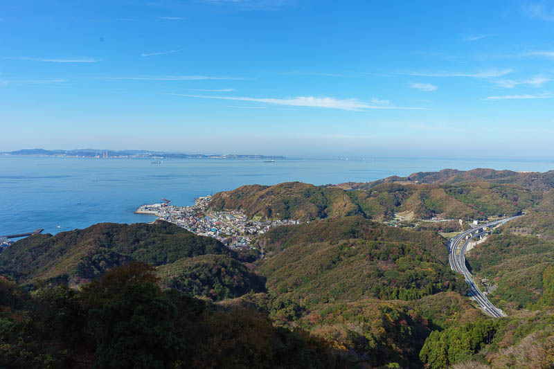
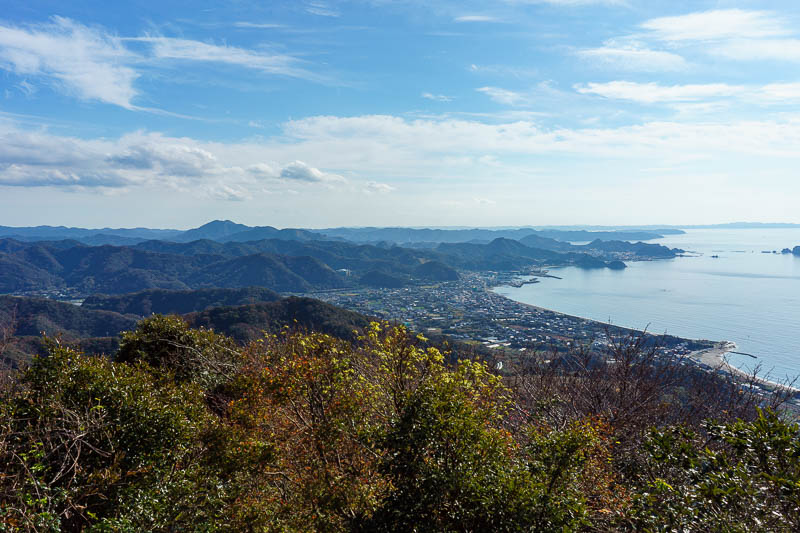
The view down to Tateyama at the foot of the Chiba Peninsula looks very inviting. If only it didnt take so long for the trains to get there. They need another bullet train. Get on it Japan!
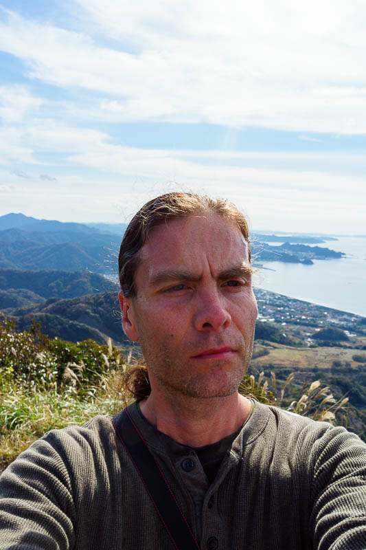
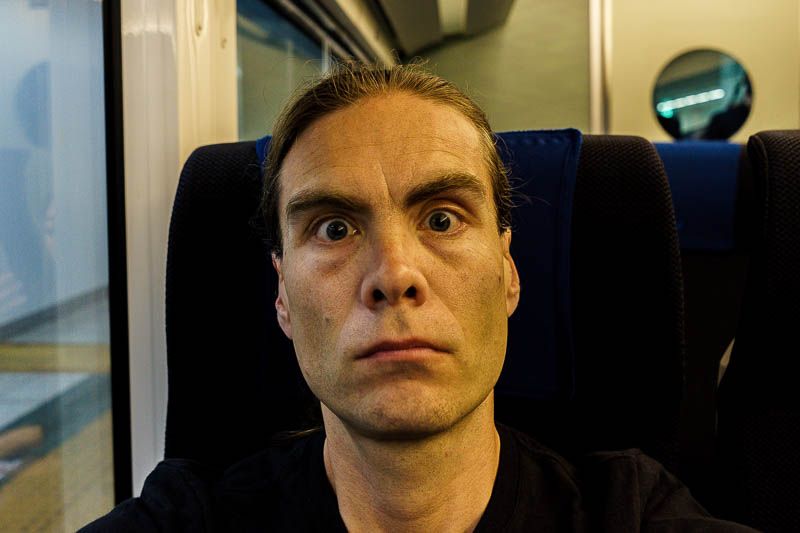
HERE IS THE LAST SELFIE OF THIS TRIP. Enjoy it in all its magnificent grandeur. I was still wearing shorts today, but I foolishly put on a long sleeve t-shirt. It was too hot for that. HOW ABOUT THIS WEATHER WE ARE HAVING?
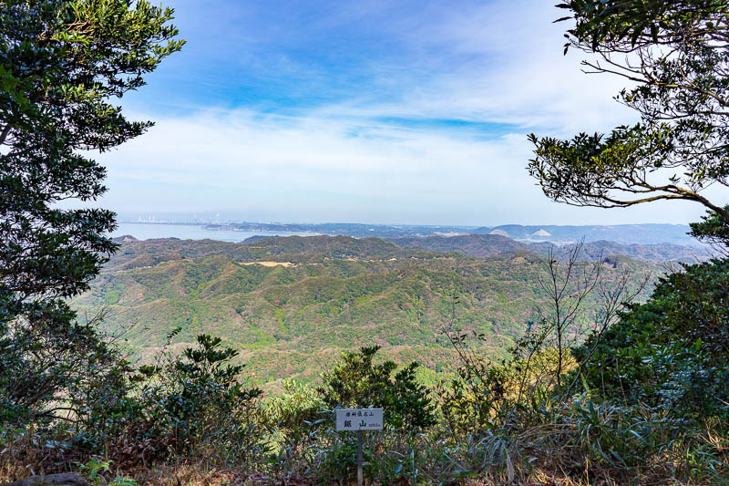
The summit of Mount Nokogiri is not very prominent, and its 'treed' in on 3 sides. Its a pretty bland grey looking view really.
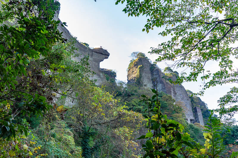
Time to back track again and check out some more ancient quarrying. This was a nice mossy bit.
I had to go down, then back up again. But I didnt mind. I was enjoying the last chance for climbing stairs in the wilderness of the quarry and giant Buddha theme park.
Here is a redundant photo of the same view again from the top of a staircase. Thats a nice freeway.
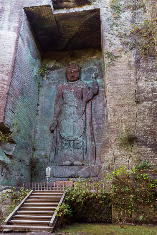
Ahhh, this is not the giant Buddha! Although I think this one is bigger. You have to be able to climb a bit over rocks and stairs to get to this one so its not as popular.
Hmmm, photos do not really give a sense of scale. I needed a person to stand in front of it.
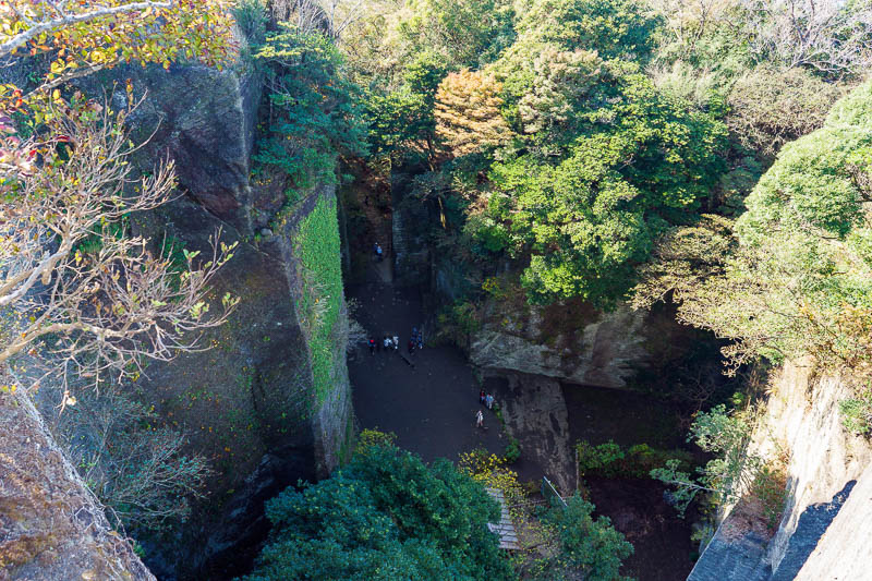
Staring down into the quarry abyss. This is a really crappy photo!
This is a great view, a shame its not more colorful and less smoggy. Still I appreciated it. Perhaps my expectations are too high after yesterday.
I like the clouds in this one.
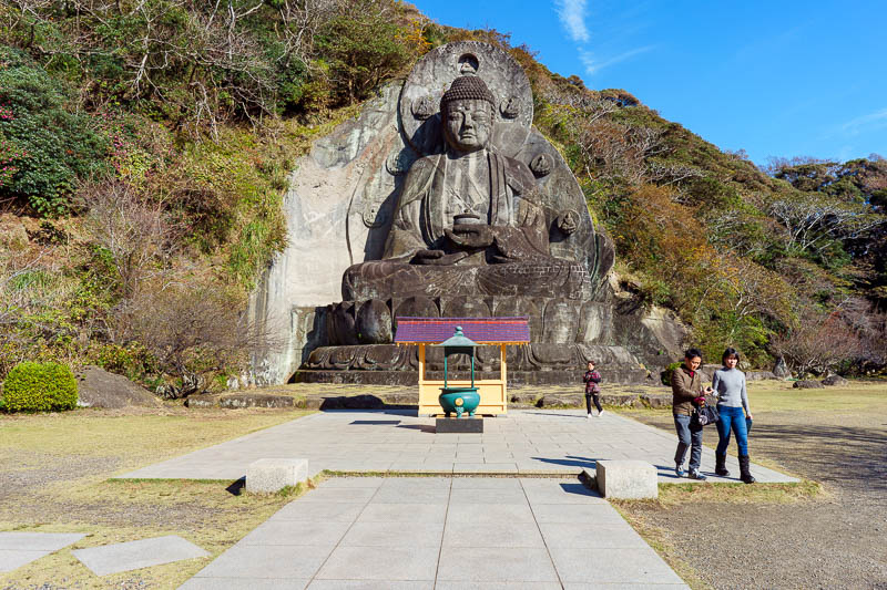
OK, this is the official big Buddha, giant Buddha, whatever you want to call him. This is the main attraction of the park, which has a 600 yen entry fee. I think the one carved into the cliff is more impressive.
Perhaps you prefer portrait orientation?
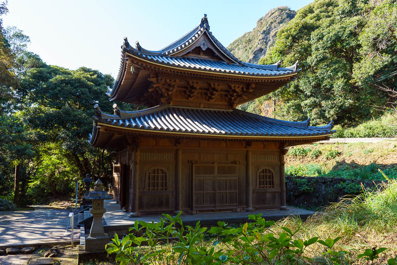
Further down towards the car park there appears to be a whole heap of nice temples and shrines, but you are not allowed in. This is the only one I could photograph.
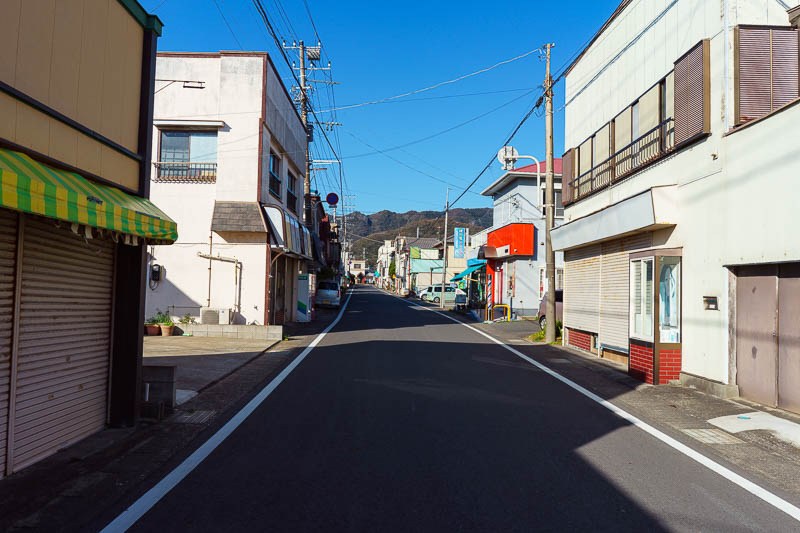
If you dont take the ropeway / cablecar back down, you end up in a bus parking area far from anywhere. After a 5km walk I got back to a station, Hota station. It is not much of a station, not even a convenience store. I bought a small bar of chocolate from a general store that sold a small selection of food (pickled or packet food generally that never goes off), hardware, clothing, and fishing gear.
There was 20 minutes until my train, so just enough time to run down to the beach and back and take one last photo staring directly into the sun so I can continue complaining about lens flare! This one has no horrible flare but its too bright.
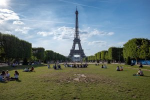
Exploring the department stores near Tokyo station
Do not say I didnt warn you because I did. I warned that this update and tomorrow mornings should I choose to post it would be boring and there would not be many pictures, and that turned out to be the case.
This evening I had to spend my remaining yen, leaving enough for breakfast and lunch tomorrow as my flight is not until 3pm. To achieve this spending (I really struggle to spend money!) I went to Mitsukoshi (basement), Taskshimaya (basement) and then the Tokyo station mega mall complex (basement). As is the case with nearly everything in Japan, no matter what you buy, you are mainly paying for packaging. This is especially the case when you are buying cheap crap for a few dollars each. These sorts of things are already wrapped in too much packaging, and then despite spending about $5, they gift wrap it for you, and put it in a bag, and tape up the bag.
I also managed to have a boring healthy dinner, regret that I did not have a healthier dinner and then photograph my healthy snack choice - the snack I eat a lof of when in Japan. THRILLING STUFF I AM SURE!
Now for a tiny amount of boring photos!
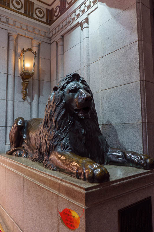
Tonights cat. Wait. I forgot to do the cat thing the last few days. I actually saw a real cat today but he stayed just out of range as I followed him around the giant Buddha. Tokyo does not have the same level of cats as the other parts of Japan, so the best I can do is a lion statue. Did I already take this photo?
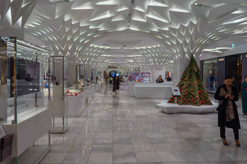
The inside of Mitsukoshi is blinding! I could not bare to go in for more than a few seconds to take this photo. It is brighter than direct sunlight.
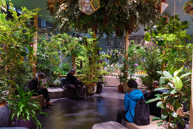
Meanwhile, down the road at Takashimaya, theres a forest in annex building 3a. Both these department store complexes span multiple blocks. Mitsukoshi even has its own Subway station named after the store.
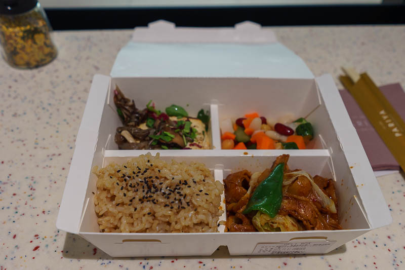
Basement level 2 in the Takashimaya annex had a healthy restaurant zone. I chose a choose your own adventure dinner box. It is just like the Korean place at Emporium in Melbourne, you choose your rice style, your main course, a salad and a side dish. As you can see I chose brown rice, with some sort of pork and cabbage, a block of tofu with mushrooms and some pickled mix vegetables. It was really very delicious! If I lived here I would probably eat here often.
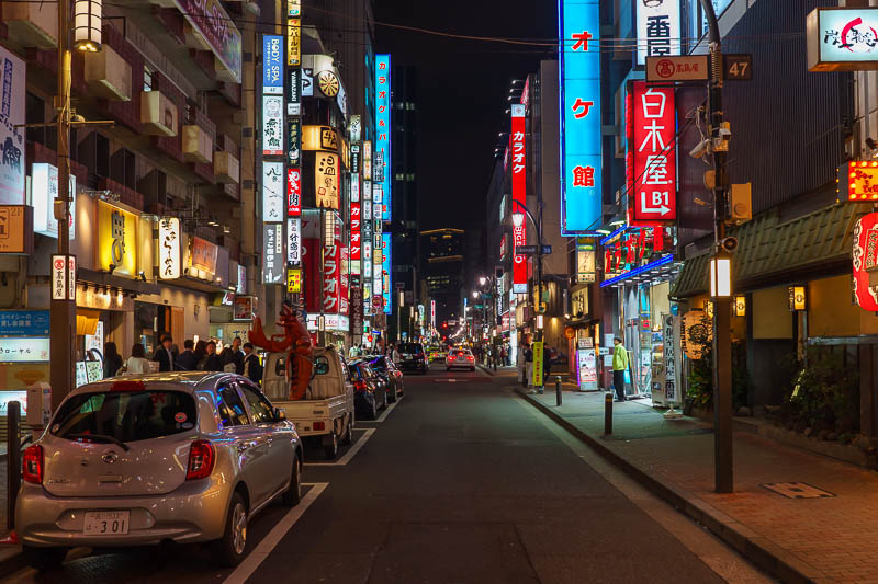
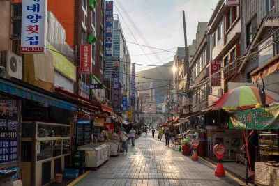
The final neon photo is... a rather typical back street around Tokyo station. Some of the business men here are already very drunk at 8pm. Lightweights.
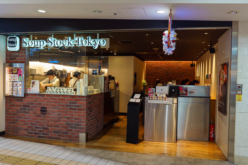
Well I thought I had a great dinner, but then I realised nearby I could have had the 2 soup combo again! My most eaten food of this trip? Probably a tie with Ramen. The soup is healthier.
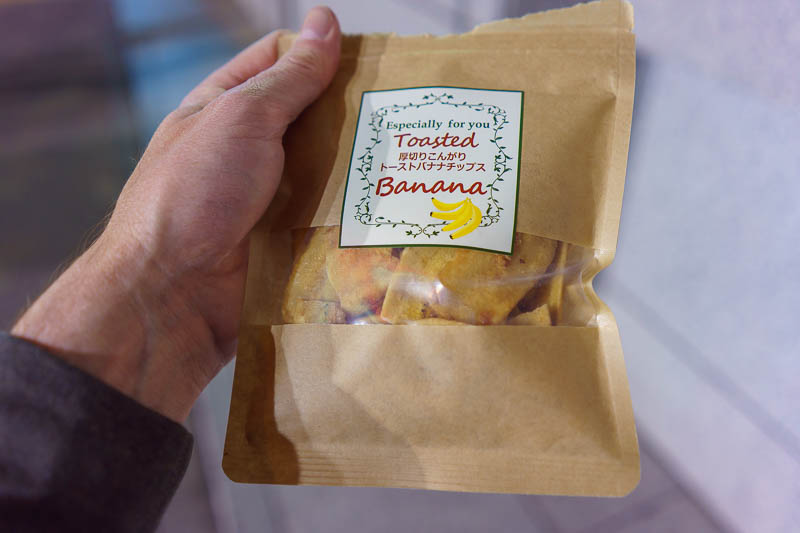
And because my hands were full of packaging, I had to put it all down to tear into my healthy snack of air baked banana chips. I eat this often in Tokyo, it can only be purchased from the purple colored Lawson natural. You can see here that I tried to rip into it one handed and failed.
I also eat it while walking along in the street, which upsets all the locals!
If you are in Tokyo I highly recommend the Lawson natural convenience stores, which have purple signs and a bigger range of interesting things. The range is almost completely different from the standard Blue colored Lawson stores and the larger green and white Lawson 100 stores. I am an expert on convenience stores.
There are currently 3 comments - click to add
David on 2018-11-21 said:
Purple Lawsons is Lawsons natural
They focus on selling organic and healthier products
adriana on 2018-11-21 said:
purple Lawson's - is this new? I only know blue I think. Dinner looks good.
jenny on 2018-11-21 said:
well you certainly can't complain about the weather. Be prepared for a bumpy flight home though. Rain, hail and gales here.
A quick walk to Tokyo Skytree before heading back to Narita airport on the Kesei Skyliner to fly home
Now I am on the train back to Narita airport.
In perfect timing the grey gloomy weather has arrived, just as I am leaving. Its impact on me is none.
To celebrate the grey gloomy depressing damp weather, I wandered around Tokyo to get my steps going, I am still working towards my million step month, I have simple goals in life.
My path took me in a looping course to the Tokyo Skytree, which was covered in cloud at the top. I took a photo of cloud.
After two coffees it was time to check out and walk from my airport to the train where I now sit, making this mornings photos look really grey, dark, mysterious and grey.
Will I post another update from Singapore airport? Doubtful. It bores me as an airport now.
So for now, enjoy the grey. Or is it gray? I dont know.
OMG SO GREY!
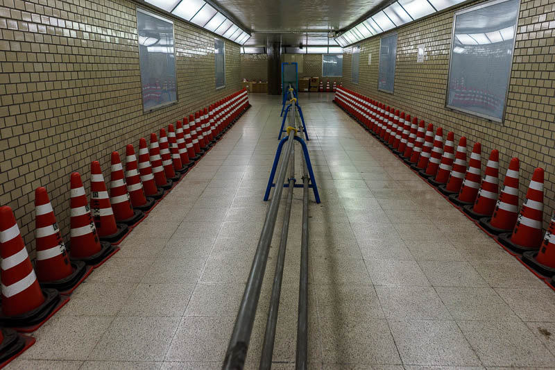
I dont know why but 2 of the underpasses I went through today featured the walls lined with safety cones (witches hats), presumably to make sure I dont walk into the wall?
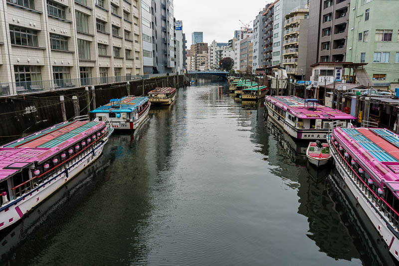
Its an old grey river lined with pleasure craft that dont look like I would be very pleasured to be on them.
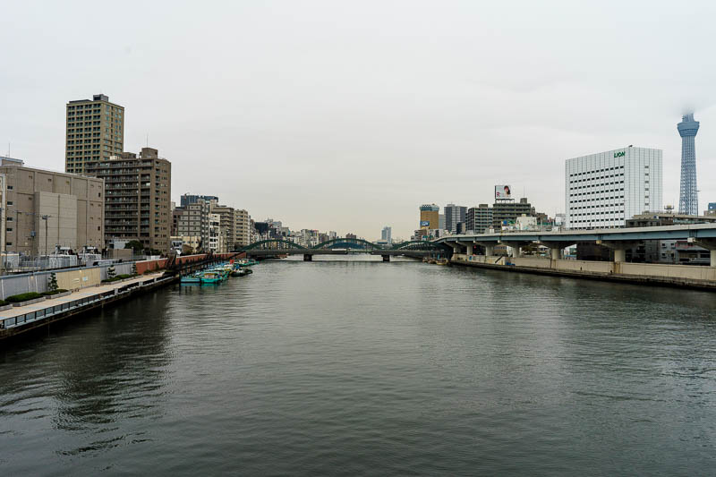
Crossing the river, I saw that the Skytree was covered in cloud, I guess I will head over there then.
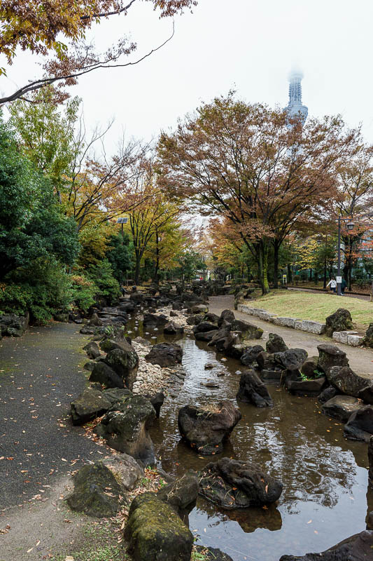
I found this linear park thing to walk along to get me there. I could keep a constant eye on the cloud and the gray.
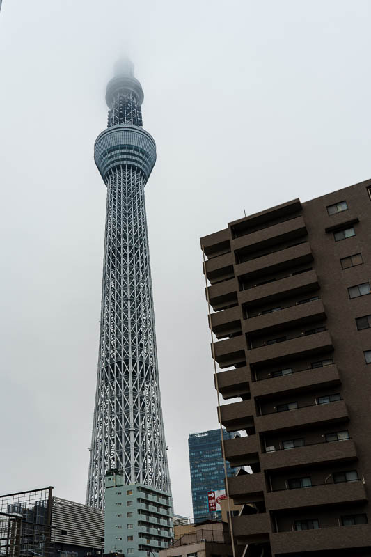
There it is. I normally cant fit it all in frame despite my wide lens, but today I dont need to photograph the top of it so it fits.
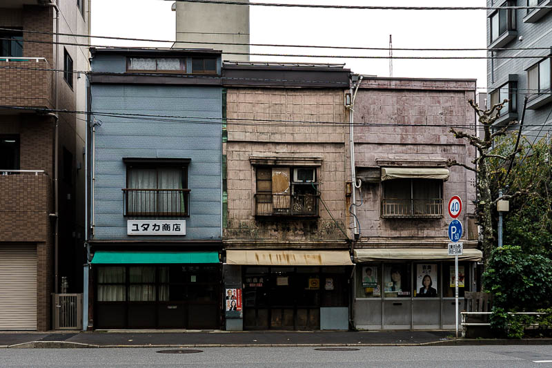
On my return journey I spotted these spooky old houses looking out of place in the street. I thought they summed up todays weather quite well.
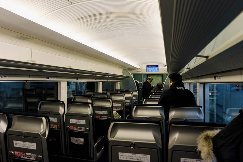
I like the Kesei Skyliner from Ueno to go to Narita. It is cheaper and faster than the NEX, plus I get to walk to it from Kanda, through Akihabara, dragging my big suitcase. Thats always fun.
ITS ME! Me and my pignose, thats the title of my autobiography. I also fear I am going bald, after which I will be VIRTUALLY INDISTINGUISHABLE from a pig. Snort snort snort.
There are currently 3 comments - click to add
David on 2018-11-23 said:
Thanks for the kind words and information you provide MoShengRen!
MoShengRen on 2018-11-23 said:
Epic trip report! Thanks for the daily updates and photos.
from one of your ten loyal readers.
mother on 2018-11-22 said:
happy flying pig nose
The end....for now....
There are currently 1 comments - click to add
mother on 2018-11-20 said:
yes wow! That's all i can say!