
Kumayama from Imbe to Kumayama station
Another great hike today. More great weather. Today's mountain literally translates to bear mountain. I saw no bears. I also saw no other people other than on the summit shrine area that you can drive to. This was very surprising as it is a Saturday.
The trail was great, the first half had spiders, the second did not. Lots of excellent views that I shall attempt to describe below.
Now for the stats -
28,500 steps
16.44km
1,492 calories - first half was hard
940m vertical ascent - felt like more
5 hours 23 minutes
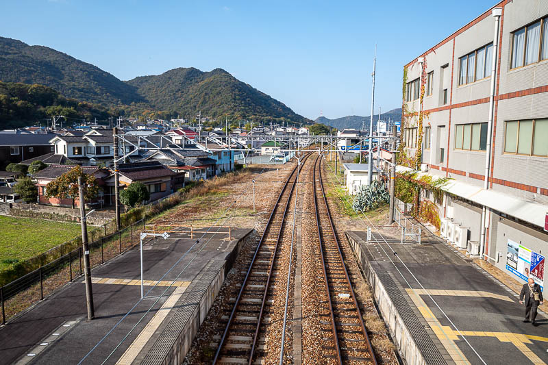
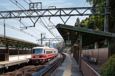
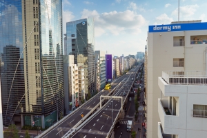
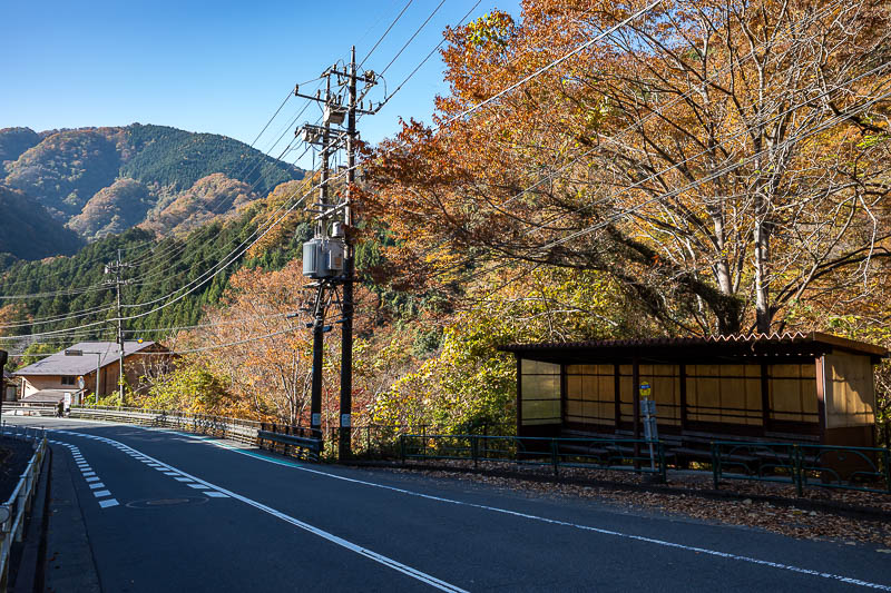
Here is Imbe station. Only 30 minutes from Okayama. There are 2 convenience stores nearby.
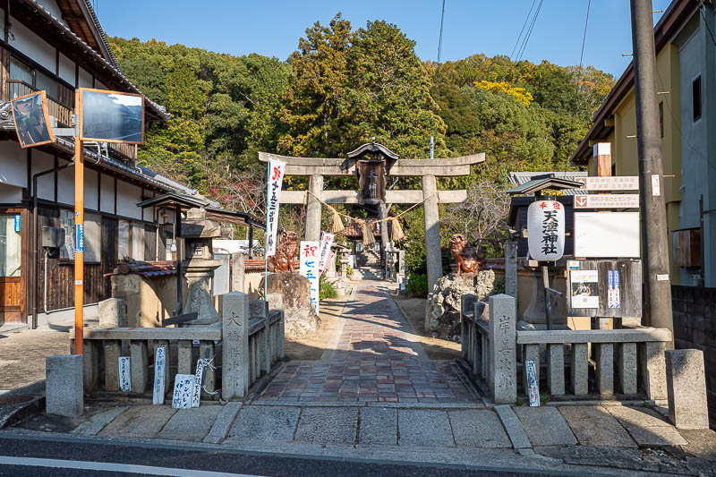
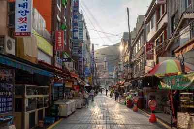
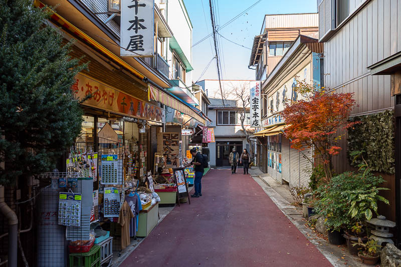
The start of the trail I used is very close to the station, right behind this little shrine area. Between the station and the shrine is a street filled with pottery shops.
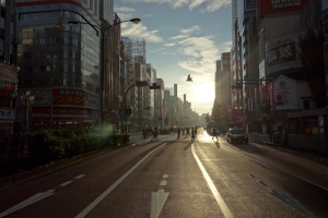
Immediate views, immediate blinding sunshine. Also smoke.
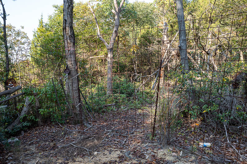
A few hundred metres in is this fence. I guess it is to keep wild pigs out. You can untie the cables and let yourself through. I double checked my map which has a heat map of recent activity to make sure people go through the gate at this spot, they do.
Low down view was already good.
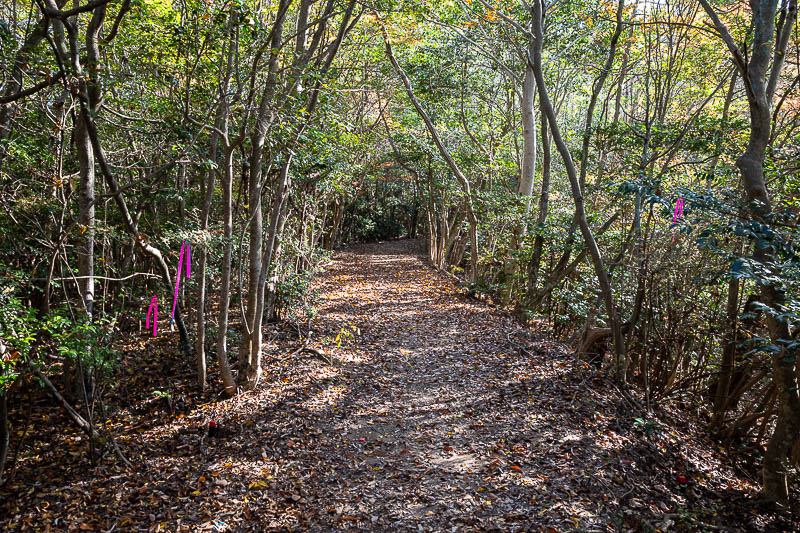
Looking back down towards the town along the wonderful but very lonely and spider filled ferny path. I knocked at least 10 spiders down.
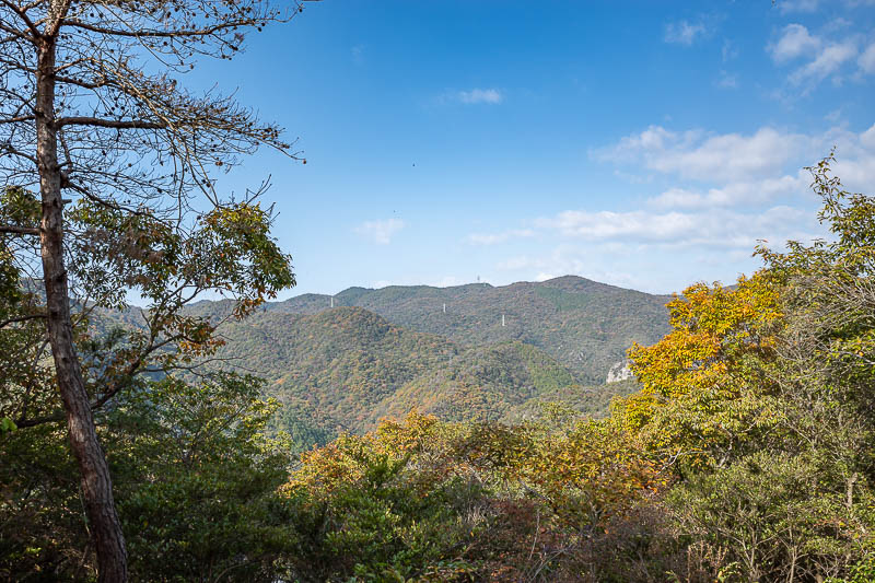
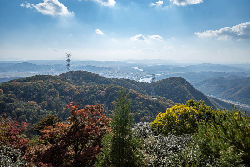
Squint and top centre of this pic you will see a communications tower that is the half way point of this hike.
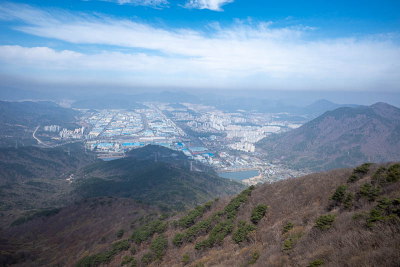
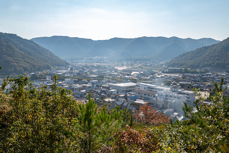
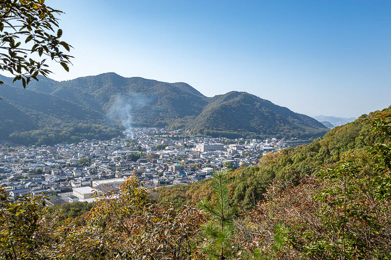
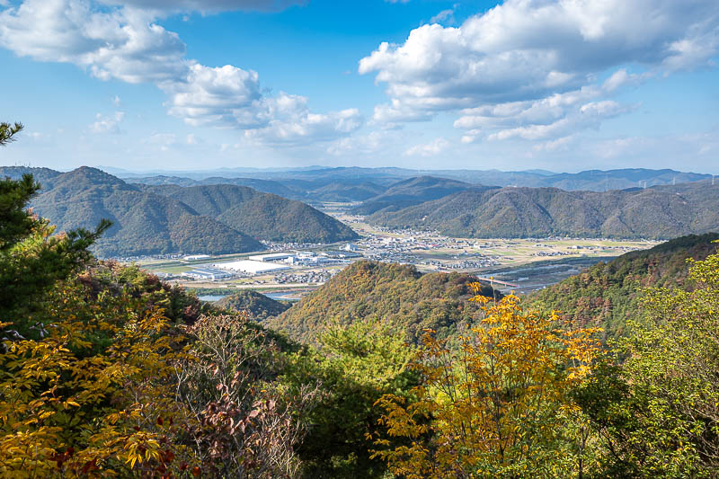
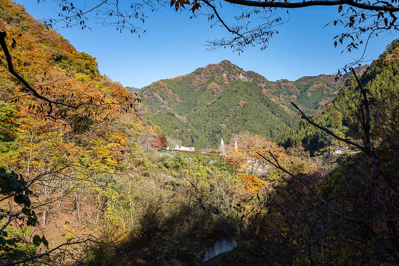
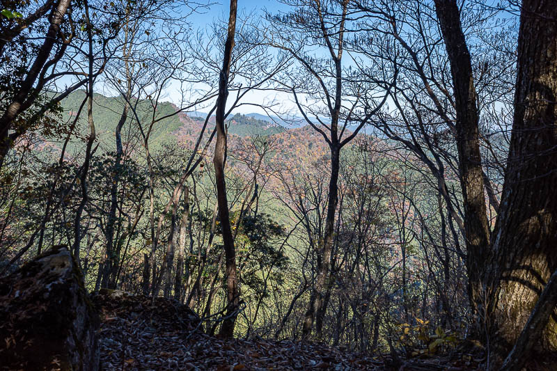
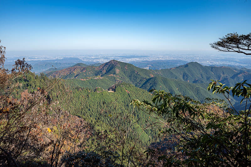
So many great views today, I really like when the mountains come up out of the flat farm land. The Shinkansen track can be seen here.
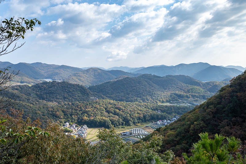
The view in the other direction features solar cells.
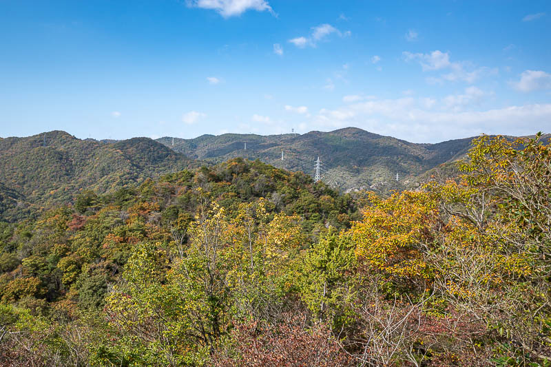
Lots of power cables today, sometimes they provide the only view spots.
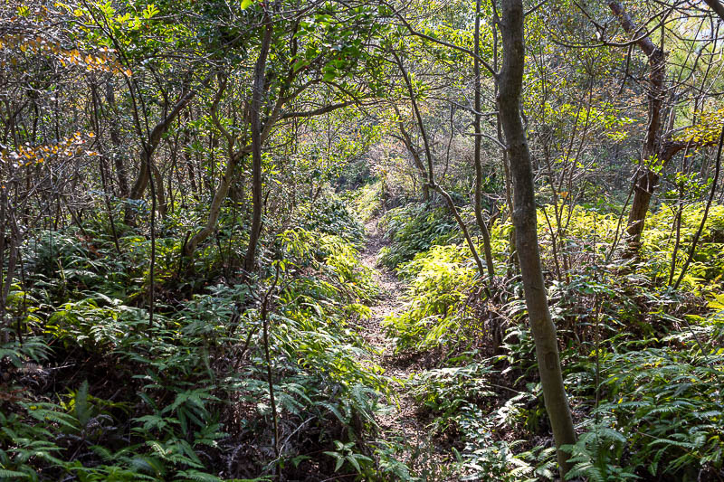
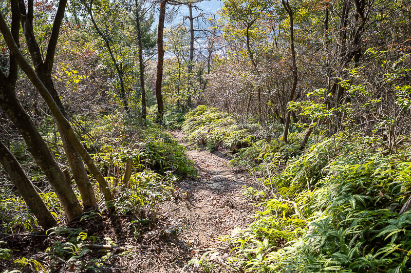
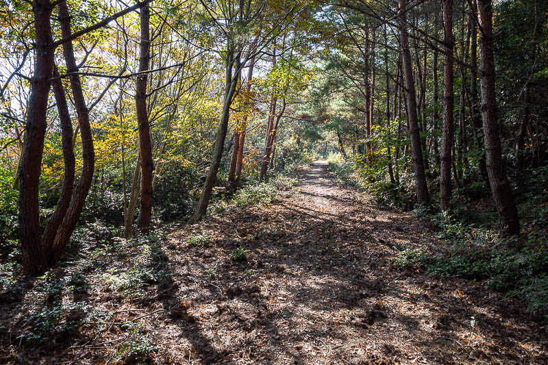
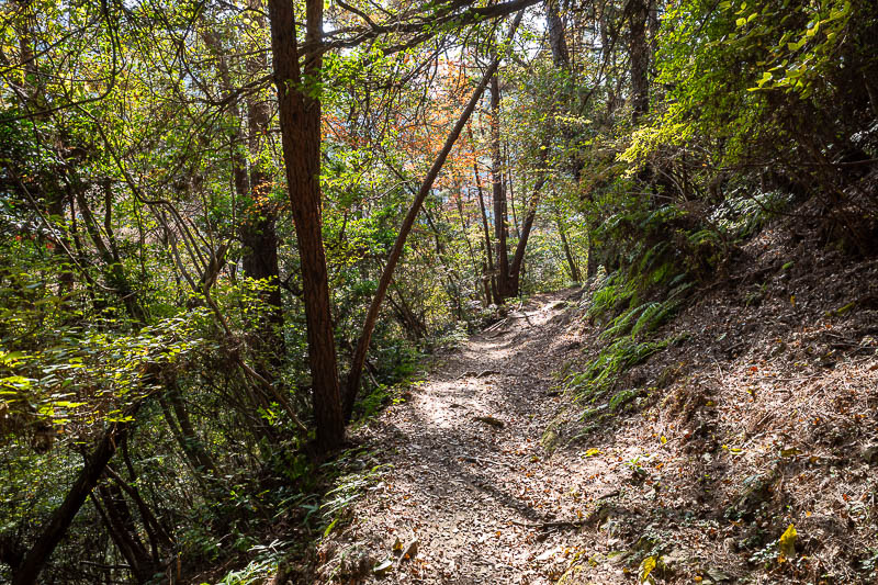
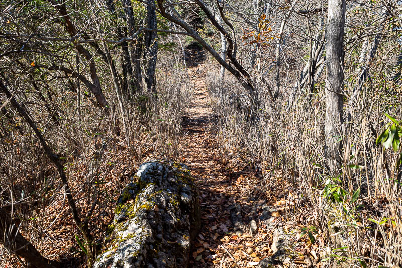
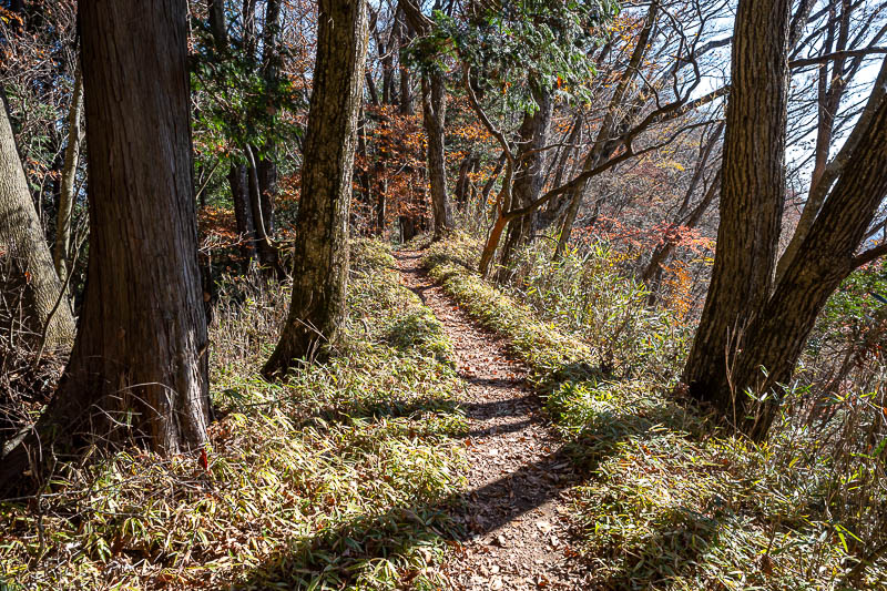
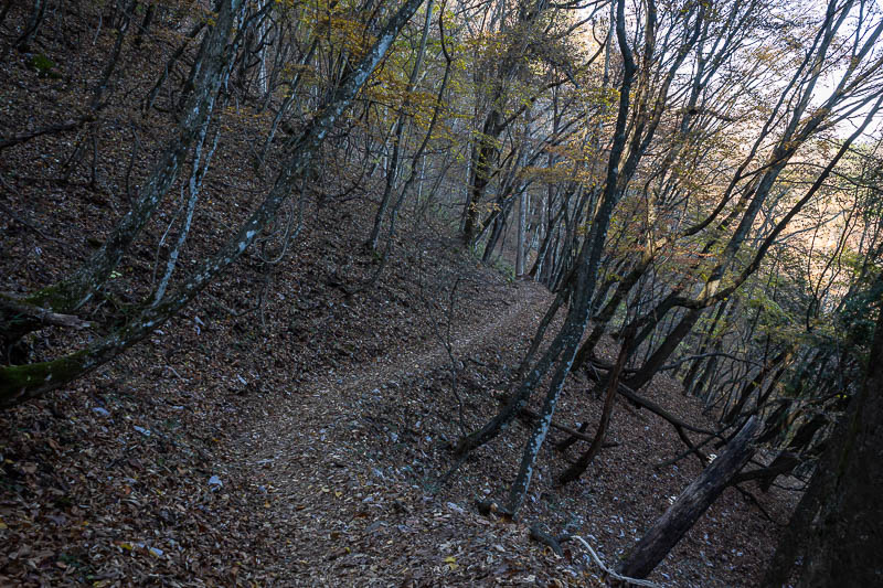
This part of the trail appears to be rarely used (based on the spiders and overgrowth), but it is very nice the whole way.
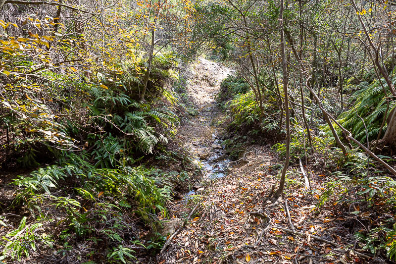
Parts of it were sandy and wet.
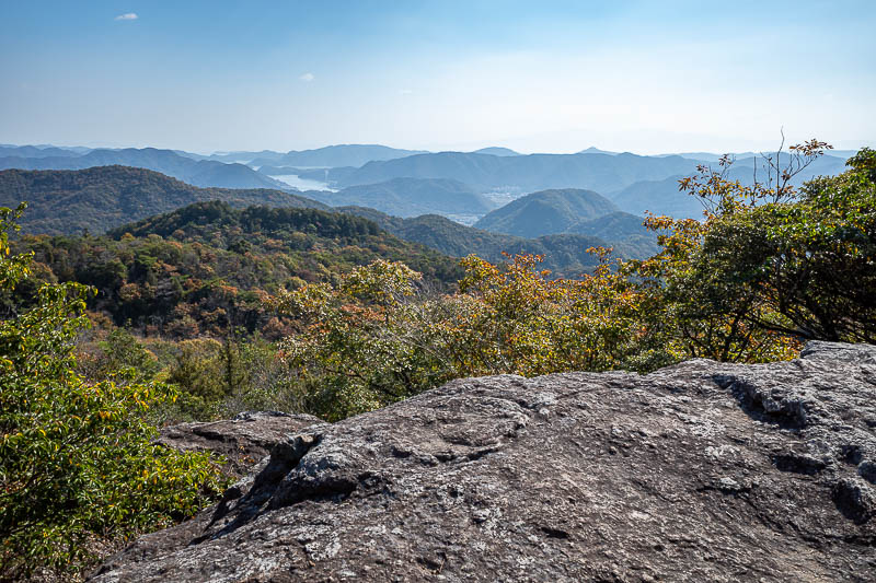
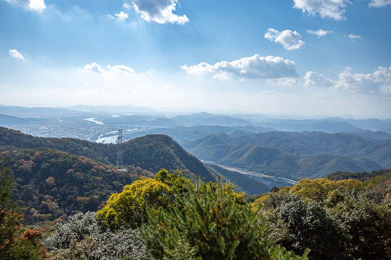
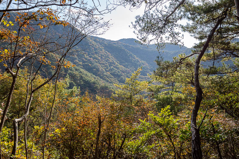
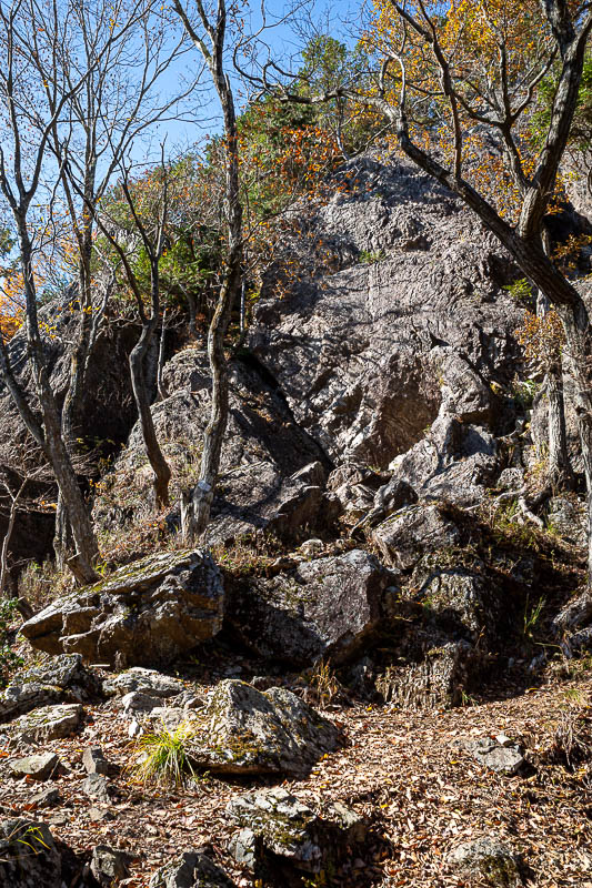
First giant rock view, it won't be the last.
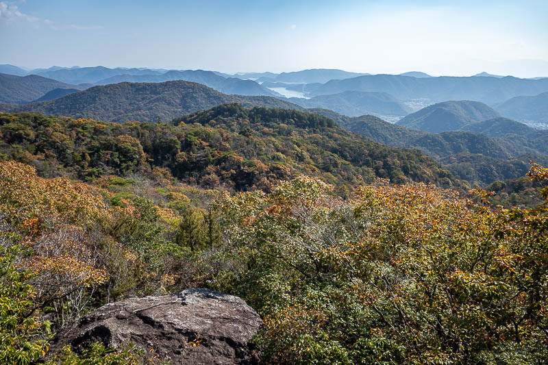
Very similar to the above pic, but I was really enjoying the view.
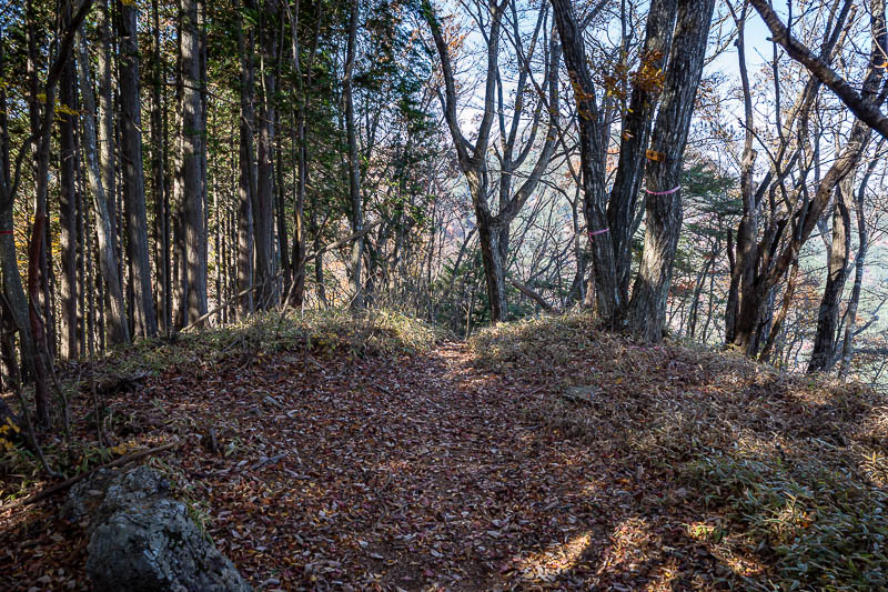
After 2.5 hours, and at the top of the ridge, the path opens up to more of a forest trail, and then right near the shrines, an actual road. It made for much faster progress.
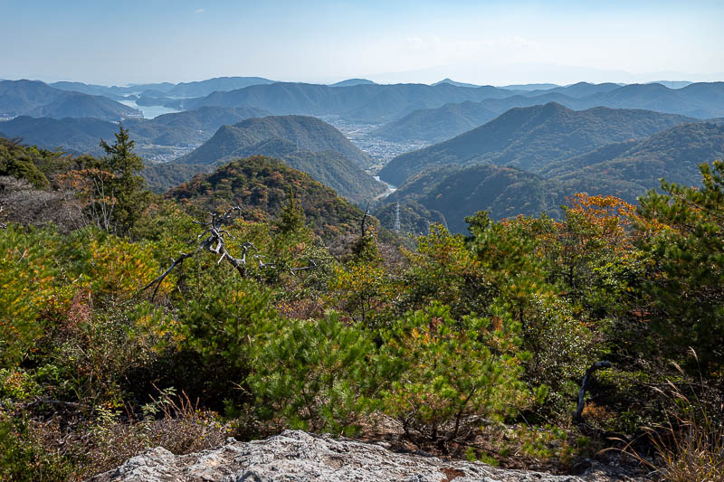
But still more great views, which just get better and better.
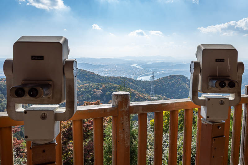
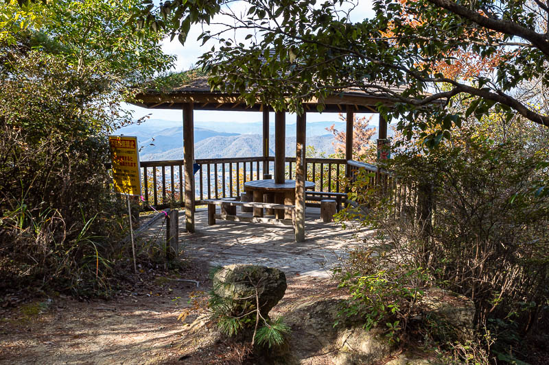
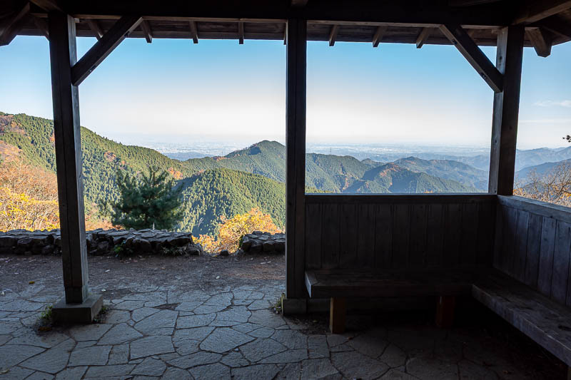
I had still seen no one at this point, even though there was view furniture around.
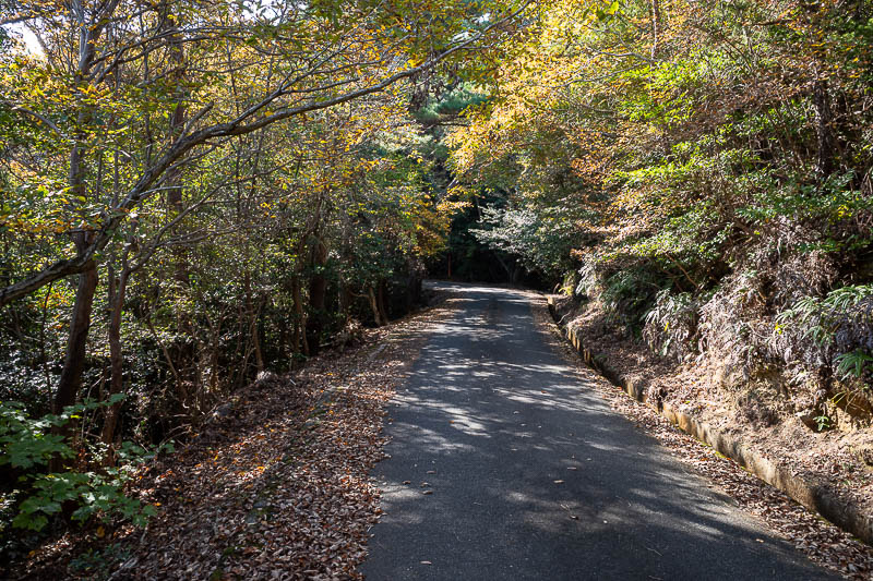
Behold, the road. Still no other people.
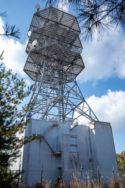
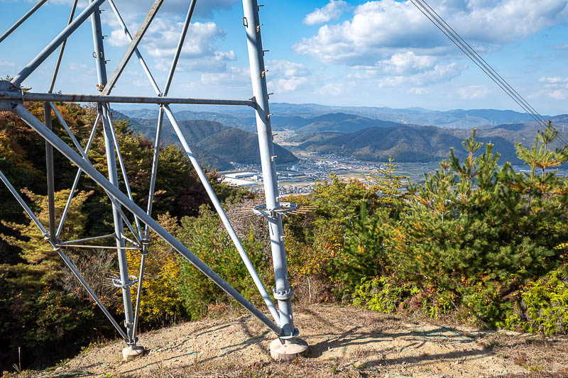
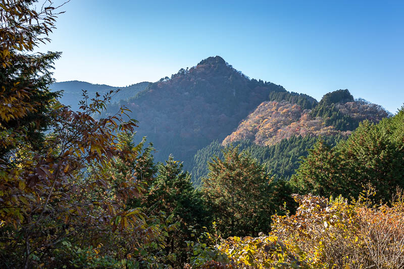
Here is the comms tower I mentioned earlier, which is at the highest point of today's hike, which admittedly is not very high.
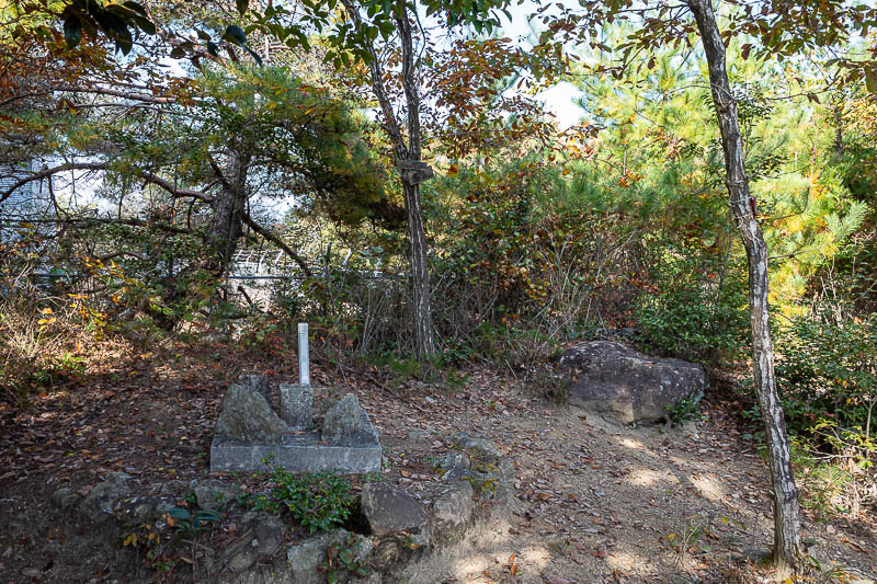
Terrible photo, but it is the summit marker of the highest summit of the day. No view from the summit.
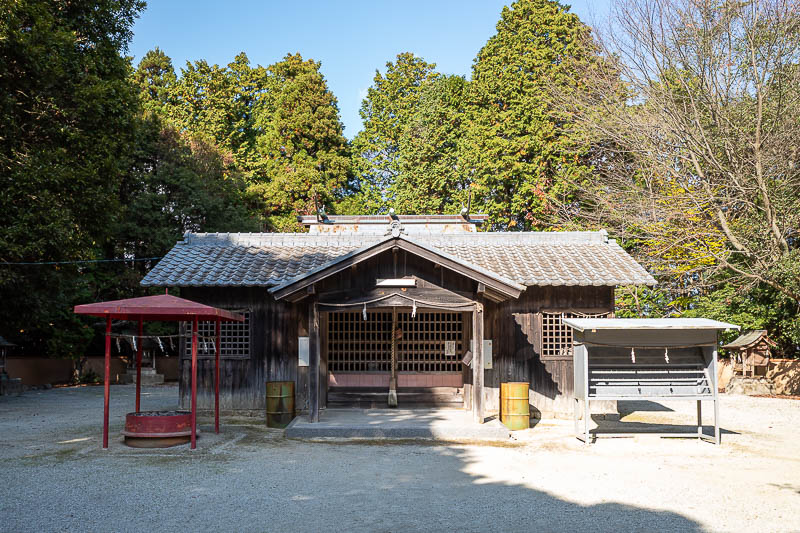
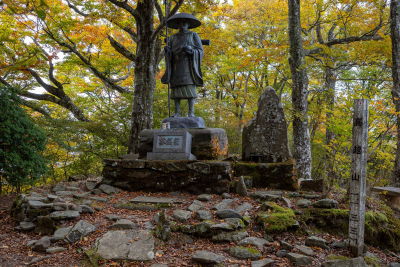
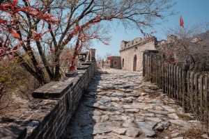
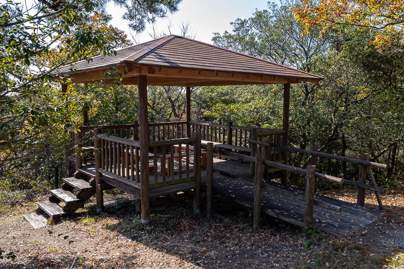
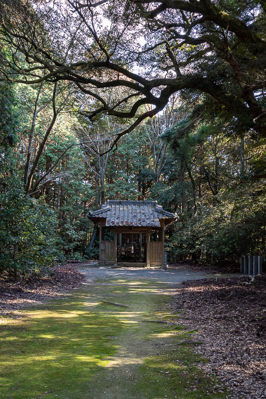
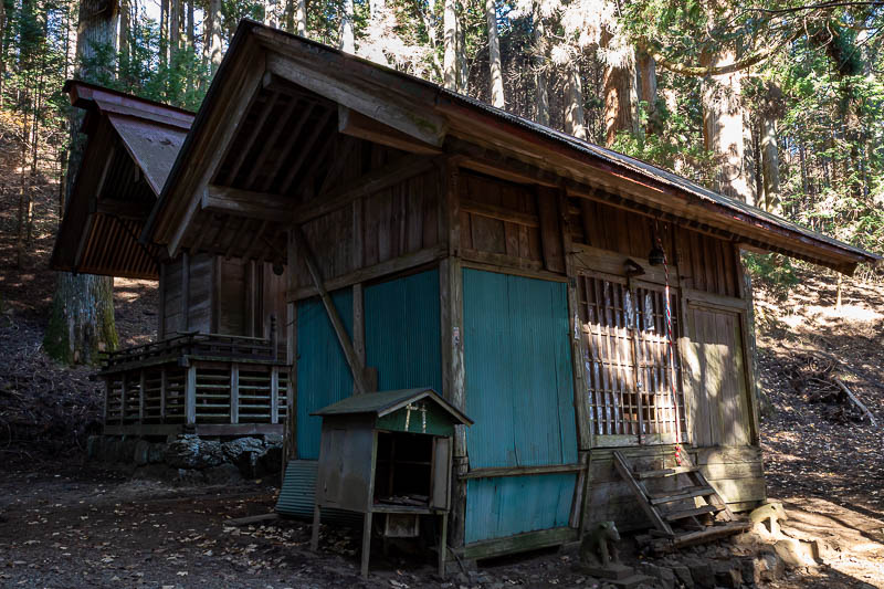
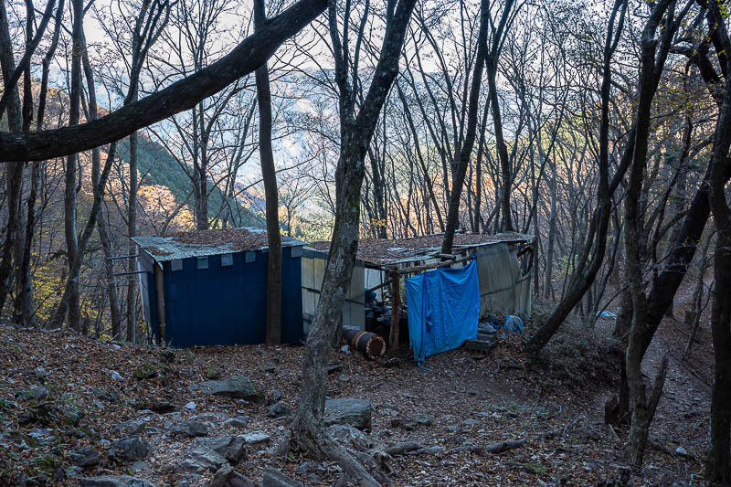
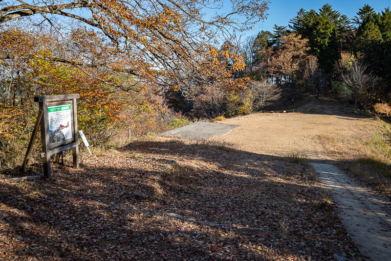
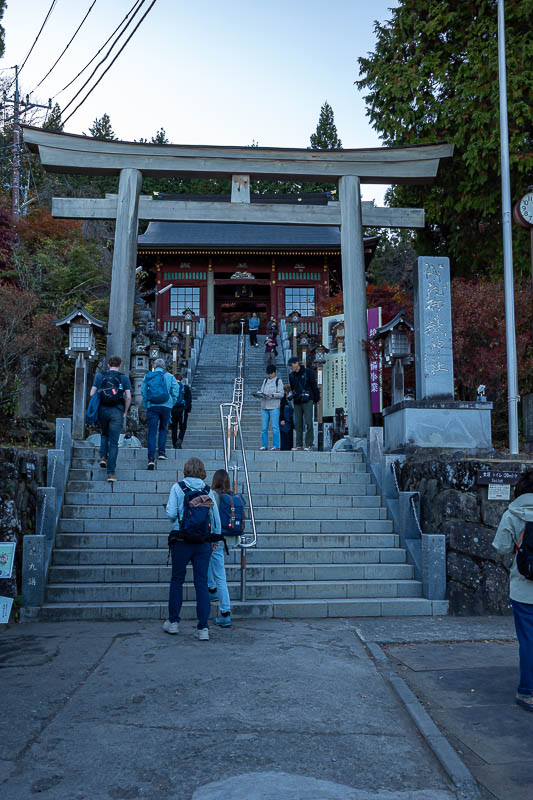
Not far from the comms tower, down the road, is the shrine area. 44 gallon drums are an interesting addition.
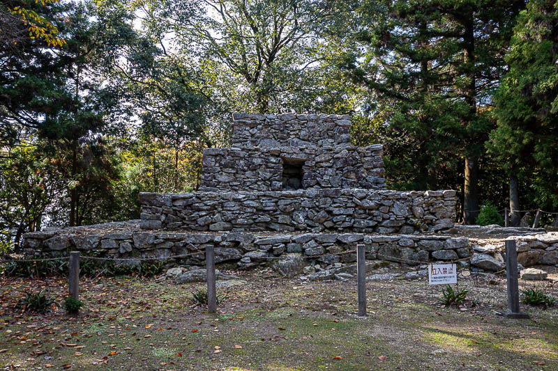
The reason the area is well known and has a road up to it the public can use are these ruins. There were a couple of cars around here.
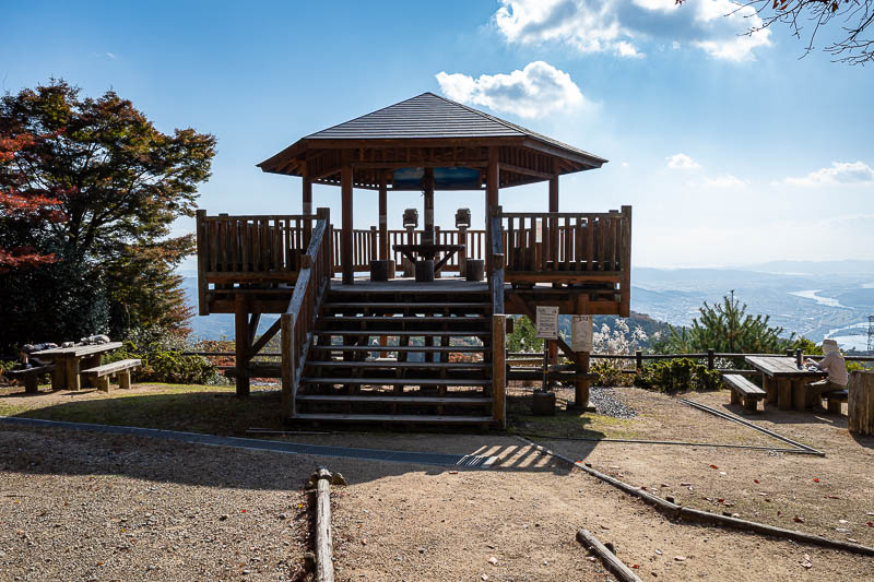
And at the nearby view spot, here are the only 2 other people I saw all day. Lady on the right and a guy sleeping on the left.
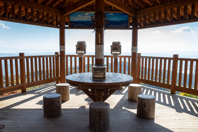
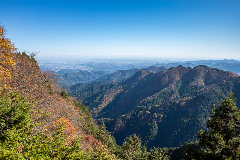
Now I will approach the view.
The view of the view.
And just the view. Someone cut down the power pole things.
Similar shot, but the clouds are interesting with the wispy bits hanging off them.
There are a lot of little structures around the top, and a few designated culturally significant trees.
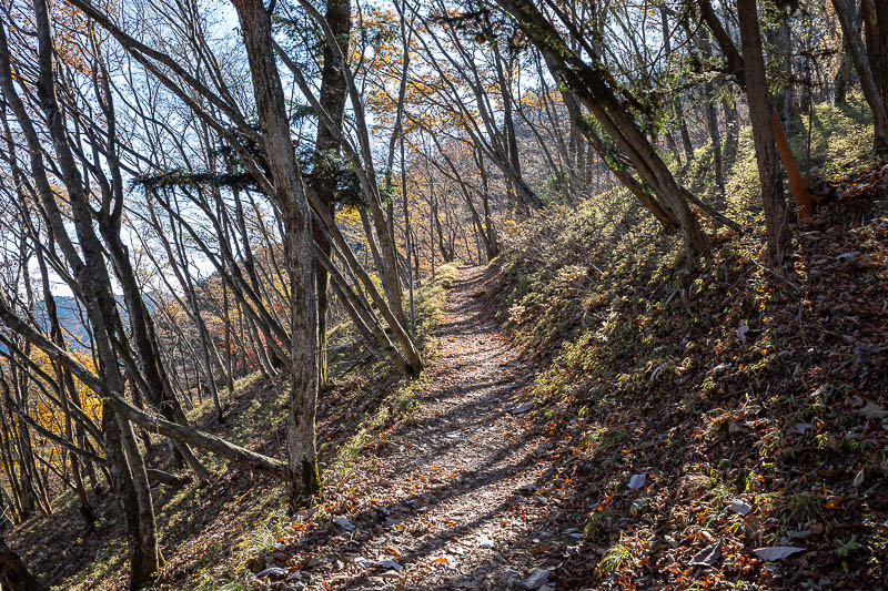
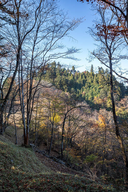
I continued north in the direction I had been travelling all day to go down the far side of the mountain range. This side is much more user friendly, no spiders, wider path, ribbons.
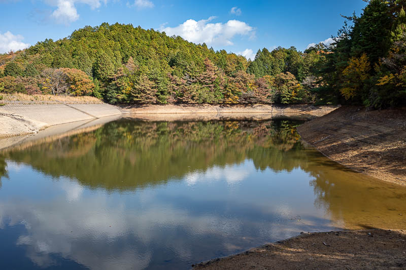
This reservoir was hidden, but I found a trail. About a 10 minute diversion, possibly not worth it.
There were limited view opportunities on the way down. In this spot I could not even find a view that did not feature a power pole. What are these poles called? Pylon, high tension tower... none of them are great words for giant electricity thing.
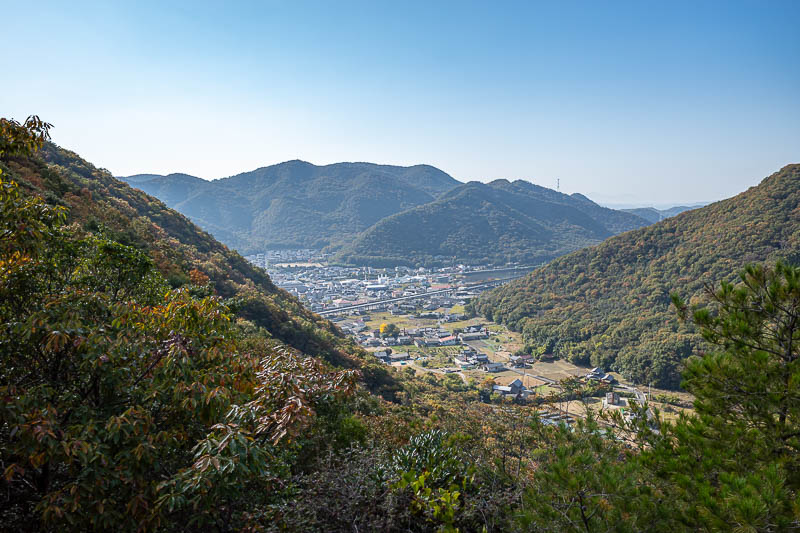
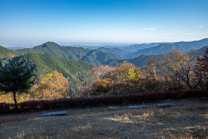
Over half way down and finally another proper view spot. By the way, there were no other people on the way down either, I guess everyone drives up. That cannot be true, the path is too well maintained, it was amazing I saw no one on this side of the trail either.
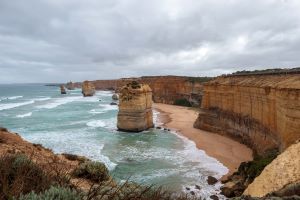
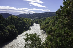
It is a close run race, but I give this one view of the day. I like the valley and the clouds seemingly leading up the valley.
The trail down was really great too.
I guess I came down from up there somewhere.
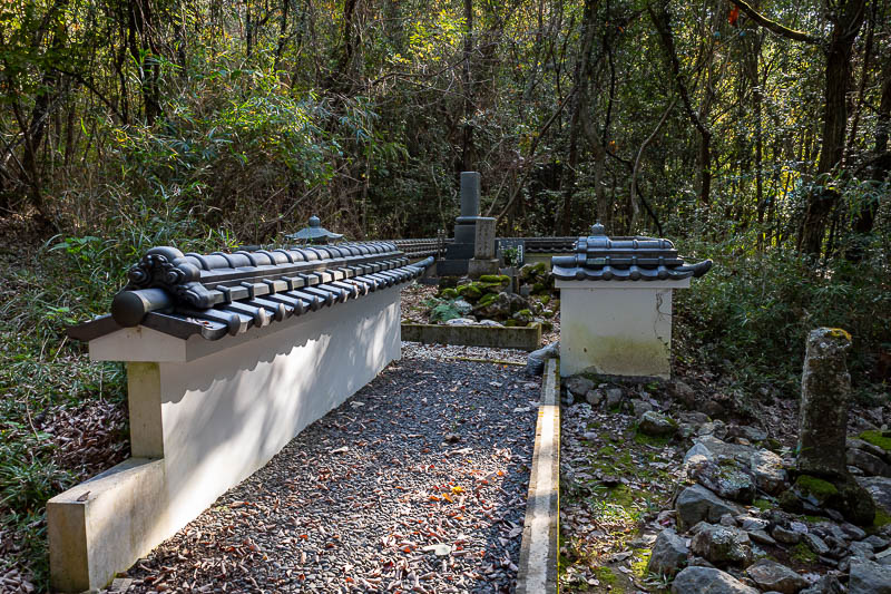
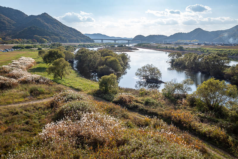
The graveyard tells me that I am approaching the end.
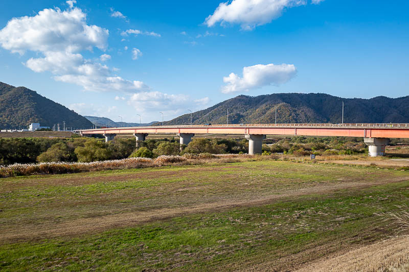
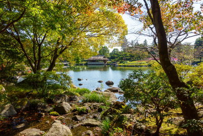
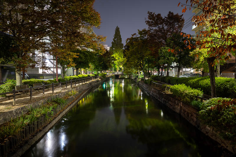
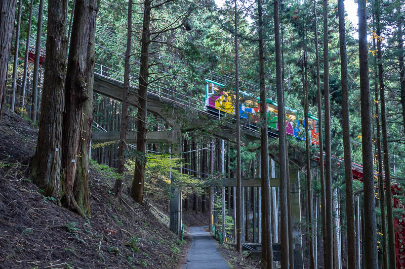
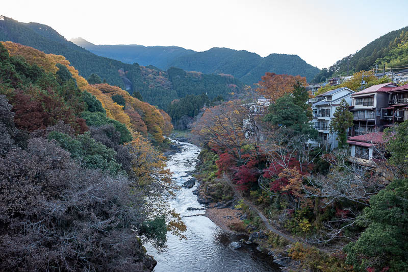
I was about 25 minutes too early for the train, so I had time for some view shots from the valley floor. Here is the red bridge you can see in earlier shots.
Great view from the bridge too. A shame about those cars on the left, I tried cropping them out but then it removes the nice vegetation on the left too.
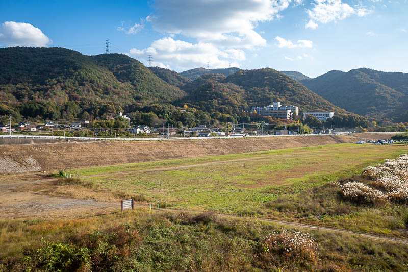
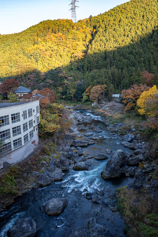
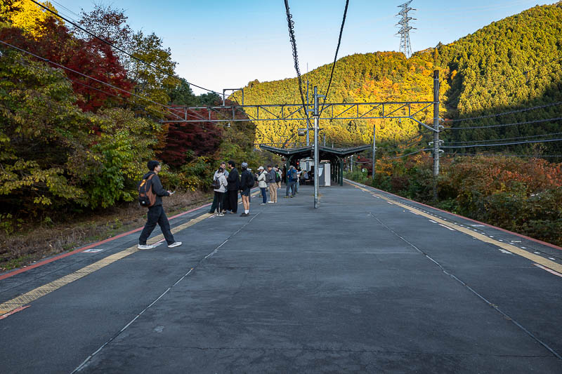
Finally, a view of the various small mountains from today. The big building on the right is a high school, there were high school kids in uniform on the 30 minute train ride back to town from Kumayama station, even though it is Saturday, because that is what Japan does.
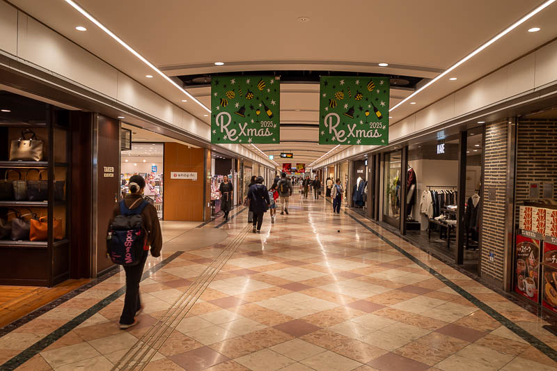
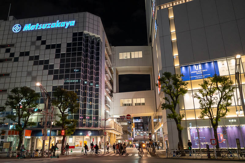
More Okayama Aeon mall
As threatened, I went back to the mall.
While there I visited the public toilets, and for the second time on this trip, I was taken aback by a boy with blonde hair using a hair straightener to make bits of his fringe pointy. Yes that exact thing has happened twice in 2 separate cities, presumably 2 different boys. I wonder if they are beautifying themselves in secret away from their homes.
As you will see below, I feel as though I have run out of things to see in the evening in Okayama, hence the sign pics, repeat mall visits, lack of photos in general.
Tomorrow I go back to Tokyo, and if I cannot find things to look at there at night, something is wrong with me.
I first checked out behind the station. This is basically all there is there.
After a lap of a hardware store I decided to make my way back to the Aeon mall via the creek. It was super dark, but a 20 second exposure can take care of that.
The underground station mall joins the creek and the Aeon mall.
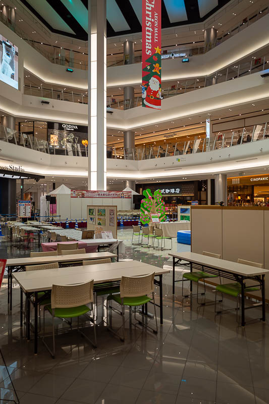
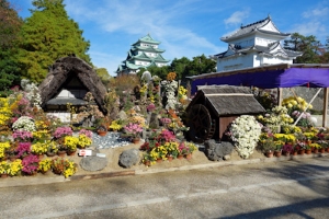
Inside the mall now, and it seems I have missed a peach festival colouring in competition. I would have totally dominated.
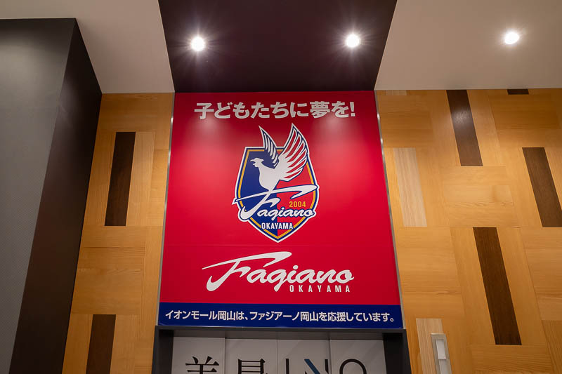
The local J league football team (which is a really big deal) is seriously named Okayama Fagiano, which is the Italian word for pheasant. The team are referred to as fags by their fans. They do not play a lot of games outside of Japan.
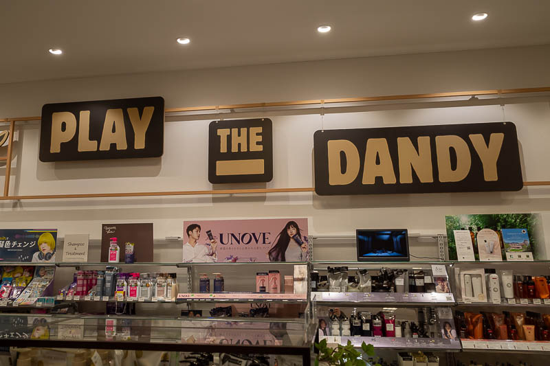
Reverting back to my hair straighteners in the men's toilets story, play the dandy. I checked, "a man unduly concerned with looking stylish and fashionable".
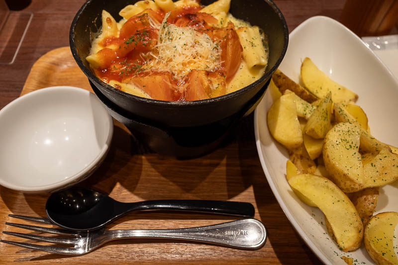
And so, after a lot of content aimed at further cancelling myself, it was time for another doria. Tongiht's doria, baked penne pasta with a whole tomato. It came with a side dish, the photo had a tiny bowl with 4 wedges of potato, where as I got a huge bowl of probably 2 entire potatoes. So pasta, cheese and potatoes. Weird angle on the photo because the doria sits on top of a alcohol burner on a stand. You are supposed to spoon mouthfuls out of it into the little bowl, so of course I tipped the potatoes in and ate it all out of the heated metal dish.
Tomorrow is a relatively long train ride back to Tokyo, no hiking and not many photos.
Okayama to Tokyo on the bullet train
Now I have returned to a hotel in Tokyo I have stayed at before. That means that after today there are no more bullet trains, no more hotel photos and therefore no more reason for anyone to look at this website. Really I can see the analytics of which photos people click on. The toilet photos get more clicks than all other photos combined.
Getting here was no issue. I had pre purchased my ticket before leaving Australia, QR code which works fine, train was busy but I had a spare seat next to me most of the way, a lot of snotty people so I put headphones on with noise cancelling to pretend they were not all dying of something.
So I will be here for 5 nights and a very long last day, staying in a very busy familiar area, so there are still a lot more photos to come that do not feature hotel toilets.
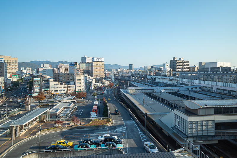
Here is the view from the Via inn hotel lobby in Okayama. Today I realised the chain is actually owned by JR West, hence why it is on top of the station.
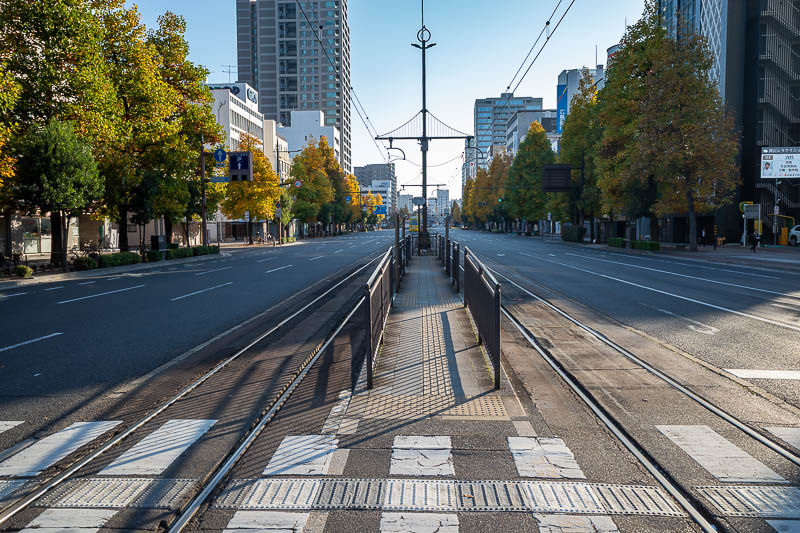
At dawn I went for a walk around the city. It was nice and quiet. I could stand in the middle of tram tracks and take photos of no cars. Nice trees.
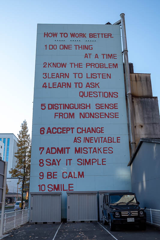
I disagree with points 3, 4, 7, 9 and especially 10. Resting asshole face is how I am best described.
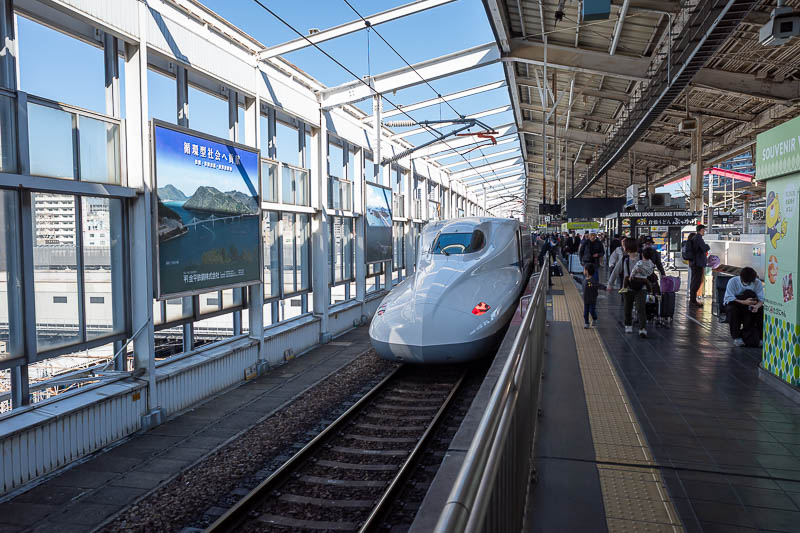
Here is a bullet train. Not my bullet train as Okayama is a station where it stops only for a few seconds. However they are all the same so you get the idea from this or 200 identical photos I have taken in the past.

Now for the hotel. It is another Sotetsu Fresa in Okachimachi (near Ueno). I have stayed here before. I have 2 windows with a view, and now that I think about it I remember selecting a corner single room, which was bigger than the normal single room. However it has 2 sets of slippers and 2 pillows, so I think maybe I got an upgrade. The entrance area is very wide compared to most rooms and the bed is bigger than I expected.

One of my 2 views (shot through glass). I am on the 8th floor.

And finally. the all important hotel toilet. Hi google image search.
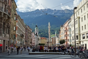
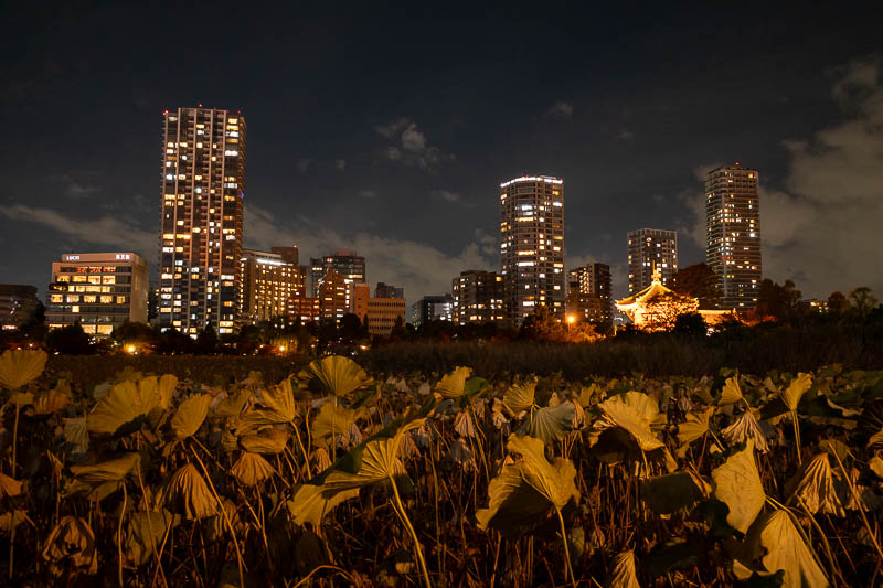
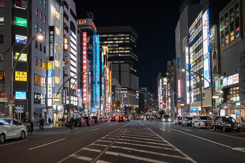
Ueno night
Cheesy title, obviously Tokyo is a much bigger city than Okayama, I need to work on my titles being in jokes that only I understand.
Now that I am back in Tokyo, among the unwashed tourists (I am up to night 5 of wearing the same clothes), it was time to walk north to Ueno, then south to Akihabara, then back north back to Okachimachi. Which is really only a gentle stroll but there is so much to see along the journey, including dead lilies and train tunnels.
Tomorrow, is a hiking day, with an early start, that involves 3 trains and a bus, in each direction. So I will be going to bed extra early. Exciting.

This is the street corner diagonally across from my hotel. You might recall (probably not), that I did reconnaissance on my hotel earlier in this trip, I think I took this same photo then.
Behold, the dead lilies at Ueno. Not as dead as I expected. Takamatsu ones were deader.

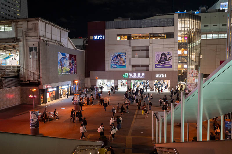
Ueno is super busy. The airport trains and some of the bullet trains terminate here.
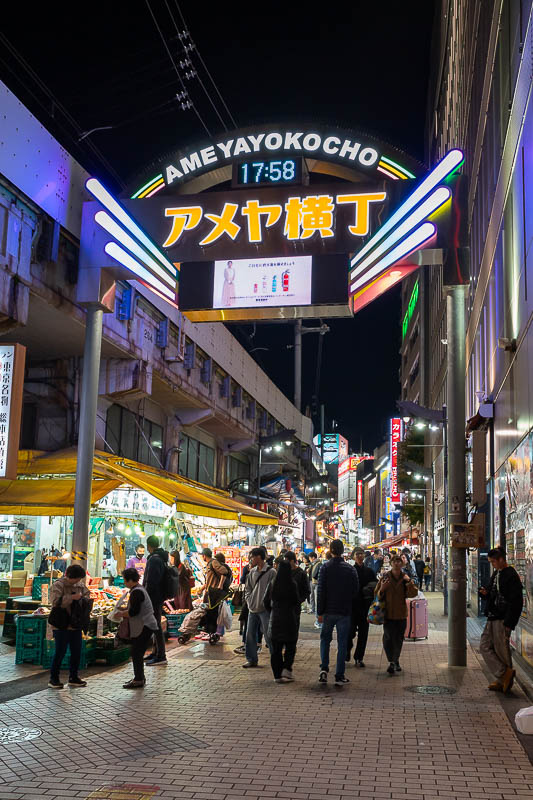
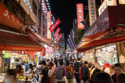
Ameyayokocho is the place to go if you are an American soldier and ww2 recently ended. Although I just learnt it is also possibly 'candy store street' as the words for America and Candy are basically the same. There is nothing American along here other than the Trump worshipping t-shirt shops.
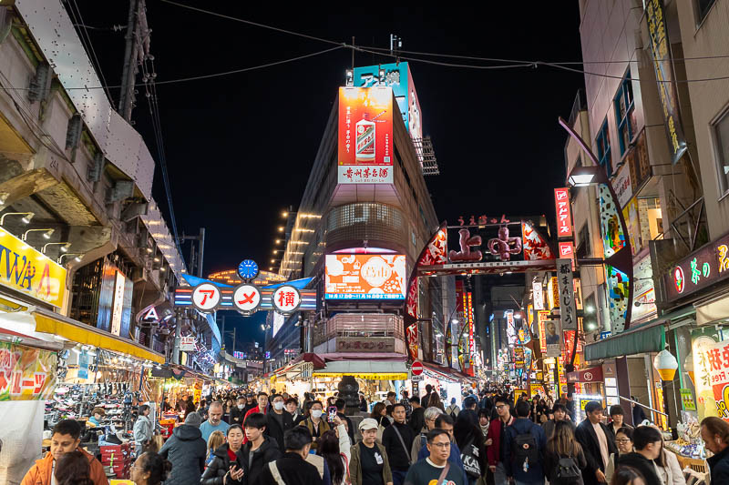
I have taken this shot on every trip. Everyone does.
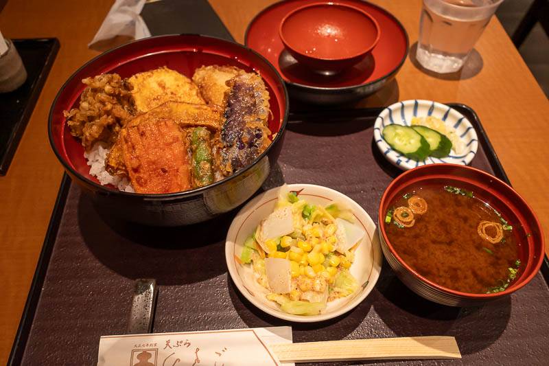
Now for some more vegetarian dinner, last night was as well. Tonight, tempura vegetables. It was pretty good too, not as much batter as many places use. It is interesting that generally, vegetables cost more than meat. The word 'interesting' is being thrown around rather liberally here.
I turned back here, otherwise I would have been rows deep in over excited tourists buying fluffy toys.
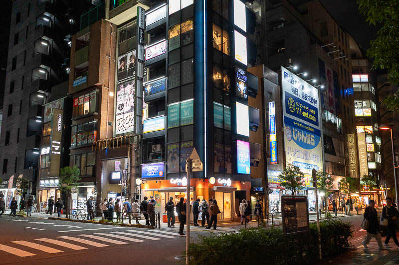
Instead I snuck through the back streets. Apparently snuck is not a word?
This last pic for my mother. Her favourite department store apparently.
Now I must hurry up and get into bed so I can get up early tomorrow and do another boring hike.
There are currently 2 comments - click to add
mother on 2025-11-16 said:
Bit more lively than Adelaide tonight. Even the massage parlors in Hyndley st were closed.
jenny on 2025-11-16 said:
nice hotel view again
Mount Odake from Musahsi-Itsukaichi to Mitake station
More correctly, from the old to the new to the old.
Today I went to a familiar station, Musashi-Itsukaichi, which is the terminal station for a branch on the Ome line, failed to heed the numerous bear warnings in and around the station and boarded a bus to take me along the wonderful valley to a hiking start point at Hinohara.
My course started on a hard and lonely trail, no one for a few hours other than a rock climber, before arriving at Mount Odake.
From there I continued on to Mitake, the shrine at the top of the cable railway that I have been to at least 3 times before. I ignored the cable railway and ran down the road, and then really ran to make a train so I did not have to wait 45 minutes for the next one.
So now, the stats, then a lot of photos, again -
31,500 steps
6 hours and 3 minutes - felt longer due to train/bus journey
19.27km
1,341m vertical ascent
2,147 calories burned - finally made it over 2,000 on this trip!
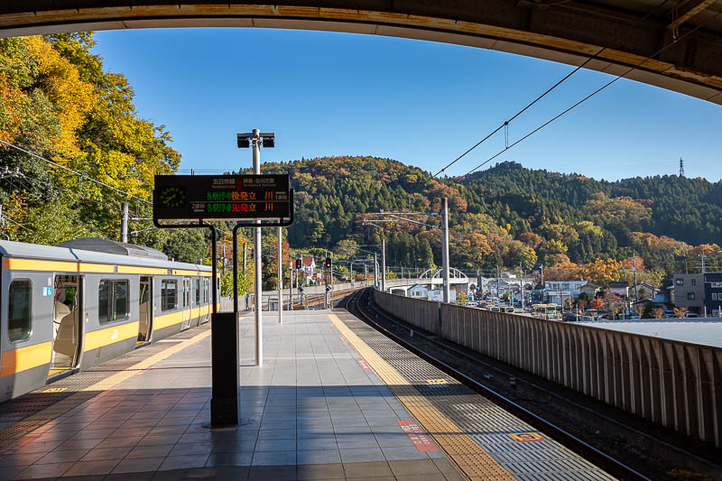
Great view from the station at the rather convolutedly named Musash-Itsukaichi station.
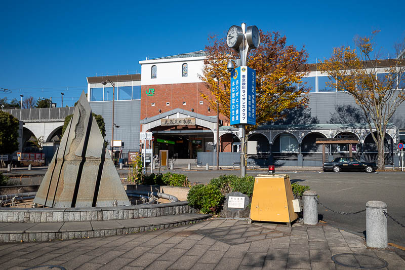
Here is the station. It is quite a large town, many convenience stores. It is the end of the train line but there are more towns beyond up the valley, so quite a few buses depart from here.
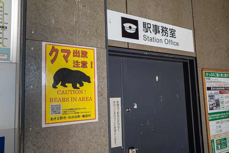
There are at least 10 warning signs about bears in the station, around the station, on the bus stops etc. None have dates about actual sightings and some were quite faded like they had been there for a year.
This is where I got off the bus. I believe right by Hinohara elementary school.
I will go up there. I think. Hard to tell.
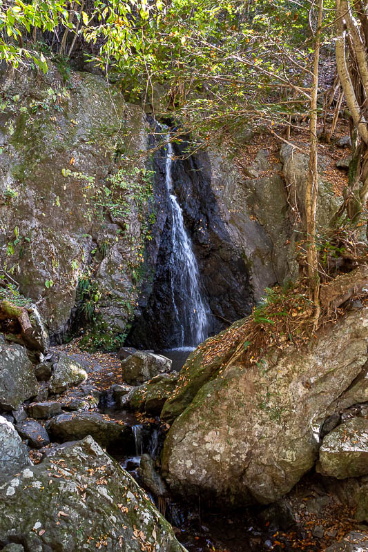
The hike starts with a pathetic little waterfall. In my experience, waterfalls in Japan are not worth the effort.
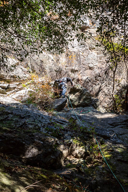
Then I spotted some shoes and a bag and thought someone had been eaten by a bear who undressed him first. But above me was a guy rock climbing on his own. The only person I saw for the first few hours, until the summit of Mount Odake.
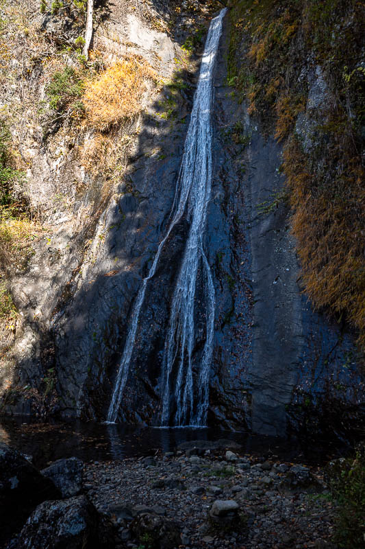
Nearby, a slightly less pathetic waterfall. The ways for crossing the streams were relatively safe today, nothing too slippery.
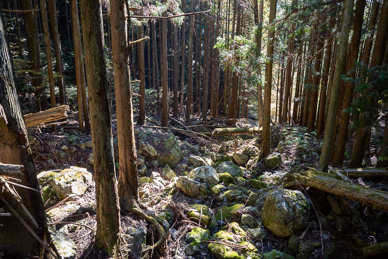
I was glad to leave the river behind, it was hard going at first.
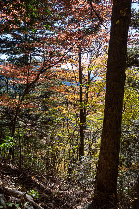
Some good colour starting to appear.
There are numerous trails you can choose from, so a map would help. I had downloaded one and was following a course someone had completed yesterday on Yamap. No spiders today even though there were no other people, they all did it yesterday.
The whole area is popular with rock climbers.
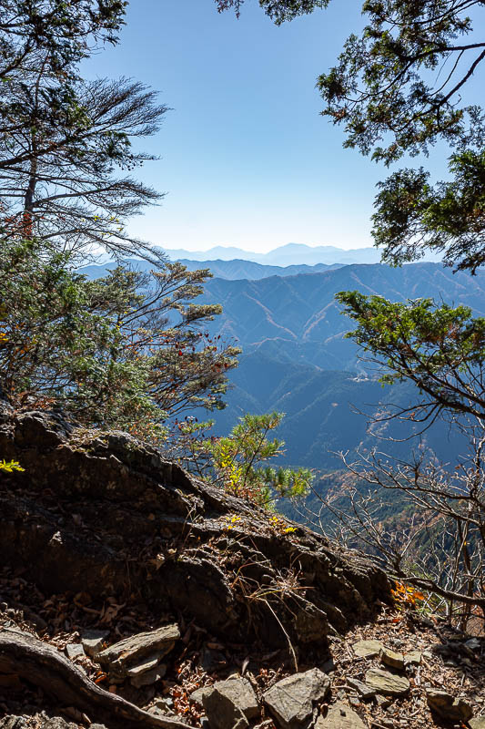
I diverted slightly to go to this summit before doubling back to my desired trail. No view, not worth the effort.
The first third of the day really did not have many views. Across from here, not that you can see it, is Mitake shrine.
The trail started to get good, getting up to here was very strenuous.
Popular enough for lunch cabin areas, with no view and no other people.
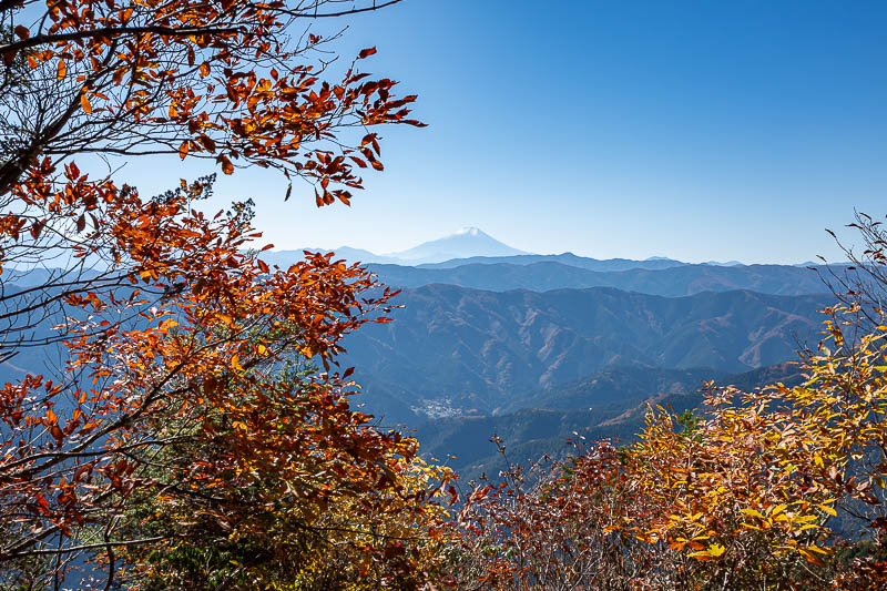
Behold. Mount Fuji. I saw it from the bullet train in both directions, but this is the first time on this trip that I saw it from a hike.
I will probably post a few more photos of Mount Fuji.
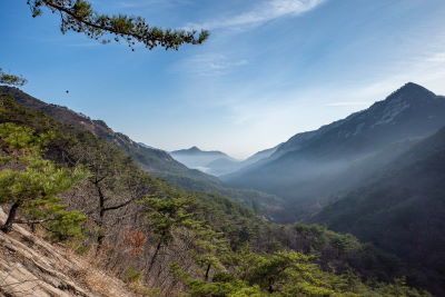
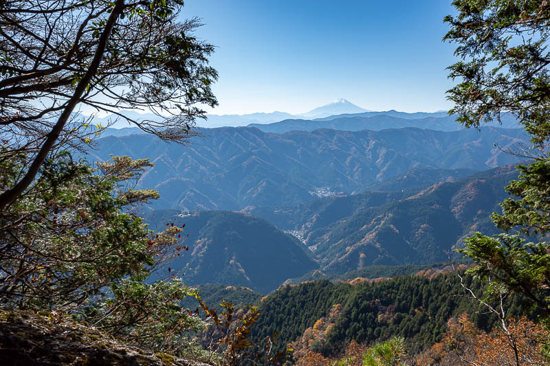
Rocks and far away mountains make for a good view. Not even a single cloud in the sky today.
Some really nice areas to run through today, with zero spiders.
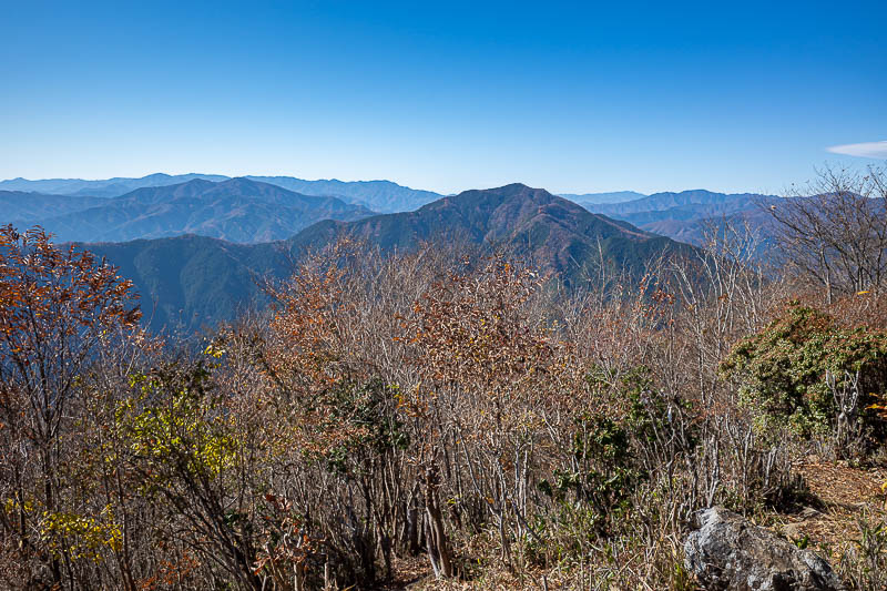
Wait, I lied, I think there is a tiny bit of cloud on the right.
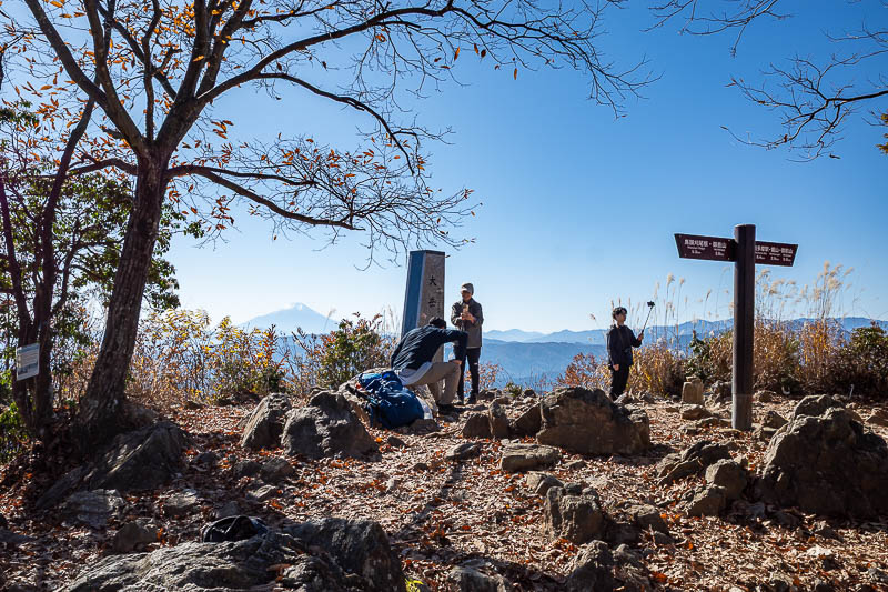
This is the summit at Mount Odake. All these people came across from Mitake rather than up the hard way. Many took the cable pulled train. There are also multiple trails to get from here to Mitake, I will choose a less popular one.
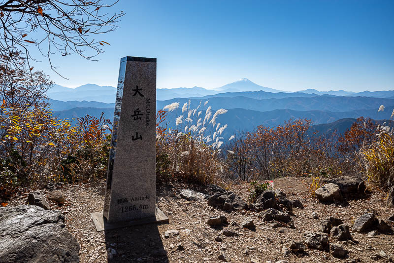
1,266m summit today. I think the second highest on this trip of not many high mountains.
Just below the summit of Mount Odake there are predictably a few shrines. Some look abandoned.
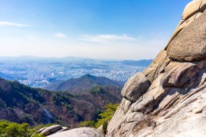
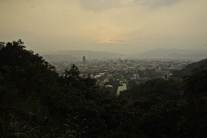
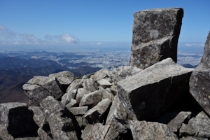
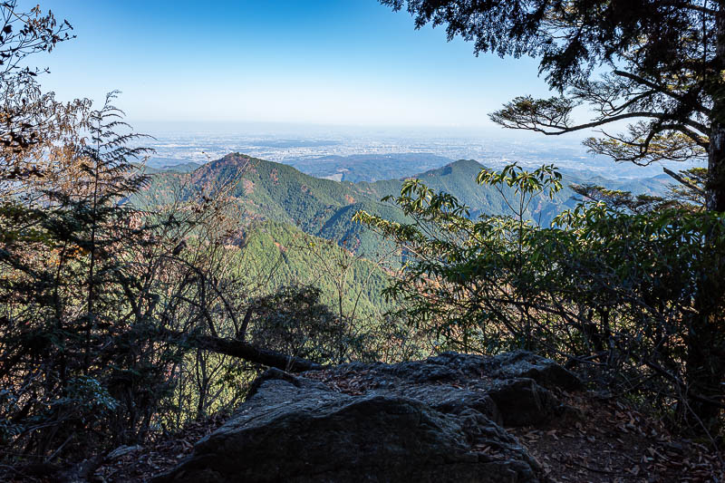
Tokyo is down there in the smog.
Surprise public toilet.
Example of a nice smooth bit of trail without rocks.
There were 2 decent looking quad bikes in this shed. I have no idea why.
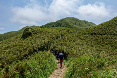
I took a detour up a less quad bike friendly trail and was rewarded with the low bamboo that I always seek out.
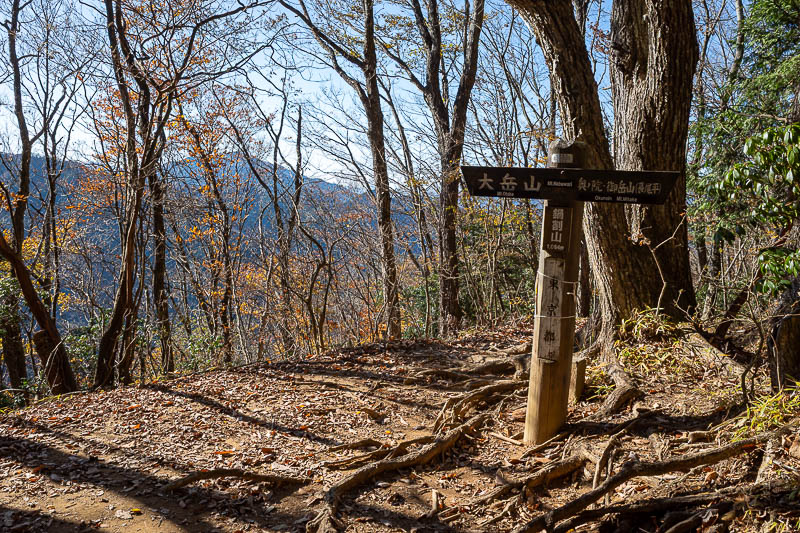
Time to join the main trail to Mitake.
Another nice view of Tokyo, with a foreground rock.
Annnnd a very similar view, no rock.
Korean style helicopter landing spot.
I believe I had come from around that way.
I was now right by Mitake shrine, so there were many picnic spots.
A view through the viewing spot.
I will now go up there to Mitake shrine.
On my previous 3 visits (at least) I went up to the shrine and was annoyed that there is no way to take a photo of the view or the shrine itself, so today I did not bother. Refer to the previous trips to see it, use the search and find Mitake.
The top of this mountain has a shopping street. 2 in fact.
As usual, I have to post a photo as proof that I did not take the cable railway.
Behold, what has on previous trips been my favourite view. I was too late for the good light today.
The view in the other direction over the ravine shows that the sun is about to vanish.
And finally, I was back at Mitake station, as were a lot of other people, who got off the bus that comes from the cable railway station.
Tonight's outing will be brief as it is now late (for me).
Ueno on Monday
Only 5 poor quality photos follow, the excitement is palpable.
First there was wontons, I thought I had better eat first because many places stop serving food at 8pm, and it is a Monday so allegedly some places might be closed, but that did not seem to be the case.
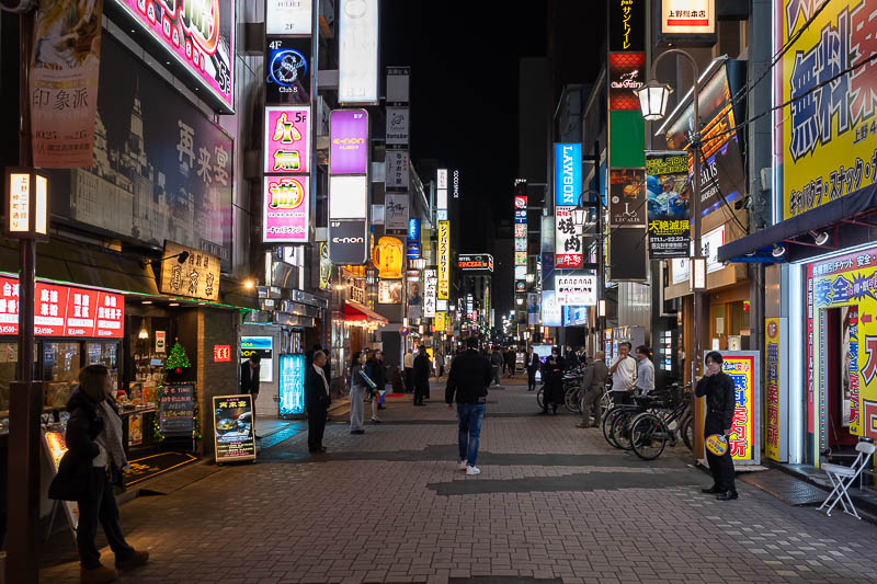
Despite the late start, I did actually set off in the opposite direction to where anything bright and colourful is, which resulted in a loop through what the map tells me is Hongo-Sanchome. The only problem with that is, I forgot to take a photo, except of a bear sign. Anyway, there was not much there.
So then I ended up back in Ueno, in the red light district near my hotel.
Tomorrow, not a hiking day. And as I often say, I have no plan.
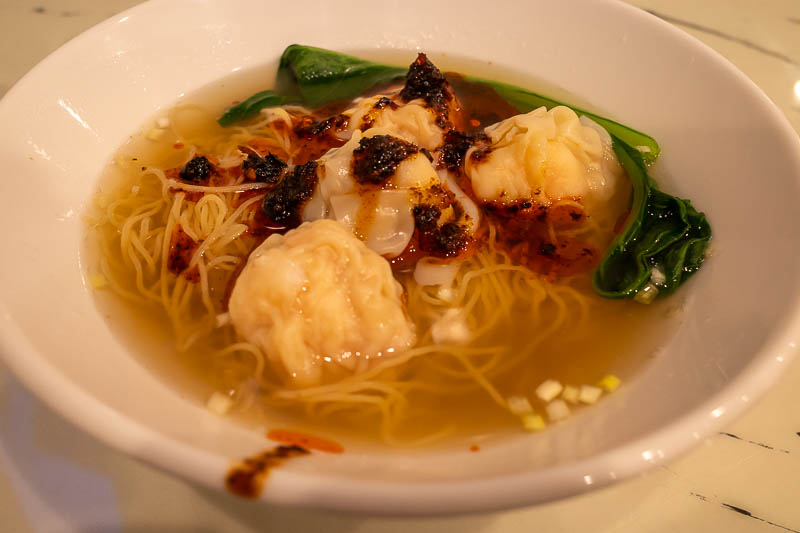
Here is a poor picture of my wontons, from Legendary Hong Kong. Not bad. Boss man was trilingual, his English had an Australian accent. Of course I threw chilli all over it and also over the table.
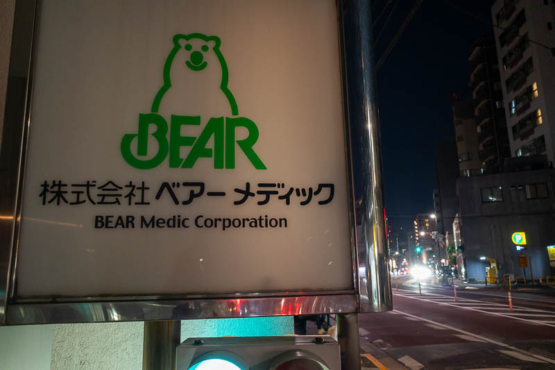
Another poor photo, hard to get a focus on the reflective sign. Today was a day of bear signs.
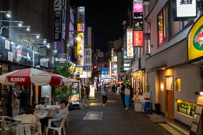
Now for the Ueno red light district. The nationality of sex slave choice here seems to be Filipino, I know this because they all said to me 'hello, Filipino' and I don't think they were asking me if I am from there.
Note the people all standing out the front with menus, one of whom is holding a flag from the Philippines. They really make it hard to spell their country name, and then its an F for the people from the country that starts with a P.
I fled back out to the main street in Ueno and scurried back to my hotel to tuck myself safely into bed.
There are currently 2 comments - click to add
jenny on 2025-11-17 said:
wontons look tasty
adriana on 2025-11-17 said:
You will be glad to know that the weather is going to cool down from tomorrow
There are currently 2 comments - click to add
mother on 2025-11-15 said:
canal photo came out great
adriana on 2025-11-15 said:
Highschool kids have club activities like tennis on Saturdays. I like the view shot of the day too.